Country:

 City:
City:



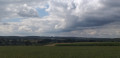
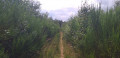
(S) With your back to the entrance to the Bois du Bané campsite, head down the forest track in front of you. Take the hairpin bend to the right at the next junction and head uphill.
(1) At the fork in the road, turn left. At the hunter’s bench, take the path on the left. Cross the footbridge over a stream.
(2) Follow the path and, when you rejoin another path, turn right. At the forest track, continue to the left.
(3) Before reaching the road, turn left onto the path. Leave the forest and, at the bus stop, cross the N40. Turn left and take the path between the embankment and the property’s hedge.
(4) At the track in the hamlet of Ronfè-Gerbéfè, turn right. Stay on the main track for 1.5 km, ignoring the forest tracks branching off on either side.
(5) At the fork in the road, before reaching the edge of the meadow, take the path on the left. At the T-junction, turn left. Follow the path for 500 m, ignoring the paths branching off on either side.
(6) At the T-junction with a wide forest track, turn right. Walk on, pass the hamlet of La Haie Courbôle and continue straight on for 750 m. Cross the bridge over the Ru La Noire Eau. The path, now overgrown with roots, turns left. Walk alongside a patch of coniferous trees on your right. A path joins from your right; continue along the main track. Cross an open stretch, walk alongside a meadow and then head back under the trees.
(7) At the crossroads in the hamlet of Sapin Pelzer, turn right. Follow the red cycle markings. Pass a track blocked by a makeshift barrier.
(8) When you reach the bend in a forest track, carry on straight ahead.
(9) At the fork in the road, turn right. Walk along the open, uphill path.
(10) At the track on your right, turn off and leave the signposted route. Head downhill and enter the forest. At the junction (not shown on the map), carry on straight ahead.
(11) At the path on your left, turn off and head downhill. Cross the bridge over the Fagne des Tailsus stream. Follow the path and, at the junction with a forest track, carry on straight ahead along the path opposite. When you reach another forest track, keep to the right. Ignore the paths on your right overlooking the stream. At the wide fork, turn right and then ignore the grassy path on your left.
(12) At the wide junction in the hamlet of Les Tachenires, turn right. The path descends, turns right and then left. Ignore the path on your right at the bend and leave the woods. Ignore the path on your left and the next one as well. On your right, enjoy the view of a pond. At the road, in the hamlet of Pont de Libin, turn right then quickly turn left towards Libin Centre. Walk uphill for 500 m.
(13) At the junction between the road and the forest tracks, turn right. Walk for 300 m.
(14) At the bend, take the path opposite.
(15) At the junction, turn right and head uphill. At the T-junction, turn left. The path turns left and is joined by another path on your right.
(16) At a place called Les Chipteuses, turn right. Walk downhill and, at the bottom, turn left. At the Fork in the road, keep to the right. At the crossroads, take the grassy path on the left. At the large crossroads, continue straight ahead, then at the partly grassy junction, take the path on the right.
(17) At the junction, where there is a hunter’s chair perched high up, turn left. Walk straight on at every junction for 1 km.
(18) At the wide forest track, continue to the right for 200 m. At the T-junction, turn left and join the N808. Then turn right, cross the road and take thefirst path.
(19) Turn left at the junction (marked with a yellow cycle symbol). The track then bends sharply to the right; ignore the track branching off opposite you in the bend. A grassy track then joins from your right. At the crossroads (not fully shown on the map), go straight on.
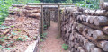
(20) As you come out of the woods, turn right. Walk to the road and cross it. At a place called Carrière de Kaolin, ignore the signposting and take the path running along the left-hand side of the pond. Discover the traces of the Nutons of the quarry by following the Sentier des Nutons. After following the path and reaching a wooden footbridge, continue straight on.
(21) At the track, turn left and then immediately left again. Yellow cycle route markings. Then continue to the right. Ignore the grassy path on your left. The forest track turns right.
(22) Keep left round the bend; a path joins you from the right. At the T-junction, turn left.
(23) At the track after the meadow, turn right and leave the signposted route. At the end of the meadow, the path turns left. Leave the broom bushes behind and carry on straight ahead. Cross an open area with Christmas trees, then at the track, continue to the left until you reach the road.
(24) At the road, cross carefully and head straight ahead onto the very quiet side road towards Villance. Walk along the road for 2.5 km. Pass under the motorway bridge and, after the first houses, ignore a road coming from the left. Enter Villance and ignore the roads on your right until you come within sight of the church.
(25) At the N808, turn right and head back to the car park (E).
 Visorando Member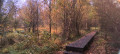
 Easy
Easy 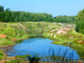
 Moderate