


There are no shops or drinking water points along the route.
There is a bench at (5) for a short break overlooking the nature reserve.
The first meanders of the Lesse from Ochamps


The source of the Lesse is situated in the forest to the east of Ochamps.
After barely 2 km, the river flows past the farms and the old La Goutelle mill, winding its way through the countryside towards Ochamps in a series of lovely meanders.
This walk invites you to discover them after completing a long circular route that follows forest paths and tracks, the condition of which varies depending on the season and forestry work. The walk crosses a few streams, some with footbridges and some without, follows a short stretch of tarmac and includes sections over wooden walkways in the lovely Troufferies nature reserve.
Details
Creation:
Last update:
Last review:
–
–
-
 Activity: Walking
 -
 Distance: 11.36 mi
 -
 Average duration: 6h 05
 -
 Difficulty: Moderate
 -
-
 Back to start: Yes
 -
 Ascent: + 948 ft
 -
 Descent: - 955 ft
 -
-
 Highest point: 1,677 ft
 -
 Lowest point: 1,325 ft
-
 Country:
Belgium
Country:
Belgium
-
 Area: Massif des Ardennes
 -
 City:
Libin
City:
Libin -
 Start/End: N 49.924916° / E 5.27705°
 -


 Hour-by-hour weather
Photos
Waypoints
- S/E : mi 0 - alt. 1,398 ft - Ochamps
- 1 : mi 0.48 - alt. 1,329 ft - lesse (rivière) - Belgique
- 2 : mi 0.93 - alt. 1,381 ft - Nargaufé Stream
- 3 : mi 1.91 - alt. 1,555 ft - Roûmont Wood
- 4 : mi 4.63 - alt. 1,424 ft - Sapins Pelzer hamlet
- 5 : mi 4.83 - alt. 1,407 ft - Les Troufferies de Libin Nature Reserve and bench
- 6 : mi 5.11 - alt. 1,362 ft - Large Fontaine Stream
- 7 : mi 5.6 - alt. 1,535 ft - A place known as La Haie Courbôle
- 8 : mi 7.28 - alt. 1,539 ft - Gerbaifet Farm
- 9 : mi 9.34 - alt. 1,506 ft - Path
- 10 : mi 9.97 - alt. 1,417 ft - Moulin de la Goutelle - lesse (rivière) - Belgique
- S/E : mi 11.36 - alt. 1,398 ft - Ochamps
Notes
Other walks in the area
Bané Campsite – Villance
 Visorando Member
 15.10 mi
+1,358 ft
-1,716 ft
8h 10
15.10 mi
+1,358 ft
-1,716 ft
8h 10
 Difficult
 Departure from Libin (Province de Luxembourg)
This second section runs along the eastern boundary of the municipality of Libin. After a night at the Bané campsite, explore the Anciennes Troufferies Nature Reserve and the Noire Eau valley as it joins the Lomme, before finishing at the former kaolin quarry in Libin.
The Anciennes Troufferies de Libin Nature Reserves
 8.60 mi
+830 ft
-856 ft
4h 40
Moderate
Departure from Libin (Province de Luxembourg)
8.60 mi
+830 ft
-856 ft
4h 40
Moderate
Departure from Libin (Province de Luxembourg)
The walk runs alongside and through the two nature reserves set up to preserve the former peat bogs or fens situated between the N40 and the railway line linking Brussels to Luxembourg. These sections offer a landscape typical of the ‘fagne’ region, with heathland, pools and shrubs.The entire route runs through woodland, with a wide variety of tree species offering a fairly balanced mix of conifers and deciduous trees. There is little undergrowth, allowing you to appreciate the forest in all its splendour.There are lovely views of the Large Fontaine stream just before the 3 km mark, the Fagne de Tailsus stream around the 6 km mark, and the Lomme stream at the 8 km mark, just before the steepest climb of the day.
The Libin Truffle Fields
 3.70 mi
+299 ft
-299 ft
2h 00
3.70 mi
+299 ft
-299 ft
2h 00
 Easy
Departure from Libin (Province de Luxembourg)
Easy
Departure from Libin (Province de Luxembourg)
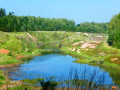
Troufferies: a Walloon word meaning peat bogs, i.e. a place where peat is extracted. Peat was extracted in Libin from the Middle Ages until the 1930s. Come and stroll through a forest landscape of marshes, peat bogs, mud flats and moors... unusual in this part of the Ardennes.
La Roche de Contranhé and the Troufferies de Libin Nature Reserve
 11.27 mi
+1,037 ft
-1,033 ft
6h 05
Moderate
Departure from Libin (Province de Luxembourg)
11.27 mi
+1,037 ft
-1,033 ft
6h 05
Moderate
Departure from Libin (Province de Luxembourg)
Set entirely within woodland, apart from a stretch of about 500 metres after the first crossing of the N40, this walk alternates between tracks, paths, areas of deciduous trees, areas of conifers, clear-cut areas, tall trees, small trees, grassy areas and other undergrowth, making for a very pleasant route where monotony never sets in.The first real point of interest you’ll come across is the old Arfaye quarry, where kaolin was once mined. It’s not the only one in the region: there’s another one along the road between Libin and Smuid. The Roche de Colanhé is worth a mention and a brief stop, as this type of rock is rare in this part of the Lomme basin. ‘Troufferie’ means ‘peat bog’ in Walloon. The entire area to the east of the route forms a landscape of peat bogs, mudflats and heathland, which is rather rare in this part of the Ardennes. The peat bogs are no longer worked, but some peaty areas are currently being restored.
Legendary site of Rocher du Cuy
 3.44 mi
+377 ft
-381 ft
1h 55
Easy
Departure from Libin (Province de Luxembourg)
3.44 mi
+377 ft
-381 ft
1h 55
Easy
Departure from Libin (Province de Luxembourg)
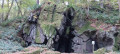
An eight-shaped route to the legendary site of Rocher du Cuy, also known as Roche aux Nutons, and the Villance forest. Nutons are creatures from Belgian and Ardennes folklore, often described as small, skilful beings living in caves and near waterways.
Forest walk in Jéhonville
 11.21 mi
+682 ft
-666 ft
5h 45
Moderate
Departure from Bertrix (Province de Luxembourg)
11.21 mi
+682 ft
-666 ft
5h 45
Moderate
Departure from Bertrix (Province de Luxembourg)
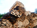
This region of the southern Ardennes is particularly active in forestry: the small village of Jéhonville alone has two sawmills.
The forest is omnipresent, even though the route crosses a few areas of pasture and crops.
The hike is a free combination of sections of local walking trails, GR® trails, the "Between Lesse and Lomme" route that circles the municipality of Libin, and unmarked but publicly accessible paths.
The route crosses a didactic route called "Sur les traces de 14-18" (In the footsteps of 14-18) and passes through the Vieille Rochette Nature Reserve.
You may or may not like the unusual shape of the bell tower of the church in Jéhonville.
In the footsteps of the First World War in Anloy
 8.63 mi
+630 ft
-633 ft
4h 30
Moderate
Departure from Libin (Province de Luxembourg)
8.63 mi
+630 ft
-633 ft
4h 30
Moderate
Departure from Libin (Province de Luxembourg)
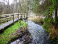
The title of this walk is a nod to – and a plug for – the signposted walk entitled ‘Sur les traces de 14-18’ (In the footsteps of 14-18), which starts in Anloy and traces the history of the First World War in the Ardennes village of Anloy through a multitude of very well-made information panels.Of these information panels, this particular route only takes you past two: one at a place called Franc-Bois and the other, just before the finish, at the Franco-German cemetery in Anloy-Bruyères.Largely through woodland with a good mix of deciduous and coniferous trees, the walk will also take you past the Pont de la Justice and, nearby, the developed wetland area of the Ri de Chêne.
Forest paths and country roads in Villance
 4.46 mi
+377 ft
-381 ft
2h 25
Easy
Departure from Libin (Province de Luxembourg)
4.46 mi
+377 ft
-381 ft
2h 25
Easy
Departure from Libin (Province de Luxembourg)
Circular route in the Ardennes forest in the Libin region, combining forest paths, trails and quiet country roads for the last two kilometres. Set off to discover the Devil's Stone, the Haute Lesse, the Pont de la Justice and Notre-Dame de Taillevent.
For more walks, use our search engine .
The GPS track and description are the property of this route's author. Please do not copy them without permission.

