


Picnic area at (5)
Walk starting from Pont de Libin


Mainly through woodland, this walk partly follows the “Sentier entre Lesse et Lomme” as well as the route of the old local road linking Poix-Saint-Hubert to Libin. The route passes by the former kaolin quarry (picnic area, pond and a fun children’s trail based on the enchanting theme of the ‘nutons’) and runs alongside numerous Christmas tree nurseries in the rural section on the western side.
Details
Creation:
Last update:
Last review:
–
–
-
 Activity: Walking
 -
 Distance: 10.75 mi
 -
 Average duration: 5h 50
 -
 Difficulty: Moderate
 -
-
 Back to start: Yes
 -
 Ascent: + 1,033 ft
 -
 Descent: - 1,014 ft
 -
-
 Highest point: 1,565 ft
 -
 Lowest point: 1,152 ft
-
 Country:
Belgium
Country:
Belgium
-
 Area: Massif des Ardennes
 -
 City:
Saint-Hubert (Belgique)
City:
Saint-Hubert (Belgique) -
 Start/End: N 49.987964° / E 5.316274°
 -


 Hour-by-hour weather
Photos

Waypoints
- S/E : mi 0 - alt. 1,227 ft - Libin Bridge - Lomme (rivière) - Belgique
- 1 : mi 1.29 - alt. 1,463 ft - A place known as Les Chipteuses
- 2 : mi 2.74 - alt. 1,322 ft - Maison Blanche hamlet
- 3 : mi 3.44 - alt. 1,257 ft - Randour-Vicinal hamlet
- 4 : mi 4.22 - alt. 1,368 ft - Pont Lozet stream
- 5 : mi 4.92 - alt. 1,480 ft - Former kaolin quarry
- 6 : mi 5.86 - alt. 1,506 ft - N808
- 7 : mi 7.13 - alt. 1,542 ft - Nurseries
- 8 : mi 8.34 - alt. 1,516 ft - Ruisseau du Moulin
- 9 : mi 9.67 - alt. 1,417 ft - A place known as Aux Tachenires
- S/E : mi 10.75 - alt. 1,227 ft - Libin Bridge - Lomme (rivière) - Belgique
Notes
Other walks in the area
Ardennes getaway in Hatrival
 Visorando Member
 11.60 mi
+955 ft
-938 ft
6h 10
Moderate
11.60 mi
+955 ft
-938 ft
6h 10
Moderate
 Departure from Saint-Hubert (Belgique) (Province de Luxembourg)
Hatrival seems to have adopted the crows as its emblem... why not!We didn’t spot any more or fewer than elsewhere, but it is indeed the town’s emblem that stands at the village entrance and adorns one or two of the local lodges.After skirting a huge stud farm, the walk heads into the forest for a few kilometres before reaching the hamlet of Pont de Libin and following the railway line.A long climb through the forest follows to reach the heights of the Carrière du Petit Bois.There’s a superb view of the quarry, but take care as the path running alongside it tends to crumble and the site’s safety fence is partially hanging over the drop!The walk then gradually leaves the forest to cross the N89 and reach the village of Bras-Haut and the surrounding countryside.Take care when crossing the N89 (see note in ‘Practical Information’ below), where the route joins the forest paths leading to the entrance to Hatrival.
Family walk in Poix-Saint-Hubert
 4.62 mi
+528 ft
-512 ft
2h 35
4.62 mi
+528 ft
-512 ft
2h 35
 Easy
Departure from Saint-Hubert (Belgique) (Province de Luxembourg)
Easy
Departure from Saint-Hubert (Belgique) (Province de Luxembourg)
The children in the group will love it… some of the adults, perhaps a little less so: around km 1, the GR®17 follows a barely visible path through mature forests, young spruce trees, young birch trees, broom and also a few brambles. It’s quite refreshing with the morning dew or after a good downpour!
Walk in Val de Poix
 5.78 mi
+554 ft
-541 ft
3h 10
Easy
Departure from Saint-Hubert (Belgique) (Province de Luxembourg)
5.78 mi
+554 ft
-541 ft
3h 10
Easy
Departure from Saint-Hubert (Belgique) (Province de Luxembourg)
Circular forest to discover the Chapel of Notre-Dame de Bon Secours, the Rocher Marie Gobaille and ending along the Lomme with its two 19th-century buildings, formerly hydroelectric power stations.
In the woods of Poix Saint-Hubert
 5.71 mi
+741 ft
-738 ft
3h 15
Moderate
Departure from Saint-Hubert (Belgique) (Province de Luxembourg)
5.71 mi
+741 ft
-738 ft
3h 15
Moderate
Departure from Saint-Hubert (Belgique) (Province de Luxembourg)
A walk through the woods of the Val de Poix. Suitable at any time of year: in summer for the cool air, in autumn for the colours, or in the snow for a peaceful atmosphere.
Circular forest loop between Poix-Saint-Hubert and Hatrival
 6.93 mi
+860 ft
-843 ft
3h 55
Moderate
Departure from Saint-Hubert (Belgique) (Province de Luxembourg)
6.93 mi
+860 ft
-843 ft
3h 55
Moderate
Departure from Saint-Hubert (Belgique) (Province de Luxembourg)
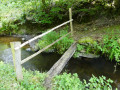
This mainly woodland walk takes the walker from the centre of Poix-Saint-Hubert to the outskirts of Hatrival, where the route passes by the Écurie des Îles (a horse breeding and trading centre) before branching off into the woods again. There isa short stretch through fairly wild, overgrown terrain in the Bois de Poix around the 1 km mark. Shortly after the 7.5 km mark, the route literally plunges down the eastern slope of the Lomme (still known as L’Homme in some places) and passes under the Brussels–Luxembourg railway line. After a steep climb of a few hundred metres, the walk turns right to head back down towards the station and the starting point, passing by the village school.
La Roche de Contranhé and the Troufferies de Libin Nature Reserve
 11.27 mi
+1,037 ft
-1,033 ft
6h 05
Moderate
Departure from Libin (Province de Luxembourg)
11.27 mi
+1,037 ft
-1,033 ft
6h 05
Moderate
Departure from Libin (Province de Luxembourg)
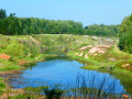
Set entirely within woodland, apart from a stretch of about 500 metres after the first crossing of the N40, this walk alternates between tracks, paths, areas of deciduous trees, areas of conifers, clear-cut areas, tall trees, small trees, grassy areas and other undergrowth, making for a very pleasant route where monotony never sets in.The first real point of interest you’ll come across is the old Arfaye quarry, where kaolin was once mined. It’s not the only one in the region: there’s another one along the road between Libin and Smuid. The Roche de Colanhé is worth a mention and a brief stop, as this type of rock is rare in this part of the Lomme basin. ‘Troufferie’ means ‘peat bog’ in Walloon. The entire area to the east of the route forms a landscape of peat bogs, mudflats and heathland, which is rather rare in this part of the Ardennes. The peat bogs are no longer worked, but some peaty areas are currently being restored.
The Libin Truffle Fields
 3.70 mi
+299 ft
-299 ft
2h 00
Easy
Departure from Libin (Province de Luxembourg)
3.70 mi
+299 ft
-299 ft
2h 00
Easy
Departure from Libin (Province de Luxembourg)
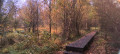
Troufferies: a Walloon word meaning peat bogs, i.e. a place where peat is extracted. Peat was extracted in Libin from the Middle Ages until the 1930s. Come and stroll through a forest landscape of marshes, peat bogs, mud flats and moors... unusual in this part of the Ardennes.
The River Lomme between Arville and Smuid
 9.90 mi
+938 ft
-925 ft
5h 20
Moderate
Departure from Saint-Hubert (Belgique) (Province de Luxembourg)
9.90 mi
+938 ft
-925 ft
5h 20
Moderate
Departure from Saint-Hubert (Belgique) (Province de Luxembourg)
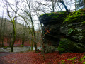
Starting from Arville cemetery, the walk heads due north at first, then turns west to reach the Chapelle du Cheny du Mont.The second stop is the Rocher de Marie Gobaille, named after a legendary witch. It is from this point that the route begins to follow the course of the River Lomme upstream.The third stop is the Sainte-Adeline Canal, running alongside the River Lomme, with its small hydroelectric power station and, further on, the old mill at Pont-à-Smuid.This is followed by a short detour to the other side of the Brussels–Luxembourg railway line to follow the route of an old local track, and a return to the starting point after crossing both the River Lomme and the railway line once more and skirting the motocross route near the Ferme du Val-de-Poix.The entire route runs through woodland from the second kilometre onwards.
For more walks, use our search engine .
The GPS track and description are the property of this route's author. Please do not copy them without permission.

