


Whilst there are ways to shorten the route here and there, unfortunately there is no way to avoid the few hundred metres of road between (S/E) and the N40.
Please note: the OpenStreetMap base map sometimes shows paths or tracks that do not exist on the ground. You should rely on the IGN topographical map instead. Above all, stay on the paths and do not take any paths or firebreaks where access is clearly prohibited. These are wildlife sanctuaries and any infringement is liable to a hefty fine.
Also take care when crossing the N40 twice: traffic is quite heavy and travelling at high speed. Furthermore, visibility during the first crossing between (1) and (3) is rather poor.
There are very few benches along the route: the first is shortly after (5), another a little further on, and a third can be found between (7) and (8).
La Roche de Contranhé and the Troufferies de Libin Nature Reserve


Set entirely within woodland, apart from a stretch of about 500 metres after the first crossing of the N40, this walk alternates between tracks, paths, areas of deciduous trees, areas of conifers, clear-cut areas, tall trees, small trees, grassy areas and other undergrowth, making for a very pleasant route where monotony never sets in.
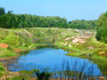
The first real point of interest you’ll come across is the old Arfaye quarry, where kaolin was once mined. It’s not the only one in the region: there’s another one along the road between Libin and Smuid.
The Roche de Colanhé is worth a mention and a brief stop, as this type of rock is rare in this part of the Lomme basin.
‘Troufferie’ means ‘peat bog’ in Walloon. The entire area to the east of the route forms a landscape of peat bogs, mudflats and heathland, which is rather rare in this part of the Ardennes. The peat bogs are no longer worked, but some peaty areas are currently being restored.
Details
–
-
 Activity: Walking
 -
 Distance: 11.27 mi
 -
 Average duration: 6h 05
 -
 Difficulty: Moderate
 -
-
 Back to start: Yes
 -
 Ascent: + 1,037 ft
 -
 Descent: - 1,033 ft
 -
-
 Highest point: 1,713 ft
 -
 Lowest point: 1,257 ft
-
 Country:
Belgium
Country:
Belgium
-
 Area: Massif des Ardennes
 -
 City:
Libin
City:
Libin -
 Start/End: N 49.957427° / E 5.277535°
 -


 Hour-by-hour weather
Photos
Waypoints
- S/E : mi 0 - alt. 1,565 ft - Route de Glaireuse
- 1 : mi 1.23 - alt. 1,529 ft - Reservoir
- 2 : mi 1.74 - alt. 1,581 ft - N40
- 3 : mi 2.14 - alt. 1,565 ft - Footbridge, forest path
- 4 : mi 2.22 - alt. 1,549 ft - Former Arfaye quarry
- 5 : mi 5.26 - alt. 1,263 ft - Fagne de Tailsus stream
- 6 : mi 5.86 - alt. 1,407 ft - Cotranhé Rock
- 7 : mi 6.76 - alt. 1,424 ft - Pelzer firs
- 8 : mi 7.22 - alt. 1,368 ft - Large Fontaine Stream
- 9 : mi 7.73 - alt. 1,535 ft - Courbôle
- 10 : mi 9.04 - alt. 1,654 ft - Roumont Castle
- 11 : mi 11 - alt. 1,604 ft - N40
- S/E : mi 11.27 - alt. 1,565 ft - Route de Glaireuse
Notes
Other walks in the area
The Libin Truffle Fields
 Visorando Member
 3.70 mi
+299 ft
-299 ft
2h 00
3.70 mi
+299 ft
-299 ft
2h 00
 Easy
Easy
 Departure from Libin (Province de Luxembourg)
Legendary site of Rocher du Cuy
 3.44 mi
+377 ft
-381 ft
1h 55
Easy
Departure from Libin (Province de Luxembourg)
3.44 mi
+377 ft
-381 ft
1h 55
Easy
Departure from Libin (Province de Luxembourg)
Bané Campsite – Villance
 15.10 mi
+1,358 ft
-1,716 ft
8h 10
15.10 mi
+1,358 ft
-1,716 ft
8h 10
 Difficult
Departure from Libin (Province de Luxembourg)
Difficult
Departure from Libin (Province de Luxembourg)
Forest paths and country roads in Villance
 4.46 mi
+377 ft
-381 ft
2h 25
Easy
Departure from Libin (Province de Luxembourg)
4.46 mi
+377 ft
-381 ft
2h 25
Easy
Departure from Libin (Province de Luxembourg)
Villance – Bané Bivouac
 17.24 mi
+1,381 ft
-1,033 ft
9h 10
Difficult
Departure from Libin (Province de Luxembourg)
17.24 mi
+1,381 ft
-1,033 ft
9h 10
Difficult
Departure from Libin (Province de Luxembourg)
Two days between Lesse and Lomme around Libin
 32.33 mi
+2,740 ft
-2,749 ft
2 days
Difficult
Departure from Libin (Province de Luxembourg)
32.33 mi
+2,740 ft
-2,749 ft
2 days
Difficult
Departure from Libin (Province de Luxembourg)
Étang des Moines and Haut-Fourneau de Marsolle
 7.41 mi
+873 ft
-879 ft
4h 10
Moderate
Departure from Libin (Province de Luxembourg)
7.41 mi
+873 ft
-879 ft
4h 10
Moderate
Departure from Libin (Province de Luxembourg)
Family walk in Poix-Saint-Hubert
 4.62 mi
+528 ft
-512 ft
2h 35
Easy
Departure from Saint-Hubert (Belgique) (Province de Luxembourg)
4.62 mi
+528 ft
-512 ft
2h 35
Easy
Departure from Saint-Hubert (Belgique) (Province de Luxembourg)
For more walks, use our search engine .
The GPS track and description are the property of this route's author. Please do not copy them without permission.

