


Refine your search for walks in Libin
Libin walks


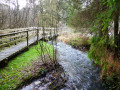
 Forest paths and country roads in Villance
 Visorando Member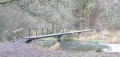
 4.46 mi
 +377 ft
 -381 ft
 2h 25
2h 25
 Easy
Easy
 Departure from Libin (Province de Luxembourg)
Circular route in the Ardennes forest in the Libin region, combining forest paths, trails and quiet country roads for the last two kilometres. Set off to discover the Devil's Stone, the Haute Lesse, the Pont de la Justice and Notre-Dame de Taillevent.
Two days between Lesse and Lomme around Libin
 32.33 mi
+2,740 ft
-2,749 ft
2 days
32.33 mi
+2,740 ft
-2,749 ft
2 days
 Difficult
Departure from Libin (Province de Luxembourg)
Difficult
Departure from Libin (Province de Luxembourg)
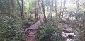
A wooded walk through the Grande Forêt de Saint-Hubert, amongst rivers and streams.
The route takes you on a journey of discovery to the source of the Lesse, the old truffle grounds of Libin and its former kaolin quarry. Explore the valleys of this magnificent region at your own pace.
Villance – Bané Bivouac
 17.24 mi
+1,381 ft
-1,033 ft
9h 10
Difficult
Departure from Libin (Province de Luxembourg)
17.24 mi
+1,381 ft
-1,033 ft
9h 10
Difficult
Departure from Libin (Province de Luxembourg)
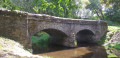
This first section runs along the western and southern boundaries of the municipality of Libin. Discover the Anloy military cemetery and the First World War memorial steles in Ochamps. Pass close to the Source de la Lesse and finish at the Bané campsite.
Legendary site of Rocher du Cuy
 3.44 mi
+377 ft
-381 ft
1h 55
Easy
Departure from Libin (Province de Luxembourg)
3.44 mi
+377 ft
-381 ft
1h 55
Easy
Departure from Libin (Province de Luxembourg)
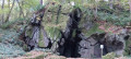
An eight-shaped route to the legendary site of Rocher du Cuy, also known as Roche aux Nutons, and the Villance forest. Nutons are creatures from Belgian and Ardennes folklore, often described as small, skilful beings living in caves and near waterways.
La Roche de Contranhé and the Troufferies de Libin Nature Reserve
 11.27 mi
+1,037 ft
-1,033 ft
6h 05
11.27 mi
+1,037 ft
-1,033 ft
6h 05
 Moderate
Departure from Libin (Province de Luxembourg)
Moderate
Departure from Libin (Province de Luxembourg)
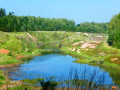
Set entirely within woodland, apart from a stretch of about 500 metres after the first crossing of the N40, this walk alternates between tracks, paths, areas of deciduous trees, areas of conifers, clear-cut areas, tall trees, small trees, grassy areas and other undergrowth, making for a very pleasant route where monotony never sets in.The first real point of interest you’ll come across is the old Arfaye quarry, where kaolin was once mined. It’s not the only one in the region: there’s another one along the road between Libin and Smuid. The Roche de Colanhé is worth a mention and a brief stop, as this type of rock is rare in this part of the Lomme basin. ‘Troufferie’ means ‘peat bog’ in Walloon. The entire area to the east of the route forms a landscape of peat bogs, mudflats and heathland, which is rather rare in this part of the Ardennes. The peat bogs are no longer worked, but some peaty areas are currently being restored.
Between Lesse and Lesse
 11.42 mi
+1,194 ft
-1,191 ft
6h 15
Moderate
Departure from Libin (Province de Luxembourg)
11.42 mi
+1,194 ft
-1,191 ft
6h 15
Moderate
Departure from Libin (Province de Luxembourg)
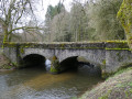
Mainly through woodland but with two long stretches in the countryside, this walk takes you on a journey of discovery through the upper Lesse and its hamlet of the same name. Mostly along wide paths, the route is fairly easy, though some sections may be a little muddy following seasonal forestry work.
Circular route between Maissin and Redu
 8.27 mi
+932 ft
-922 ft
4h 35
Moderate
Departure from Libin (Province de Luxembourg)
8.27 mi
+932 ft
-922 ft
4h 35
Moderate
Departure from Libin (Province de Luxembourg)
A forest route from Maissin, an Ardennes village situated on a bend in the Haute Lesse, to the outskirts of Redu, passing through the village of Lesse.
Chamont Woods
 7.69 mi
+719 ft
-745 ft
4h 10
Moderate
Departure from Libin (Province de Luxembourg)
7.69 mi
+719 ft
-745 ft
4h 10
Moderate
Departure from Libin (Province de Luxembourg)
In the Centre Ardenne region, explore the forest paths of the Bois de Chamont, the farm tracks of Transinne, the Pont de la Justice, the Roche des Nutons, LandArt and much more...
In the footsteps of the First World War in Anloy
 8.63 mi
+630 ft
-633 ft
4h 30
Moderate
Departure from Libin (Province de Luxembourg)
8.63 mi
+630 ft
-633 ft
4h 30
Moderate
Departure from Libin (Province de Luxembourg)
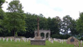
The title of this walk is a nod to – and a plug for – the signposted walk entitled ‘Sur les traces de 14-18’ (In the footsteps of 14-18), which starts in Anloy and traces the history of the First World War in the Ardennes village of Anloy through a multitude of very well-made information panels.Of these information panels, this particular route only takes you past two: one at a place called Franc-Bois and the other, just before the finish, at the Franco-German cemetery in Anloy-Bruyères.Largely through woodland with a good mix of deciduous and coniferous trees, the walk will also take you past the Pont de la Justice and, nearby, the developed wetland area of the Ri de Chêne.
A bit of history in the woods around Maissin
 8.17 mi
+719 ft
-738 ft
4h 25
Moderate
Departure from Libin (Province de Luxembourg)
8.17 mi
+719 ft
-738 ft
4h 25
Moderate
Departure from Libin (Province de Luxembourg)
Maissin, a village forming part of the very new Southern Ardennes Nature Park, was the scene of a bloody battle between the German and French armies on 22 and 23 August 1914. It was the only engagement won by the French in Belgium. Starting from the Pierre Massé military cemetery, discover the sites of the old, original cemeteries, as well as La Mambore and its llamas, the Pont de la Justice, the Roche des Nutons and the Pont Marie-Thérèse.
The Libin Truffle Fields
 3.70 mi
+299 ft
-299 ft
2h 00
Easy
Departure from Libin (Province de Luxembourg)
3.70 mi
+299 ft
-299 ft
2h 00
Easy
Departure from Libin (Province de Luxembourg)
Troufferies: a Walloon word meaning peat bogs, i.e. a place where peat is extracted. Peat was extracted in Libin from the Middle Ages until the 1930s. Come and stroll through a forest landscape of marshes, peat bogs, mud flats and moors... unusual in this part of the Ardennes.
The Anciennes Troufferies de Libin Nature Reserves
 8.60 mi
+830 ft
-856 ft
4h 40
Moderate
Departure from Libin (Province de Luxembourg)
8.60 mi
+830 ft
-856 ft
4h 40
Moderate
Departure from Libin (Province de Luxembourg)
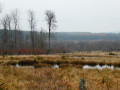
The walk runs alongside and through the two nature reserves set up to preserve the former peat bogs or fens situated between the N40 and the railway line linking Brussels to Luxembourg. These sections offer a landscape typical of the ‘fagne’ region, with heathland, pools and shrubs.The entire route runs through woodland, with a wide variety of tree species offering a fairly balanced mix of conifers and deciduous trees. There is little undergrowth, allowing you to appreciate the forest in all its splendour.There are lovely views of the Large Fontaine stream just before the 3 km mark, the Fagne de Tailsus stream around the 6 km mark, and the Lomme stream at the 8 km mark, just before the steepest climb of the day.
The first meanders of the Lesse from Ochamps
 11.36 mi
+948 ft
-955 ft
6h 05
Moderate
Departure from Libin (Province de Luxembourg)
11.36 mi
+948 ft
-955 ft
6h 05
Moderate
Departure from Libin (Province de Luxembourg)
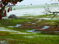
The source of the Lesse is situated in the forest to the east of Ochamps.After barely 2 km, the river flows past the farms and the old La Goutelle mill, winding its way through the countryside towards Ochamps in a series of lovely meanders.This walk invites you to discover them after completing a long circular route that follows forest paths and tracks, the condition of which varies depending on the season and forestry work. The walk crosses a few streams, some with footbridges and some without, follows a short stretch of tarmac and includes sections over wooden walkways in the lovely Troufferies nature reserve.
Étang des Moines and Haut-Fourneau de Marsolle
 7.41 mi
+873 ft
-879 ft
4h 10
Moderate
Departure from Libin (Province de Luxembourg)
7.41 mi
+873 ft
-879 ft
4h 10
Moderate
Departure from Libin (Province de Luxembourg)
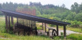
From the village of Smuid (pronounced Smoui), discover the Étang des Moines and the remains of the Marsolle blast furnace.
Walk between the Lesse and the Our
 10.53 mi
+1,033 ft
-1,024 ft
5h 45
Moderate
Departure from Libin (Province de Luxembourg)
10.53 mi
+1,033 ft
-1,024 ft
5h 45
Moderate
Departure from Libin (Province de Luxembourg)
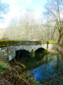
Starting from the hamlet of Lesse, the walk begins by following the river of the same name upstream on the left bank, crosses it at the Moulin de Molhan and then heads along the right bank towards Villance.Shortly after the 4-kilometre mark, the route branches off due south towards the Pont de la Justice before reaching the centre of Maissin. On leaving Maissin, the walk heads out into the countryside before entering the forest and descending gently towards the Our, which you follow almost to its confluence with the Lesse. No difficulties apart from a bit of mud here and there.
The two waters from Lesse
 11.69 mi
+1,027 ft
-1,024 ft
6h 15
Moderate
Departure from Libin (Province de Luxembourg)
11.69 mi
+1,027 ft
-1,024 ft
6h 15
Moderate
Departure from Libin (Province de Luxembourg)
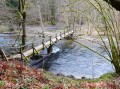
Set off on a walk themed around water and the forest from the hamlet of Lesse.The two main rivers in the region are the Our and the Lesse, which converge less than 2 km from the starting point.
To the Pont du Sanglier from Redu
6.89 mi
+860 ft
-856 ft
3h 55
Easy
Departure from Libin (Province de Luxembourg)
A lovely walk of nearly 11 km, mostly along the banks of the Lesse and through the woods.
Start from the centre of Redu near the tavern.
There you’ll find a small beach (1) where you can have a picnic or dip your toes in the water.
The route is fairly easy, although there are a few short climbs, but nothing too difficult.
I simply crossed the Lesse at (5) about 750 m from the Pont du Sanglier (4) – the water was 30 cm deep – to follow the riverbank in the opposite direction; otherwise, you can turn around and retrace your steps to rejoin the route at the Pont du Sanglier.
And to finish off, enjoy a drink on the terrace at the tavern at the starting point.
Loop around the Lesse starting from Redu, Village of Books
 8.05 mi
+981 ft
-991 ft
4h 35
Moderate
Departure from Libin (Province de Luxembourg)
8.05 mi
+981 ft
-991 ft
4h 35
Moderate
Departure from Libin (Province de Luxembourg)
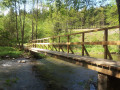
Discover the wild Haute Lesse from Redu, passing through La Roche aux Chevaux and the Notre-Dame de Walcourt chapel in the village of Lesse.
Bané Campsite – Villance
 15.10 mi
+1,358 ft
-1,716 ft
8h 10
Difficult
Departure from Libin (Province de Luxembourg)
15.10 mi
+1,358 ft
-1,716 ft
8h 10
Difficult
Departure from Libin (Province de Luxembourg)
This second section runs along the eastern boundary of the municipality of Libin. After a night at the Bané campsite, explore the Anciennes Troufferies Nature Reserve and the Noire Eau valley as it joins the Lomme, before finishing at the former kaolin quarry in Libin.
More walks in Libin
Select a point of interest below: