At the Source of the Lesse

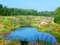
A forest walk to discover the Source of the Lesse

Details

n°56019436
Creation:
Last update:
Last review:
  • Walking
    Activity: Walking
  • ↔
    Distance: 3.15 mi
  • ◔
    Average duration: 1h 40 
  • ▲
    Difficulty: Easy

  • ⚐
    Back to start: Yes
  • ↗
    Ascent: + 240 ft
  • ↘
    Descent: - 230 ft

  • ▲
    Highest point: 1,634 ft
  • ▼
    Lowest point: 1,483 ft

Photos

Description of the walk

Car park at the entrance to the forest track starting from Rue Jules Philippe in Ochamps, not far from No. 175.

Markings: Red Rectangle 3

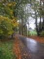
(S/E) With your back to the road, head into the forest. Walk for 600 m.

(1) Ignore the forest track branching off to the left and continue straight on, ignoring the adjacent paths. Change of signposting.

Green Rectangle signpost + Forêt de Saint-Hubert logo

Continue for 1.75 km along the well-marked stony path. This turns sharply to the right and leads out onto the road.

(2) Cross diagonally to the left towards the sign for the hamlet of Source de la Lesse. Take the path near the sign. Walk past a bench and look out for the path on a slope to your left.

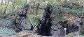
(3) Follow it to discover the Source de la Lesse. Retrace your steps and continue along the path to the left. Cross a footbridge. At the junction with a green barrier, carry on straight ahead.

(4) Turn left. Cross another pontoon bridge. Keep to the left.

(5) Leave the woods. Walk for 850 m until you reach the road. The signposting ends here.

No signposting

(6) Turn right, walk past the farm and join a road.

(7) Turn left onto this road and walk along it carefully for 250 m until you reach your car park. (S/E)

Waypoints

  1. S/E : mi 0 - alt. 1,512 ft - Forest track
  2. 1 : mi 0.37 - alt. 1,509 ft - Crossroads
  3. 2 : mi 1.46 - alt. 1,624 ft - Route
  4. 3 : mi 1.58 - alt. 1,575 ft - Source of the - lesse (rivière) - Belgique
  5. 4 : mi 1.89 - alt. 1,572 ft - Turn left
  6. 5 : mi 2.29 - alt. 1,532 ft - Exit the woods
  7. 6 : mi 2.82 - alt. 1,503 ft - Route: Markings discontinued
  8. 7 : mi 2.99 - alt. 1,542 ft - Route
  9. S/E : mi 3.15 - alt. 1,512 ft - Forest track

Notes

No drinking water along the route.
Wide paths from the start (S) to (2), root-covered trails from (2) to (5).
The route is exposed from (5) to the finish (E), so remember to protect yourself.

Worth a visit

Reviews and comments

4.7 / 5
Based on 1 review

Reliability of the description
5 / 5
Ease of following the route
5 / 5
Route interest
4 / 5
Lucw
Lucw

Overall rating : 4.7 / 5

Date of your route : Aug 12, 2024
Reliability of the description : ★★★★★ Very good
Ease of following the route : ★★★★★ Very good
Route interest : ★★★★☆ Good
Very busy route : No

A lovely little walk in the woods

Machine-translated

Other walks in the area

For more walks, use our search engine .

The GPS track and description are the property of this route's author. Please do not copy them without permission.