Les Mémises on snowshoes: western circular loop

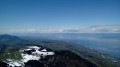
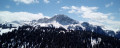
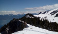
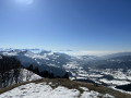
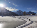
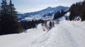
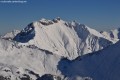
An easy circular walk through snow-covered mountain pastures dominated by the north face of the Dent d’Oche and the slopes of Les Mémises. The (optional) ascent to the summit offers a magnificent view over Lake Geneva.

Details

n°19830756
Creation:
Last update:
Last review:
  • Snowshoeing
    Activity: Snowshoeing
  • ↔
    Distance: 2.95 mi
  • ◔
    Duration according to the author: 1.5 hrs 
  • ▲
    Difficulty: Easy

  • ⚐
    Back to start: Yes
  • ↗
    Ascent: + 509 ft
  • ↘
    Descent: - 502 ft

  • ▲
    Highest point: 5,492 ft
  • ▼
    Lowest point: 4,961 ft

Photos

Description of the walk

Access to the Thollon-les-Mémises resort via the D24 from Evian-les-Bains, Maxilly or Lugrin. Drive past the village centre of Thollon; at the resort, there is a large car park on the left-hand side of the road. The lower station can be reached on foot via a small road that branches off to the right and leads uphill after passing the car park.

Start from the upper station of the Les Mémises gondola lift. On the descent, head to the right and cross the terrace of the mountain bar-restaurant. Make your way to a ski area for young beginners and leave the sheltered ski lift at this site on your right.

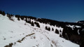
The route is unmarked but signposted with large blue stakes

(S/E) At the foot of the ski lift, looking westwards, you’ll see two runs: take the one on the left and descend gently beneath the spruce trees. Once in open terrain, make a hairpin bend to the left and continue down.

(1) After about 250 m, turn sharply right and follow the slope on a roughly level path.

(2) Ignore a track coming from the left and head uphill to quickly reach another junction (geological information sign).

(3) Turn sharply right towards the cable car. Climb gently and steadily, first across open ground and then through the spruce trees.

Unmarked route

(S/E) For those wishing to climb the Pic des Mémises, head left and make a short ascent between a chalet (on the left) and the edge of the beginners’ ski area (on the right).

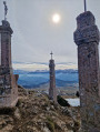
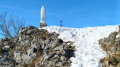
(4) At the corner of the chalet, turn left (west) and follow the ridge up to the summit (pylon, monumental cross).

(5) Retrace your steps to return to the starting point (S/E).

Waypoints

  1. S/E : mi 0 - alt. 5,236 ft - Top station of the - Télécabine des Mémises
  2. 1 : mi 0.51 - alt. 5,046 ft - Junction
  3. 2 : mi 1.04 - alt. 5,010 ft - Junction
  4. 3 : mi 1.14 - alt. 5,049 ft - Crossroads – Geological information board
  5. 4 : mi 2.01 - alt. 5,243 ft - Crête des Mémises – View of the - Lac Léman
  6. 5 : mi 2.47 - alt. 5,492 ft - Pic des Mémises
  7. S/E : mi 2.95 - alt. 5,236 ft - Top station of the - Télécabine des Mémises

Notes

Winter hiking equipment required, including poles. If snow cover is moderate (late in the season, for example), this route may be suitable for walkers without snowshoes but wearing suitable footwear.

The first circular loop starting from (S/E), via (3), is maintained. The ascent of the Pic des Mémises from (S/E) to (5) follows the ridge: take care of the sheer drops to the north (on the right as you ascend).

The area is not prone to avalanches.

There is a bar-restaurant at the top station of the cable car (S/E).

A detailed map is useful (at the very least, the one accompanying this description).

Hike completed twice by the author, the first time on 3 March 2022, the second on 10 March 2022.

Worth a visit

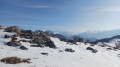
- A very beautiful snow-covered mountain setting.
- A sweeping panorama of Lake Geneva, its Swiss shore and the Jura Mountains from the Pic des Mémises (5).

Reviews and comments

5 / 5
Based on 1 review

Reliability of the description
5 / 5
Ease of following the route
5 / 5
Route interest
5 / 5
User 30452906

Overall rating : 5 / 5

Date of your route : Aug 10, 2026
Reliability of the description : ★★★★★ Very good
Ease of following the route : ★★★★★ Very good
Route interest : ★★★★★ Very good
Very busy route : Yes

A lovely walk for beginners

Machine-translated

Other walks in the area

For more walks, use our search engine .

The GPS track and description are the property of this route's author. Please do not copy them without permission.