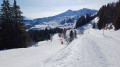
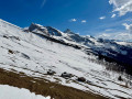
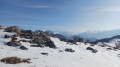
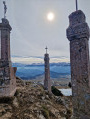
Col de la Golèse and Lac des Mines d’Or as seen from L’Erigné

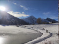
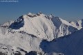
This intermediate-level hike takes you to the Col de Golèse and the Golèse Refuge from L’Erigné, whilst also offering views of the panorama around Lac des Mines d’Or. Depending on snow conditions, it is possible to cover a large part of the route wearing only hiking boots fitted with crampons. However, you will still need to use snowshoes for the highest sections.

Details

43982205
Creation:
Last update:
Last review:
  • Snowshoeing
    Activity: Snowshoeing
  • ↔
    Distance: 6.00 mi
  • ◔
    Duration according to the author: 5 hrs 
  • ▲
    Difficulty: Moderate

  • ⚐
    Back to start: Yes
  • ↗
    Ascent: + 1,818 ft
  • ↘
    Descent: - 1,808 ft

  • ▲
    Highest point: 5,440 ft
  • ▼
    Lowest point: 3,878 ft
  • ⚐ Country: France
  • ⚐
    Areas: Alps, Giffre
  • ⚐ City: Morzine (74110)
  • ⚑
    Start/End: N 46.149506° / E 6.753664°
  • ❏
    IGN map(s): Ref. 3528ET, 3528ETR, 3530ET, 3530ETR
  • Hour-by-hour weather

Photos

Description of the walk

The route starts from the Érigné d’en Haut car park. During school holidays, the free ‘E’ shuttle bus provides access to this car park. The start of this hike is at the terminus of the ‘E’ line. If you decide to take the shuttle bus, please be aware of the timetable (allow at least 45 minutes between services) and check the departure times at the bus stops.

(S/E) Follow the road uphill towards Lac des Mines d’Or for about 900 metres until you reach a junction just past the hamlet of Charny.

(1) Turn right, follow the right bank of the Dranse de la Manche and you’ll reach the Pont de Chardonnière.

(2) Leave the bridge on your left and turn right onto the path which climbs quite steeply towards the Col de la Golèse. Walk uphill, first through the woods and then across a clearing, to reach the Vigny chalets.

(3) Continue the climb and, via a few widely spaced hairpin bends, reach the crossroads at the Bonnevalette chalets.

(4) Carry on due south, continuing the steep climb to reach the Col de la Golèse and the Refuge de la Golèse.

(5) Then head back down the same route to the Pont de Chardonnière.

(2) Important note: if you’re feeling tired, you can avoid the climb to the lake by turning left onto the path you took on the way there to return to the junction you passed on the way up.
- Otherwise, cross the bridge – this is the route shown on the map – then turn left to head up towards Lac des Mines d’Or. Please note: just off the bridge, there are two paths running almost parallel to each other. Take the higher one, which is generally the busier and wider of the two.
You’ll soon reach a junction of tracks.

(6) Head straight ahead to complete the climb and reach Lac des Mines d’Or.

(7) Head back in the opposite direction to return to the previous junction.

(6) Turn right to descend to the initial junction you passed on the way out.

(1) Follow the original route back in the opposite direction to return to the Érigné car park (S/E).

Waypoints

  1. S/E : mi 0 - alt. 3,878 ft - Érigné car park
  2. 1 : mi 0.55 - alt. 4,170 ft - Crossroads of the circular loop
  3. 2 : mi 1.06 - alt. 4,298 ft - Chardonnière Bridge
  4. 3 : mi 1.7 - alt. 4,803 ft - Vigny
  5. 4 : mi 2.19 - alt. 5,118 ft - Bonnevalette crossroads
  6. 5 : mi 2.69 - alt. 5,410 ft - Col de Golèse (1662m)
  7. 6 : mi 4.53 - alt. 4,377 ft - Crossroads – Access to the lake
  8. 7 : mi 4.81 - alt. 4,541 ft - Lac des Mines d'Or
  9. S/E : mi 6 - alt. 3,878 ft - Érigné car park

Notes

Elastic crampons can be very useful on sections of the path where the snow is not powdery and snowshoes are of little use. However, snowshoes will be necessary for the highest sections.

As you approach the Col de Golèse, be wary of the wind, which very often tends to pick up.

When descending the Col de Golèse, it is strongly advised not to take the fork to the right (i.e. to the left on the ascent) at Sous Bonnevalette. This section is very rarely used in winter; the tracks and signposts are virtually invisible and, above all, the path is often on a slope and close to avalanche corridors.

Worth a visit

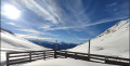
(5) After passing the Col de Golèse, you’ll soon reach the Refuge de Golèse, where you can stop for lunch, for example. The views from there are magnificent. From this refuge, it’s possible to continue and climb towards the Refuge de Bostan, but the route is more challenging and the tracks are limited.
(7) At Lac des Mines d’Or, before turning back, you can walk round the lake fairly quickly (it’s a small artificial lake) and find a few picnic tables or two deckchairs where you can rest in the sunshine and admire a magnificent, peaceful panorama.
From Lac des Mines d’Or, you can carry on towards the Chalets de Fréterolle (about a 30-minute climb in snowshoes).
(S/E) Finally, if you finish your hike too early and have missed the return shuttle, you can, whilst waiting for the next one, enjoy a hot chocolate at Génépi Chez Layanne, which is located right opposite the bus stop for the return journey.

Reviews and comments

5 / 5
Based on 2 reviews

Reliability of the description
5 / 5
Ease of following the route
5 / 5
Route interest
5 / 5
seminois
seminois

Overall rating : 5 / 5

Date of your route : Jul 05, 2025
Reliability of the description : ★★★★★ Very good
Ease of following the route : ★★★★★ Very good
Route interest : ★★★★★ Very good
Very busy route : Yes

A lovely walk in fine weather. A lovely view. On the way back, we took a slightly different route.
Highly recommended.

Machine-translated

Daniel Bériaux
Daniel Bériaux

Overall rating : 5 / 5

Date of your route : Aug 13, 2024
Reliability of the description : ★★★★★ Very good
Ease of following the route : ★★★★★ Very good
Route interest : ★★★★★ Very good
Very busy route : No

A lovely walk to enjoy with the family

Machine-translated

Other walks in the area

For more walks, use our search engine .

The GPS track and description are the property of this route's author. Please do not copy them without permission.