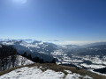
La Pointe du Haut Fleury

A lovely snowshoe hike starting from Praz de Lys. Superb panoramic views (Lake Geneva, Chablais, Mont Blanc, Aravis, Bornes/Bargy...).

Details

20012
Creation:
Last update:
Last review:
  • Snowshoeing
    Activity: Snowshoeing
  • ↔
    Distance: 2.23 mi
  • ◔
    Duration according to the author: 3 hrs 
  • ▲
    Difficulty: Moderate

  • ⚐
    Back to start: Yes
  • ↗
    Ascent: + 1,555 ft
  • ↘
    Descent: - 1,555 ft

  • ▲
    Highest point: 6,473 ft
  • ▼
    Lowest point: 4,918 ft

Photos

Description of the walk

Access: from Geneva (Annemasse), take the Autoroute Blanche towards Chamonix. Take exit 19, Cluses-centre, then head through Taninges towards Praz de Lys (Les Gets – Morzine). After a steep, winding climb, turn left towards Le Praz de Lys. Drive through this resort (towards Col de la Ramaz) and, almost at the exit, park at Les Moliettes (Les Bétex), opposite the Jean de la Pipe restaurant.

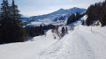
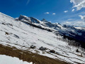
(S/E) From the car park, cross the esplanade at the bottom of the slopes and take the road that climbs towards the Col de la Ramaz for about a hundred metres, then head up to your left up the fairly steep slope (with a few scattered spruce trees) until you reach a small pass at the start of the Lac de Roy plateau. Throughout this initial climb, there are superb views of the Pointe d’Uble, the Roc d’Enfer, the Pointe de Chalune and the Pointe de Chavasse.

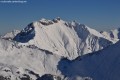
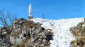
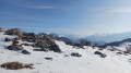
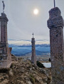
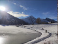
(1) Cross the cross-country ski trail (watch out for skiers!) and continue straight on; pass to the right of the large rock and carry on towards the far right of the cirque, towards the Pointe du Haut Fleury on the southern slope. A beautiful viewpoint overlooking the entire ridge route leading to the Pic de Marcelly (via the Frête de Penaille and the Pointe de la Couennasse), the cirque, Lac de Roy – whose outline is barely visible – and Mont Blanc in the distance. You’ll make your way diagonally up the hillside to the foot of the Haut Fleury; this allows you to bypass the Pointe de Perret, which you’ll leave on your left. Continue to the right, following the track below for a short while before tackling a very steep slope. Climb steadily diagonally, keeping below the rocks. As soon as the terrain allows, you can reach the summit ridge and follow it to the highest point of the Pointe du Haut Fleury, at 1,981 metres. Do not get too close to the edge of the ledge! The panoramic view is truly fabulous, in good weather of course. The view is unforgettable, particularly of the peaks mentioned above, the Haute Pointe, much of the Chablais region, Mont Blanc, the Haut Giffre, the Aravis, the Bornes/Bargy, the Môle, the Salève, the Voirons, the Pointe des Brasses, the Pointe de Miribel, the Pointe d’Hirmentaz, the Lake Geneva basin and many others.

(2) For the return journey, head back down across the slope to reach the foot of the peak’s southern face.

(3) Continue to the left, towards the small ‘pass’ you took on the way up, once again diagonally; be careful, as there are a few rocky surprises, sometimes well hidden depending on the depth of the snow (follow the tracks if there are any).

(1) From the pass, you can descend more directly (a few rocks) to reach the car park; however, veer slightly to the left before rejoining the piste. Take care when crossing the pistes; some skiers come hurtling down at full speed (S/E).

Waypoints

  1. S/E : mi 0 - alt. 4,918 ft - Car park
  2. 1 : mi 0.46 - alt. 5,453 ft - Small pass
  3. 2 : mi 1.02 - alt. 6,467 ft - Pointe du Haut Fleury (1966m)
  4. 3 : mi 1.19 - alt. 6,250 ft - Foot of the southern slope of the peak
  5. S/E : mi 2.23 - alt. 4,918 ft - Car park

Reviews and comments

4 / 5
Based on 4 reviews

Reliability of the description
4.3 / 5
Ease of following the route
4 / 5
Route interest
3.8 / 5
coulaloire49
coulaloire49

Overall rating : 3 / 5

Date of your route : Mar 01, 2021
Reliability of the description : Not used / Not applicable
Ease of following the route : ★☆☆☆☆ Very disappointing
Route interest : ★★★★★ Very good
Very busy route : Yes

Hello,
The aim of this post is to encourage people to discover the stunning view from the summit of Haut Flery. However, neither the map nor the description is particularly helpful. It would be better to advise people to follow the tracks as closely as possible and to warn them to be mindful of the weather and to check for avalanche risks.
On my smartphone (Sony Xperia), I didn’t have GPS positioning when I needed it most. I recommend using GPS when hiking.
I hope this has been helpful,
Joël Andromaque

Machine-translated

cmoifrancky72
cmoifrancky72

Overall rating : 4 / 5

Date of your route : Aug 19, 2019
Reliability of the description : ★★★★☆ Good
Ease of following the route : ★★★★★ Very good
Route interest : ★★★☆☆ Average

A lovely walk, but very crowded.
The views are lovely, but it was really too crowded in early August – a bit of a shame.

Machine-translated

MAGNIN
MAGNIN

Overall rating : 4.7 / 5

Date of your route : Oct 21, 2017
Reliability of the description : ★★★★☆ Good
Ease of following the route : ★★★★★ Very good
Route interest : ★★★★★ Very good

A superb hike with exceptional views on a clear day.
I’d love to do it again in winter if possible

Machine-translated

Nho
Nho
• Edited:

Overall rating : 4 / 5

Date of your route : Feb 20, 2017
Reliability of the description : ★★★★★ Very good
Ease of following the route : ★★★★★ Very good
Route interest : ★★☆☆☆ Disappointing

Disappointing in winter – far too many ski runs to cross, so it’s far too crowded. Worth a return visit when the weather’s better.

Machine-translated

MicheleG
MicheleG

Thanks, I’ll keep the guide for next winter.
Have a lovely day (a rainy one here in Brittany...) to all the walkers!

Machine-translated

patrick.grosch@gmail.com
• Edited:

Hello. You won’t be taking any risks with the route described; however, a rockfall is always possible on certain sections, but by observing the terrain, you’ll quickly spot any potentially dangerous areas that are best avoided (there are a few sections that could prove treacherous near rocks or rocky outcrops, especially on the descent as it’s harder to make out the nature of the terrain). Of course, avoid going near the edges of the summit ledges. Kind regards

Machine-translated

MicheleG
MicheleG

Hello
I went hiking in the Mieussy area this summer and was captivated by the beauty of the scenery. I went back there this winter and stuck to the marked snowshoe trails for fear of avalanches. Does the route you’re describing pose this sort of risk?
It’s so much nicer to get off the beaten track.
Thank you

Machine-translated

Other walks in the area

For more walks, use our search engine .

The GPS track and description are the property of this route's author. Please do not copy them without permission.