Les Étangs des Moines in Fourmies

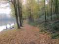
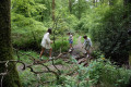
This trail, ideal for families, is dotted with information boards illustrating forest management and the forest’s heritage through the ages.

Details

1547615
Creation:
Last update:
Last review:
  • Walking
    Activity: Walking
  • ↔
    Distance: 2.68 mi
  • ◔
    Average duration: 1h 20 
  • ▲
    Difficulty: Easy

  • ⚐
    Back to start: Yes
  • ↗
    Ascent: + 138 ft
  • ↘
    Descent: - 135 ft

  • ▲
    Highest point: 764 ft
  • ▼
    Lowest point: 653 ft

Photos

Description of the walk

Étangs des Moines car park.

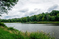
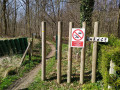
(S/E) With your back to Saint-Charles Hospital and the campsite, walk along the right-hand side of the pond, following the path. You’ll pass the signs for ‘the monks of Liessies and Fourmies’, ‘the Mill’ and ‘La Haye de Fourmies’. Follow the path straight ahead

(1) Pass to the left between the two ponds, then head uphill through the undergrowth opposite. Follow the forest track as it turns right. A sign reads “Les Jumeaux”. After the signposts marked “l’exploitation du sous-sol” and “le rôle préindustriel de la forêt”, you’ll reach a junction with a road; make a quick right-then-left turn to rejoin a forest path.
Carry on straight ahead to reach “Les Jumeaux”, two neighbouring oak trees dating from around 1785 whose trunks have fused together. You’ll come to a T-junction.

(2) At the T-junction, turn right (“the forest: a place of activity”) and head down towards the first pond. Ignore a path on the left and take the second path on the left.

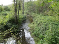
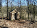
(3) Take the footbridge on the right to cross the stream, then follow the path as it turns left. Ignore a path on the right and continue straight on to the Notre-Dame du Bois Chapel. Two information boards explain its distant origins. Carry on straight ahead, then follow the Route Forestière du Trou Colette to the left; this is a tarmac track for 350m. Pass a track and a path on your left, then turn left onto the second path, 500m further on. You’ll come out onto the Route Forestière des Étangs des Moines.

(4) Turn left and walk for 400 metres

(5) Take the forest track on the right into the woodland. Carry on straight ahead and take the first path on the left.
Return to the Route Forestière des Étangs des Moines, head downhill to the right, go round the buildings on the right and you’ll find the car park on the left (S/E).

Waypoints

  1. S/E : mi 0 - alt. 656 ft - Étangs des Moines car park
  2. 1 : mi 0.25 - alt. 669 ft - Les Jumeaux
  3. 2 : mi 0.69 - alt. 738 ft - Junction after Les Jumeaux
  4. 3 : mi 0.9 - alt. 689 ft - Footbridge to > - Chapelle Notre-Dame des Bois
  5. 4 : mi 1.78 - alt. 764 ft - Forest Roads of the Étangs des Moines
  6. 5 : mi 2.02 - alt. 725 ft - Forest trail
  7. S/E : mi 2.68 - alt. 656 ft - Étangs des Moines car park

Notes

Route listed in the PDIPR (Departmental Plan for Walking and Hiking Routes)

Follow the yellow markings
Some sections of the route are shared with another themed trail (marked in green) and feature information boards about the trees and the forest ecosystem.

Worth a visit

Reviews and comments

4.2 / 5
Based on 3 reviews

Reliability of the description
4.3 / 5
Ease of following the route
4.3 / 5
Route interest
4 / 5
marie marco
marie marco

Overall rating : 3.7 / 5

Date of your route : Mar 30, 2026
Reliability of the description : ★★★★☆ Good
Ease of following the route : ★★★☆☆ Average
Route interest : ★★★★☆ Good
Very busy route : No

i The twins are actually twin girls, and we ended up on a different route. No more signs. We did it during the week and at lunchtime

Machine-translated

Arianelagolden
Arianelagolden

Overall rating : 5 / 5

Date of your route : Jun 28, 2024
Reliability of the description : ★★★★★ Very good
Ease of following the route : ★★★★★ Very good
Route interest : ★★★★★ Very good
Very busy route : No

Be sure to follow the Visorando route description carefully, as there are two identical yellow markings that cross paths; if you rely solely on the markings, you risk ending up on a different circular route (particularly at the junction mentioned in point 3).
Otherwise, what Visorando calls ‘les Jumeaux’ are, in reality, ‘les Jumelles’ on the ground (we haven’t checked which is correct )

Machine-translated

isav59nord
isav59nord

Overall rating : 4 / 5

Date of your route : Aug 11, 2021
Reliability of the description : ★★★★☆ Good
Ease of following the route : ★★★★★ Very good
Route interest : ★★★☆☆ Average
Very busy route : Yes

There are plenty of routes to choose from (walking, horse riding, mountain biking and even a fitness route). As a result, the routes constantly cross paths, but they’re all marked in the same colours 😏. So, do make sure you don’t forget your map!
One trail focuses on the forest, but the information boards have disappeared or are too damaged to read.
The advantage of this route is that it’s short and therefore great for children. However, I’d advise you to do it in the morning so you can enjoy some peace and quiet… Very soon you’ll be hearing the sounds of the city, fire engine sirens (the hospital is nearby), music, and so on and so forth…
Conclusion: go for Val Joly instead (there’s a birdwatching route there that the children will love)

Machine-translated

Other walks in the area

For more walks, use our search engine .

The GPS track and description are the property of this route's author. Please do not copy them without permission.