The Gabelous Route starting from Anor (long version)

Lovers of peace and nature will find a change of scenery and tranquillity on this route. They’ll travel from
France into Belgium without even realising it.

Details

1665394
Creation:
Last update:
Last review:
  • Walking
    Activity: Walking
  • ↔
    Distance: 9.05 mi
  • ◔
    Average duration: 4h 25 
  • ▲
    Difficulty: Moderate

  • ⚐
    Back to start: Yes
  • ↗
    Ascent: + 256 ft
  • ↘
    Descent: - 233 ft

  • ▲
    Highest point: 833 ft
  • ▼
    Lowest point: 725 ft
  • ⚐ Country: France
  • ⚐
    Area: Avesnois
  • ⚐ City: Anor (59186)
  • ⚑
    Start/End: N 49.991519° / E 4.100021°
  • ❏
    IGN map(s): Ref. 2808E, 2808O
  • Hour-by-hour weather

Photos

Description of the walk

Start at the Anor Tourist Information Centre, Rue du Général de Gaulle.

(S/R) Head up Rue du Général de Gaulle on the right, then continue along Rue de Momignies. Walk past the cemetery. Then turn left onto Rue des Anorelles.

(1) About a hundred metres further on, turn right and follow the narrow, winding road through the hedgerow, heading east-north-east. Ignore a path branching off to the right and, at the next Fork in the road, veer to the right, still on Rue des Anorelles.

(2) At the next junction, carry straight on along Rue des Anorelles.

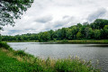
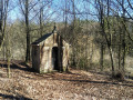
(3) When you reach a wayside shrine, turn left onto Rue de la Galoperie to reach the Étang de la Galoperie. Carry on straight ahead.

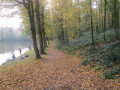
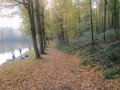
(4) Head uphill through the forest along the path on the right. Follow a small, winding path alongside the pond until you reach a blockhouse and, a little further on, the border markers.

(5) Cross into Belgium. Follow Rue de la Pilerie.

(6) Turn left onto La Bretèque. Carry on straight ahead until the end of the tarmac road.Enter the woodland again via a grassy path, passing in front of a house. Cross the border again and, after veering slightly to the right, cross the railway line.

(7) At the fork in the road, ignore the path on the right and continue along the track on the left, Chemin de la Réserve.

(8) At the junction with Chemin du Pont Baudet, turn right, then quickly take the path on the left into the woodland.

(9) At the T-junction in the woods, turn right onto Chemin du Pont Servoise and cross the Ruisseau des Dardennes. At the Fork in the road, take the left-hand path, Rue des Quarante, until you reach the roundabout with five exits.

(10) Take the second street on the left, Rue Neuve. Carry straight on at the next junction and take the path leading into the woods. Cross the Ruisseau des Dardennes again.

(11) At the crossroads, carry on straight ahead along Chemin des Mineurs (GRP®® marked yellow on red). Continue straight on (south-east) along this long path, which crosses several side paths as well as the railway line. You will come to the Étang de la Galoperie.

(4) Follow the path you took on the way out in the opposite direction, turning right onto Rue de la Galoperie.

(3) Turn right onto Rue des Anorelles.

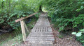
(2) At the fork in the road, turn right onto Rue du Pont des Boeufs. In the bend, turn right onto a small wooded path that runs alongside the stream and offers a view of the valley.

(1) After the buildings at Pont des Boeufs, continue left onto Rue des Anorelles. Then turn right and retrace your steps in the opposite direction to return to the starting point (S/E).

Waypoints

  1. S/E : mi 0 - alt. 761 ft - Anor Tourist Office
  2. 1 : mi 0.54 - alt. 801 ft - Fork
  3. 2 : mi 1.17 - alt. 768 ft - Fork
  4. 3 : mi 1.28 - alt. 774 ft - Oratory
  5. 4 : mi 1.76 - alt. 755 ft - Galoperie Pond
  6. 5 : mi 2.66 - alt. 748 ft - French-Belgian border
  7. 6 : mi 3.07 - alt. 823 ft - La Bretèque
  8. 7 : mi 3.64 - alt. 833 ft - Chemin de la Réserve
  9. 8 : mi 4.17 - alt. 791 ft - Chemin du Pont Baudet
  10. 9 : mi 4.59 - alt. 761 ft - Chemin du Pont Servoise
  11. 10 : mi 4.72 - alt. 797 ft - At the roundabout, turn left onto Rue Neuve
  12. 11 : mi 5.35 - alt. 738 ft - Crossroads
  13. S/E : mi 9.05 - alt. 761 ft - Anor Tourist Information Office

Notes

This route is listed in the PDIPR (Departmental Plan for Walking and Hiking Routes).

Follow the yellow markings.

Worth a visit

Reviews and comments

4 / 5
Based on 3 reviews

Reliability of the description
4.3 / 5
Ease of following the route
4 / 5
Route interest
3.7 / 5
debrie
debrie
• Edited:

Overall rating : 3.7 / 5

Date of your route : Feb 26, 2024
Reliability of the description : ★★★★☆ Good
Ease of following the route : ★★★★☆ Good
Route interest : ★★★☆☆ Average
Very busy route : No

This route is not recommended in winter, and certainly not in wet weather. It turns into a proper quagmire.

Machine-translated

MAILLARD.HERVE
MAILLARD.HERVE

Overall rating : 3.7 / 5

Date of your route : Sep 11, 2023
Reliability of the description : ★★★★☆ Good
Ease of following the route : ★★★☆☆ Average
Route interest : ★★★★☆ Good
Very busy route : No

Nice information boards.
It’s difficult to find your way without a GPS after point 11.

Machine-translated

pa6_6
pa6_6
• Edited:

Overall rating : 4.7 / 5

Date of your route : Jun 07, 2019
Reliability of the description : ★★★★★ Very good
Ease of following the route : ★★★★★ Very good
Route interest : ★★★★☆ Good

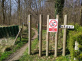
A lovely walk through the woods. We could have set off from the Étang de la Galopette; that would have avoided the tarmac road but would have made the walk shorter. Crossing the border from Belgium into France is quite amusing: there’s a wooden sign marked ‘FRANCE’.

Machine-translated

Other walks in the area

For more walks, use our search engine .

The GPS track and description are the property of this route's author. Please do not copy them without permission.