Country:

 City:
City:


This circular route follows part of the signposted ‘Forges d’Anor’ route to the south and part of the ‘Gabelous’ route to the north, whilst taking a few liberties with both, and utilising theGR® Pays du Tour de l’Avesnois as an eastern link.
The start and finish are at the car park opposite Anor Church, on Rue du Maréchal Joffre.
(S/E) From the car park, turn right onto Rue Joffre (heading south). The road curves to the right as it descends and joins Rue Pasteur: follow this to the left. Pass two streets on your left and continue down to the junction at the bottom of the slope.
(1) Turn left onto Rue Victor Delloué, which climbs steadily up the hillside and passes just a few isolated houses. At the junction, take Rue de la Vieille Verrerie, which leads down to the right between two houses.
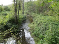
(2) At the junction at the bottom of the descent, turn left onto the dirt track leading down into a valley. Cross a stream and head back up the other side. You’ll reach a tarmac road running alongside the railway line: follow it to the left. You’ll come to a road at a level crossing.
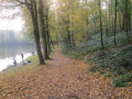
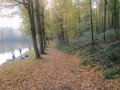
(3) Take a path on the left. Immediately ignore a path on the left and head down the hillside. You’ll reach the Étang de Milourd; walk along its left-hand side until you reach a tarmac road.
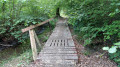
(4) Turn left and cross the bridge, then immediately turn right onto a path that crosses a small meadow. Enter a small wood, cross a footbridge and come out onto a tarmac road.
(5) Cross the road and head up the Rue du Maka, almost directly opposite. About 150 m further up, take the path that branches off to the right before thefirst house. You are now on aGRP® route marked in red and yellow. Follow this path for about 1.5 km, running more or less alongside the Rie de Bon Feu, before turning sharply left uphill to reach a tarmac road, which you take to the right. You’ll come to a crossroads with a cross that I’ve dubbed the ‘Croix des verriers’ (Glassmakers’ Cross) because of its decoration featuring shards of coloured glass.
(6) Continue straight ahead down a gentle slope, cross the crossroads, walk 50 m uphill and take the path on the right before thefirst house. After about 500 m, turn left onto the hard-surfaced path which passes two houses, cross a road and continue straight ahead for 300 m until you find a grassy path on the right leading to a pasture.
(7) Do not take this track, but take the path to its right, which goes through a hedge and leads into heathland. When you reach a tarmac road, turn left, then left again at the next junction. You’ll reach the D156; follow it to the left, then after 50 metres turn right onto a small street, and at the fork 50 metres further on, take the path on the right, which, after a left-hand bend, passes between two ponds before reaching a tarmac road.
(8) Take the road opposite, then turn right at the junction. Head down towards several private ponds, and before passing under a culvert, turn left onto the forest track which follows the southern bank of the Ruisseau des Anorelles. You’ll come to a road; take it to the right to reach the Étang de la Galoperie via its spillway. Leave the GRP®.
(9) Take the lane on the right to the north of the pond, then immediately take the path on the right signposted in yellow: Route des Gabelous. Several information boards detailing the activities of the gabelous line this path. After passing a small blockhouse, you cross the Belgian border and continue straight ahead along a small tarmac road. After 400 m, opposite the second group of houses, take a well-marked path that enters the forest on the left. You’ll come to a track and a house.
(10) Turn left, walk past the house, cross back into France, and take the path opposite. Cross the railway line and continue along the path, which heads due north before undulating generally north-west, then descends towards the Ruisseau de Dardennes.
(11) Before crossing the bridge, take the path on the left which follows the southern bank of the stream more or less closely. You’ll cross a track, then a forest road and, before reaching the tarmac road, at a bend to the right of the path, take the last track leading uphill to the left.
(12) Follow the track to the forest road, turn right onto it, then left onto the Chemin des Mineurs. After about 500 m, cross a wide forest road; 600 m further on, cross the railway line. Pass a small house on the left and, 300 m further on, you’ll reach the first track.
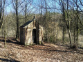
(13) Take this footpath on the right, which descends to a converted bunker. Pass the bunker and take the correct path on the left, heading generally south-south-east until you reach a valley floor.
(14) Cross over the footbridge, continue southwards and you’ll come to a good track: take it to the right. You’ll reach the D156, which you take to the right. You’ll arrive at the village and the car park (S/E).

 AONB
AONB
 Moderate
 Easy
Easy 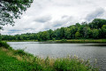
 Visorando Member