Follow Ciclus the Dipper at Anor

A family-friendly route for discovering birds. You can learn through play using the Baladavesnois app.

Details

n°15874372
Creation:
Last update:
–
Last review:
  • Walking
    Activity: Walking
  • ↔
    Distance: 4.74 mi
  • ◔
    Average duration: 2h 20 
  • ▲
    Difficulty: Easy

  • ⚐
    Back to start: Yes
  • ↗
    Ascent: + 174 ft
  • ↘
    Descent: - 174 ft

  • ▲
    Highest point: 827 ft
  • ▼
    Lowest point: 725 ft
  • ⚐ Country: France
  • ⚐
    Area: Avesnois
  • ⚐ City: Anor (59186)
  • ⚑
    Start/End: N 49.991541° / E 4.100178°
  • ❏
    IGN map(s): Ref. 2808E, 2808O
  • Hour-by-hour weather

Photos

Description of the walk

Start from the car park on Rue du Maréchal Joffre, opposite the church.

(S/E) As you leave the car park, head left then turn right into Rue du Général de Gaulle. Cross Rue Léo Lagrande on the right-hand side and continue along Rue de Momignies. Pass the cemetery and, at the next Fork in the road, take Rue des Anorelles on the left.

(1) At the next Fork in the road, turn left onto Rue du Pont des Bœufs until you reach the houses. Continue straight on along the grassy path. At the end of the path, turn left onto Rue du Pont des Bœufs.

(2) At the junction, turn left onto Rue des Anorelles and follow it for about 200 metres.

(3) At the junction, turn left onto Rue de la Galoperie. Keep going straight on (north) and ignore a road on the right and then one on the left.

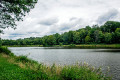
(4) Carry on straight ahead, cross a stream and you’ll reach the Étang de la Galoperie.

(5) Turn round and cross the stream again.

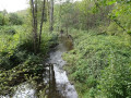
(4) Shortly afterwards, leave the road and take a path on the left, entering the forest. Follow the stream on your left, keeping a varying distance from it. Go through a gate and you’ll come out onto a road.

(6) Turn right onto Rue de Beauwelz. Turn right at the next junction (marker 252) and follow Rue des Anorelles. At the next junction (marker 242), go straight on.

(3) At a junction you have already passed on the way there, carry on straight ahead.

(2) After about 200 m, keep left towards Rue des Anorelles. At the next junction, turn slightly left, still staying on Rue des Anorelles.

(1) Carry on straight ahead, then turn right onto the D156 to return to the starting point (S/E).

Waypoints

  1. S/E : mi 0 - alt. 764 ft - Car park on Rue du Maréchal Joffre - Église Saint-Nicolas (Anor)
  2. 1 : mi 0.54 - alt. 801 ft - Crossroads at the end of the circular loop
  3. 2 : mi 1.35 - alt. 768 ft - Rue des Anorelles
  4. 3 : mi 1.46 - alt. 774 ft - Rue des Anorelles x Rue de la Galoperie
  5. 4 : mi 1.77 - alt. 748 ft - Junction
  6. 5 : mi 1.89 - alt. 748 ft - Étang de la Galoperie
  7. 6 : mi 2.61 - alt. 748 ft - Rue de Beauwelz
  8. S/E : mi 4.74 - alt. 764 ft - Car park on Rue du Maréchal Joffre - Église Saint-Nicolas (Anor)

Notes

Worth a visit

Reviews and comments

5 / 5
Based on 1 review

Reliability of the description
5 / 5
Ease of following the route
5 / 5
Route interest
5 / 5
PCochez
PCochez

Overall rating : 5 / 5

Date of your route : Jul 24, 2023
Reliability of the description : ★★★★★ Very good
Ease of following the route : ★★★★★ Very good
Route interest : ★★★★★ Very good
Very busy route : No

A lovely walk

Machine-translated

Other walks in the area

For more walks, use our search engine .

The GPS track and description are the property of this route's author. Please do not copy them without permission.