Route du Camp de Giblou starting from Fourmies

Take the shorter alternative route during the hunting season (calendar available at the town hall or on the ONF website).
This route takes you through a large part of the Fourmies State Forest.

Details

1546584
Creation:
Last update:
Last review:
  • Walking
    Activity: Walking
  • ↔
    Distance: 5.78 mi
  • ◔
    Average duration: 2h 50 
  • ▲
    Difficulty: Easy

  • ⚐
    Back to start: Yes
  • ↗
    Ascent: + 243 ft
  • ↘
    Descent: - 246 ft

  • ▲
    Highest point: 807 ft
  • ▼
    Lowest point: 653 ft

Photos

Description of the walk

Park in the Étangs des Moines car park, between the3rd Étang des Moines and the Étang de la Petite Chapelle.

(S/E) Take the path along the3rd Étang des Moines (on the side opposite the restaurant).
Head towards the2nd Étang des Moines, leave three paths on your right and take the one furthest to the left. Walk between the2nd and3rd Étangs des Moines.

(1) Head uphill opposite (the path curves to the right). At the end of the path, first turn left then right to join a path leading to Les Jumeaux, a pair of twin oak trees planted around 1785, approximately 30 metres tall and with a circumference of 5.70 metres.
After Les Jumeaux, at the junction with the road, turn right towards thefirst pond; ignore thefirst path on the left and take the second one.

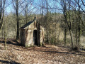
(2) At the bend, cross a footbridge on your right; you’ll then come out on the left at the Notre-Dame des Bois Chapel and continue straight on.

(3) When you reach the Route Forestière du Trou Colette, carry on straight ahead: there are two parallel paths, either of which you can take.

(4) Leave the forest via a small lane that leads out opposite a chapel. Then turn left onto Rue du Camp de Giblou. Ignore the path on your right and the next two on your left.

(5) Turn right onto Rue de Trélon (D963), cross the railway line, then take thesecond left onto Rue de Saint-Laurent, which winds through the bocage. Ignore the path on the left, then the one on the right, and at the Y-junction take the left-hand road, which is still Rue de Saint-Laurent. Pass the first junction, then at the next junction, turn left, cross the railway line and continue straight on until you reach the D963

(6) Cross the D963 again and take the first right, the Route Forestière des Étangs des Moines. Take the second track on the right.

(7) At the end, turn left and head straight down the gentle slope, following the PR® markings (yellow) and the Avesnois-Thiérache Regional Long-Distance Trail (marked in yellow and red).

(8) At the junction of several forest tracks, take the one furthest to the left, then take thefirst track on the right. You will then pass five junctions with forest tracks.

(9) At thesixth junction, turn left, then take thefirst forest track on the left. At the next junction, take thesecond left and then immediately thefirst right. You will arrive on the Route Forestière des Étangs des Moines. Turn right, then take thefirst right and finally turn left to reach the Étangs des Moines car park (S/E).

Waypoints

  1. S/E : mi 0 - alt. 659 ft - Étangs des Moines car park
  2. 1 : mi 0.32 - alt. 669 ft - Path on the right - Les Jumeaux
  3. 2 : mi 0.88 - alt. 689 ft - Footbridge on the right - Chapelle Notre-Dame des Bois
  4. 3 : mi 1.2 - alt. 751 ft - Trou Colette Forest Road
  5. 4 : mi 1.7 - alt. 797 ft - Exit from the forest
  6. 5 : mi 2.23 - alt. 791 ft - Turn right onto Rue de Trélon
  7. 6 : mi 3.5 - alt. 791 ft - Cross the D963
  8. 7 : mi 4.25 - alt. 791 ft - GRP Avesnois-Thiérache to the left
  9. 8 : mi 4.82 - alt. 725 ft - Forest track on the left
  10. 9 : mi 5.24 - alt. 712 ft - 6th junction: turn left
  11. S/E : mi 5.78 - alt. 659 ft - Étangs des Moines car park

Notes

Take care when crossing the RD963.
In wet weather, waterproof footwear is essential.
Route listed in the PDIPR (Departmental Plan for Walking and Hiking Routes)

Follow the yellow markings
Short alternative route to follow during the hunting season (calendar available at the town hall or on the ONF website).

Worth a visit

Always be cautious and plan ahead when you're outdoors. Visorando and the author of this route cannot be held responsible for any accidents occurring on this route.

The GR® and PR® markings are the intellectual property of the Fédération Française de Randonnée Pédestre.

Reviews and comments

4.2 / 5
Based on 4 reviews

Reliability of the description
4.5 / 5
Ease of following the route
4.3 / 5
Route interest
3.8 / 5
User 17907839

Overall rating : 4.3 / 5

Date of your route : Jun 30, 2026
Reliability of the description : ★★★★★ Very good
Ease of following the route : ★★★★☆ Good
Route interest : ★★★★☆ Good
Very busy route : No

A well-described route with no particular difficulties, perfect for a group of our ability.

Machine-translated

vincent181262
vincent181262

Overall rating : 4 / 5

Date of your route : Apr 27, 2026
Reliability of the description : ★★★★☆ Good
Ease of following the route : ★★★★☆ Good
Route interest : ★★★★☆ Good
Very busy route : No

A lovely walk, pleasant and well signposted.

Machine-translated

Jocelyne.duquenoy
Jocelyne.duquenoy

Overall rating : 5 / 5

Date of your route : Feb 23, 2026
Reliability of the description : ★★★★★ Very good
Ease of following the route : ★★★★★ Very good
Route interest : ★★★★★ Very good
Very busy route : No

A varied route, mostly through the forest, then part of it in Anor, which means it never gets boring.
The forest route takes us past the twin trees and the little chapel in the woods.

Machine-translated

yv5954
yv5954

Overall rating : 3.3 / 5

Date of your route : Sep 30, 2019
Reliability of the description : ★★★★☆ Good
Ease of following the route : ★★★★☆ Good
Route interest : ★★☆☆☆ Disappointing

a route that isn’t particularly interesting

Machine-translated

Other walks in the area

For more walks, use our search engine .

The GPS track and description are the property of this route's author. Please do not copy them without permission.