The Pignolet trail in Fiefs

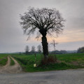
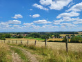
A short walk alternating between roads, tracks and forest paths. You’ll be treated to some stunning views, especially in fine weather.

Details

3132993
Creation:
Last update:
Last review:
  • Walking
    Activity: Walking
  • ↔
    Distance: 7.24 mi
  • ◔
    Average duration: 3h 40 
  • ▲
    Difficulty: Moderate

  • ⚐
    Back to start: Yes
  • ↗
    Ascent: + 381 ft
  • ↘
    Descent: - 381 ft

  • ▲
    Highest point: 633 ft
  • ▼
    Lowest point: 295 ft
  • ⚐ Country: France
  • ⚐ City: Fiefs (62134)
  • ⚑
    Start/End: N 50.50378° / E 2.326734°
  • ❏
    IGN map(s): Ref. 2305E, 2305O
  • Hour-by-hour weather

Photos

Description of the walk

Park in the Town Hall car park

(S/E) With your back to the town hall, turn right heading north-north-west, ignore the roads on the left and continue along the D77.

GRP® Tour du Ternois Nord (yellow and red markings)

At the Y-junction, leave the D77 and take the road on the right heading north, Rue Tailly. Follow

(1) At the T-junction, carry straight on along the path heading north-north-east. At the first junction, go straight on.

(2) At the next junction, turn left 90° heading north-west.

(3) At the high-voltage power line, leave the road on your right and carry on straight ahead. Enter Nédonchel and, at the first road junction, carry on straight ahead.

(4) At the junction, turn right onto Rue Principale, pass the care home and the town hall, then leave this street. Carry on straight ahead, then turn left.

(5) Take the path on the right and, at the end of the path, turn right onto the road.

PR (yellow markings)

(6) After 70 m, turn onto the path on the left and, at the end of the path, turn right.

(7) At the left-hand bend, take the path on the right towards Nédon Church. At the church, turn left, ignoring the two roads on the right and the one on the left.

(8) At the crossroads, turn right towards the south. Ignore the path on the left. At the junction with the D90, cross it and follow the path opposite.

(9) At the crossroads in the woods, turn left towards the south-west. Pass the three paths on the right as well as the one on the left.

(10) At the crossroads, take the path on the right heading north-west and, at the junction with the D77E3, turn left. Follow it for about 1,000 metres.

Unmarked

(11) At the junction at the entrance to Fiefs, continue along the D77E3 south-east towards the church. Pass the two streets on the left and, at the junction with the D77, turn right back towards the starting point (S/E).

Waypoints

  1. S/E : mi 0 - alt. 604 ft - Fiefs Town Hall/School car park
  2. 1 : mi 0.44 - alt. 633 ft - Crossroads at the end of the circular loop
  3. 2 : mi 0.91 - alt. 594 ft - 90° left-hand bend and path on the right
  4. 3 : mi 1.69 - alt. 436 ft - High-voltage power line
  5. 4 : mi 2.29 - alt. 351 ft - Nédonchel - Nave (rivière) - Affluent de la Lys
  6. 5 : mi 2.52 - alt. 387 ft - Path on the right
  7. 6 : mi 2.91 - alt. 354 ft - Path on the left
  8. 7 : mi 3.23 - alt. 331 ft - Path on the right
  9. 8 : mi 3.56 - alt. 295 ft - T-junction – take the path on the right
  10. 9 : mi 5.06 - alt. 571 ft - Crossroads – turn right
  11. 10 : mi 5.7 - alt. 604 ft - Path on the right
  12. 11 : mi 6.81 - alt. 623 ft - Entrance to Fiefs
  13. S/E : mi 7.24 - alt. 604 ft - Fiefs Town Hall/School car park

Notes

Appropriate kit may be useful.
Don’t forget your water bottle

Reviews and comments

4.8 / 5
Based on 2 reviews

Reliability of the description
5 / 5
Ease of following the route
5 / 5
Route interest
4.5 / 5
Jean-Mi 62550
Jean-Mi 62550

Overall rating : 5 / 5

Date of your route : Apr 09, 2021
Reliability of the description : ★★★★★ Very good
Ease of following the route : ★★★★★ Very good
Route interest : ★★★★★ Very good
Very busy route : No

A walk completed in 2 hours and 33 minutes! Absolutely stunning

Machine-translated

Jean-Mi 62550
Jean-Mi 62550

Overall rating : 4.7 / 5

Date of your route : Mar 09, 2021
Reliability of the description : ★★★★★ Very good
Ease of following the route : ★★★★★ Very good
Route interest : ★★★★☆ Good
Very busy route : No

A lovely walk that we took at a leisurely pace in 2 hours and 33 minutes
No difficulties at all!

Machine-translated

Other walks in the area

For more walks, use our search engine .

The GPS track and description are the property of this route's author. Please do not copy them without permission.