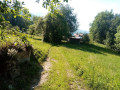
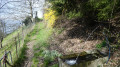
The 16 waterfalls on the Grand Ruisseau

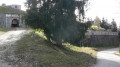
A route running alongside the Grand Ruisseau du Saint-Clément. In 1935, following the major events of the early 20th century, a restoration area was established to stabilise the torrent’s bed. As part of this, 16 weir dams were built in successive phases in 1937, 1967 and 1980. You will end up on a forest path running along a ledge.

Details

n°3102104
Creation:
Last update:
Last review:
  • Walking
    Activity: Walking
  • ↔
    Distance: 2.15 mi
  • ◔
    Average duration: 2h 00 
  • ▲
    Difficulty: Moderate

  • ⚐
    Back to start: Yes
  • ↗
    Ascent: + 1,132 ft
  • ↘
    Descent: - 1,129 ft

  • ▲
    Highest point: 2,218 ft
  • ▼
    Lowest point: 1,368 ft

Photos

Description of the walk

Start from the car park located below the drop-off area, at a place called Le Désert.

(S/E) Head east along the track for about twenty metres.

(1) Turn left and walk up to the loading bay. Continue along the embankment until you reach a track at the power station. Turn right and cross the Grand Ruisseau.

(2) Continue along the track (follow the yellow markings) and walk alongside the stream on your left until you reach the bend. Leave the track on your right and follow the path (elevation 494) alongside the Grand Ruisseau (path not shown on the map). Ignore the two paths on your right that lead away from the stream and head towards the final waterfall.

(3) After the last waterfall, turn sharply right. Head southwards across country along a track not shown on the map. At the junction, take the path leading down to the right, continue on and reach the inhabited Villaret chalet. Then follow the descending track and, on your left, reach the start of the path (signposted ‘Biorges le Touvet’).

(4) At the crossroads, turn left onto the path marked ‘Le Touvet’. Follow the path southwards along the ledge, passing in front of the Chalet du Touvet, and after about ten minutes you’ll reach a junction near a ruin.

(5) Turn sharply right (still following the red markings). Descend via a series of hairpin bends until you reach the bridge over the large stream, which you cross.

(1) Carry on straight ahead and you’ll immediately reach the car park where you started (S/E).

Waypoints

  1. S/E : mi 0 - alt. 1,371 ft - Car park below the drop-off area
  2. 1 : mi 0.04 - alt. 1,378 ft - Crossroads at the end of the circular loop
  3. 2 : mi 0.23 - alt. 1,499 ft - Grand Ruisseau
  4. 3 : mi 0.7 - alt. 2,218 ft - End of the waterfalls
  5. 4 : mi 1.09 - alt. 1,844 ft - Crossroads – Chemin du Touvet
  6. 5 : mi 1.64 - alt. 1,975 ft - Junction – Ruins
  7. S/E : mi 2.15 - alt. 1,371 ft - Car park below the drop-off area

Worth a visit

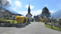
Don’t miss the Saint-Clément Chapel above the power station.

Reviews and comments

3.2 / 5
Based on 5 reviews

Reliability of the description
3.4 / 5
Ease of following the route
3.2 / 5
Route interest
3 / 5
Patrice braems
Patrice braems
• Edited:

Overall rating : 4 / 5

Date of your route : Oct 26, 2026
Reliability of the description : ★★★★★ Very good
Ease of following the route : ★★★★☆ Good
Route interest : ★★★☆☆ Average
Very busy route : No

The first part of the route is very pretty (the climb past the waterfalls), but then the path gets a bit lost.
It’s fairly easy to find your way back, as it comes out onto a fairly busy track.
The ‘Balcon’ path is pleasant, particularly the section leading to the ruins, but you end up above the entrance to the Tarentaise valley and the traffic noise is constant right up to the turning point: a shame.

Machine-translated

User 28902437

Overall rating : 2.7 / 5

Date of your route : May 11, 2026
Reliability of the description : ★★★☆☆ Average
Ease of following the route : ★★★☆☆ Average
Route interest : ★★☆☆☆ Disappointing
Very busy route : No

The route offers no views and is very steep. It’s more of a challenge than a sightseeing trip.

Machine-translated

User 26026733

Overall rating : 3.7 / 5

Date of your route : Aug 04, 2025
Reliability of the description : ★★★★☆ Good
Ease of following the route : ★★★★☆ Good
Route interest : ★★★☆☆ Average
Very busy route : No

Disappointing trail. Poor visibility of the waterfalls, which are overgrown with vegetation. The path is narrow and steep in places. The climb is steep and the descent over the rocks is challenging. However, the trails are very well maintained and clearly marked. On the plus side, there are blackberries and watercress

Machine-translated

gérard bruet
gérard bruet

Hello
Cleaning takes place at the start of June, along with resurfacing of the path.

Machine-translated

User 25652990

Overall rating : 4 / 5

Date of your route : May 31, 2025
Reliability of the description : ★★★★☆ Good
Ease of following the route : ★★★★☆ Good
Route interest : ★★★★☆ Good
Very busy route : No

A very interesting but dangerous route. The start of the trail runs alongside the various waterfalls, but the path is very narrow (at times less than 15 cm wide), with a steep drop-off at the side. On the day of the walk (31 May), the path had not been cleared (nettles and brambles were strewn across the trail). Once past the waterfalls, you reach a more conventional path, although the slopes are sometimes quite steep.

Machine-translated

henri57
henri57 ★
• Edited:

Hello,

You have noted:

Accuracy of the description: Very disappointing
Accuracy of the route on the map: Very disappointing

And

The app is very difficult to use compared to Google Maps and Maps.me. The geolocation isn’t very accurate; I don’t know if I need to download the route beforehand
: when there’s no network signal, it’s impossible to get any information on where I am or which direction I should head in!!!

Is this the reason for the previous comments?

As for the app, here are two tips:

1. Read the specific help section:

Visorando app user guide

And in your case, regarding the lack of a 4G, 3G, etc. connection…

Make a hike or base map available offline

2. If you’re having difficulties, ask your question on the dedicated forum:

Support: Visorando mobile app

Kind regards

Machine-translated

martine.deloybergman
• Edited:

Overall rating : 1.7 / 5

Date of your route : Jun 14, 2020
Reliability of the description : ★☆☆☆☆ Very disappointing
Ease of following the route : ★☆☆☆☆ Very disappointing
Route interest : ★★★☆☆ Average
Very busy route : No

The app is very difficult to use compared to Google Maps and Maps.me. The geolocation isn’t very accurate – I don’t know if I need to download the route beforehand
: when there’s no signal, it’s impossible to get any information on where I am or which way I should go!!!
I regret taking out a one-year subscription! What’s more, the walks I want to do are unavailable.
DELOY BERGMAN MARTINE

Machine-translated

Other walks in the area

For more walks, use our search engine .

The GPS track and description are the property of this route's author. Please do not copy them without permission.