Country:
 City:
City:


Access: Head towards Saint-Denis and join Boulevard Sud. Follow this boulevard and, if you’re coming from Le Port, carry on until you see a sign on the right at a junction reading: ‘Centre de pneu Sautron’. Then take the road on the right that leads towards this sign at the junction. If you’re coming from Sainte-Marie, follow Boulevard Sud until you reach the exit of the next tunnel and take the second left. Then take the first left and turn right at the next junction. In both cases, continue until you reach the sign on the right indicating the botanical trail. Take the path indicated by the sign and follow it to the end.
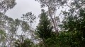
(S/E) At the start, admire the beautiful royal palms of the Providence Forest. A water point and tables are available at the starting point. Take the Mercure Trail, which starts on the right at the far end of the car park, where an information sign is located. Set off along the trail, which quickly leaves the palm forest behind and leads to the chocas. As is often the case in Réunion, the path is muddy if it has rained. The slope becomes steeper quite quickly, and the first stones appear. The path is very well maintained, as is often the case withGR® trails. To the left, the higher slopes of the Camélias become increasingly visible. After a few hairpin bends, you’ll soon reach a gazebo offering a lovely view of the main town.
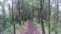
(1) During the first part of the ascent, the Sentier Mercure shares a section with the Providence Botanical Trail circular loop, which explains the information boards providing details about the surrounding environment. The rocks, which are very prominent at the start, gradually give way to numerous tree roots. The path soon enters the Forêt de la Providence, one of the first forests on the island to have been altered by human activity.
(2) At the first junction, turn left. After a few hairpin bends, the path straightens out onto a steeper slope with more roots, which can be a hazard for your ankles.
(3) At the second junction, leave the botanical trail heading to the right and continue straight on through a forest of araucarias. The path then curves before crossing a road.
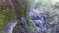
(4) Cross the road and rejoin the path on the other side. The gradient is then less steep for a while. You may hear the sound of water from the Montplaisir Ravine on several occasions, though it is very rarely visible. Do not hesitate to stop and enjoy the views through the clearings overlooking the Bellepierre neighbourhood and the Piton de Tête.
At the next junction, leave the path that heads right towards Bellepierre once again. Epiphytic plants soon come into view, along with lianas climbing up the trees. You’ll also notice a beautiful palm tree at the edge of the path. There’s no doubt about it: the Forêt de la Providence is a veritable green lung just a stone’s throw from civilisation.
(5) After a few hairpin bends, turn right onto the road, which has a fairly steep gradient.
(6) Then rejoin the Mercure Trail heading towards Le Brulé. It starts a little further up on the right at the end of the tarmac road and is signposted. The gradient steepens again without becoming too steep. Tree roots are still present, as are the chocas. Follow the trail to the ONF sign bearing the word ‘Mercure’ and the altitude below it.
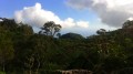
(7) At this sign, keep to the right towards Le Brulé. This sign indicates that you still have half the route to go. Then ignore all the small paths branching off to the right and stay on the Sentier Mercure, which is wide for almost its entire length and very well maintained. Don’t hesitate to stop at the few but beautiful viewpoints overlooking Sainte-Marie, Roland Garros Airport and the eastern part of Saint-Denis.
Further up, a few clearings offer views of Pic Adam, which is easily spotted from a distance. Along the edges of the path, you’ll occasionally come across imposing filaos that must be several hundred years old. After passing these filaos, the path narrows in places, but the occasional clearings offering views of the houses along the Canal du Brulé are still visible. You’ll then tackle a series of new hairpin bends before entering the guava groves, where you can enjoy a wider view of Saint-Denis and the airport, and where it’s possible to see the Ravine du Butor valley.
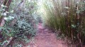
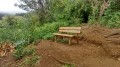
(8) The path then descends slightly before crossing two streams that feed into this ravine. After climbing up from the second stream, the path becomes straighter and passes a few araucaria trees once more. A bench has even been installed just before the end of the path. At the bench, take the path that veers to the right, winding its way beneath thick clumps of bamboo.
After an ascent of around 1 hour 45 minutes, the path soon reaches the village of Le Brulé at Allée Félicien Vincent. You can see the church at Le Brulé by turning left at this junction. There is also a small shop where you can stock up on supplies.
(9) A water point is available here. Then return to the starting point via the same route (S/E).

 Visorando Member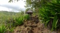
 Easy
Easy 
 Difficult