Country:
 City:


I strongly recommend downloading the route file for this walk.
Access: head towards Saint-Denis and join Boulevard Sud. Follow this boulevard and, if you’re coming from Le Port, carry on until you see the sign for Saint-François on your right. Then take the road on the right that branches off at this junction. If you’re coming from Sainte-Marie, follow Boulevard Sud until you exit the next tunnel and take the second left. Then take the first left and then right at the next junction. In both cases, continue on to Saint-François and then to the sign on the left pointing to the church. Turn left at this junction. Follow the road to Chemin de l’Église, which is signposted on the right. Turn right and park at the end of the street.
(S/E) Visit the church before setting off on the walk. There is a water tap to the right of the church. Then take the path to the right of the church.
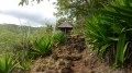
(1) Turn right when you reach the road. From here, you can see the Piton de Saint-François. The first part of the walk follows this road exclusively, which only ends 3 km further up. The climb is steady. You’ll then pass a large wayside shrine on your right. The path is shaded in places. After passing the statue of the Virgin Mary, a few windows offer views over the other side of the Ravine Laverdure.
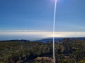
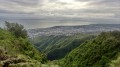
(2) Keep left at the junction. You can pick some guavas here when they are in season (April–June). After negotiating about ten hairpin bends, a few clearings offer views of Piton de Saint-François once more, but from a different angle, as well as of Saint-Denis and, further up, Piton du Butor. The road then becomes tarmac, with fairly frequent steep gradients.
A short flat section follows as you cross a tributary of the Ravine Boucan Launay. After a fairly steep climb, you can once again see the Piton du Butor and the Ravine Bois d’Oiseaux valley. The more observant may even spot a waterfall. Cross a second stream and follow the winding path once more, alternating between flat sections and steep climbs whilst enjoying a few views.
(3) Look out for the return track on the left at the 960-metre mark and carry on straight ahead to the Macassis bus stop.
(4) Look out for the start of the Sentier Laverdure on the right, which you’ll need to take later. Walk back up the road for about ten metres and don’t miss the inconspicuous path branching off to the left. It’s narrow and very slippery but clearly visible. Some sections are a bit overgrown: take a machete with you just in case. The climb is steady along this section of the path.
You’ll come out onto the forest track; follow it to the left through the cryptomeria trees. Stay on this track until you reach the start of the Morne Saint-François trail, which is signposted.
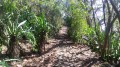
(5) Then begin the descent along this path, which is mostly straight and often runs beneath the cryptomeria trees. Soon, a clearing offers a view of Pic Adam and its distinctive shape.
You’ll reach the first hairpin bends and the first steps, and then the junction with the return path, which is situated just before you cross the stream.
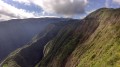
(6) Cross the stream and enjoy the magnificent views over the Ravine des Patates valley at Durand, Pic Adam and the northern coastline. Make the most of this view, as it will be far less spectacular once you reach Morne de Saint-François. This can be reached in 20 minutes from the forest road. The view is partly obscured by vegetation. However, this summit is easily spotted from a distance thanks to its casuarina trees.
(7) Then return to the previous junction via the same path.
(6) Turn right. The path is faint but well marked as it winds its way beneath the cryptomeria trees. The gradient is gentle but becomes a little steeper as it descends into the Ravine Laverdure. Cross the ravine and rejoin the path directly opposite, which is rather obscured by the vegetation. It is heavily overgrown and a machete would once again be a great help. Towards the end of the climb, you may catch a view of the cryptomeria forest you have just passed through and Pic Adam in the distance. Reach a track and follow it to the right. It descends steadily, crossing two streams. Reach the road junction.
(3) Turn left and, following the same path as before, head towards the junction with the Sentier Laverdure.
(4) Take this path to the right. However, it is strongly recommended that you download the GPS track, as the numerous junctions can be confusing.
The path is clearly defined and signposted at the start. Cross the Ravine Bois d’Oiseau quickly. At the first junction, carry straight on and turn left at the second. The path winds its way through cryptomeria trees at times and bamboo thickets at others. It is possible to take the numerous shortcuts, but having a GPS is crucial to avoid getting lost in this maze of paths.
The path then becomes overgrown as it descends towards the Ravine du Butor. It continues on the other side of the ravine but is heavily overgrown with sword grass and other tall weeds. The name of the path takes on its full meaning here. Numerous trees have grown across the path and you’ll often have to duck under them: this isn’t the place for anyone with back problems. Reaching the cryptomeria forest marks the end of the ordeal.
(8) At the junction in the forest, keep to the right. There will still be some overgrown sections, but they won’t be as long. A few flowers, however, add a little something extra to these overgrown stretches. Bamboo becomes increasingly prevalent. Reaching the houses and the Bras Mahot footbridge signals that the end of the path is near.
(9) At the junction, turn right.
Please note: this section is tricky. If you wish to avoid it, turn left at the junction and then right onto the road. Follow this road until you reach the descent towards Le Brûlé, then rejoin the route described.
To attempt the suggested route, keep to the right on a narrow path which quickly leads to a very high natural ‘step’. You’ll need to hold on to the trees to make your way down. Take great care where you place your feet as it is slippery and the path slopes diagonally. It continues with a narrow, sloping section close to the edge: stay close to the cliff face. On the right, a pipe hangs over the drop. The path has subsequently collapsed. It is still possible to get through by holding onto the pipes, but caution is essential.
After this tricky section, you’ll reach the road.
(10) Walk down it. At the first hairpin bend, continue straight on along a path. Then turn left at the first hairpin bend and stay on the path until you reach the junction with the Chemin de la Roche Écrite.
(11) Take the road, then at the next hairpin bend keep left onto the path that cuts across the wide bend. You will then rejoin the road. Follow it and stay on it, turning right onto the Chemin des Frangipaniers. Continue to the junction with the Route des Azaelées.
(12) Turn right. Take care on this section. You’ll reach the third ravine at a wayside shrine.
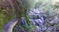
(13) At the third ravine, take a small path to the right. Cross the ravine and climb up the steep slope on the other side via a series of switchbacks. You’ll soon reach the water catchment. The waterfall downstream is magnificent when there’s water. It feeds a very pretty pool.
(14) Return to the road via the same route.
(13) Turn right back onto the road (D43). Pass through La Convalescence and head for the ‘Lataniers’ bus stop.
(15) At the first hairpin bend, keep to the left. Continue along an old track. Only a few tarmac sections have stood the test of time, along with a few signs and guardrails. Cross a stream and come out onto a track which is now in very good condition as it still serves local houses: follow it. You’ll pass close to a church. Head back down the next ravine for a few metres and you’ll reach the Bassin Pilon Marianne. It’s fed by a long water slide. This pool in turn feeds another, larger pool. This pool is well known to locals. The waterfall is quite beautiful when there’s water.
(16) Then return to the road and turn left. Head back to the crossroads you passed at the start.
(2) Turn left and return to the starting point via the same route you took on the way there (S/E).

 Visorando Member
 Moderate

 Easy