From La Redoute to Cap Bernard

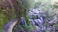
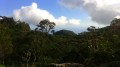
Here’s a short walk offering splendid views of the largest city in the French overseas territories! You can also visit the town of Saint-Denis with its many historic monuments. This walk follows the Sentier des Rampes and its cobbled sections. It can, however, get very hot when the sun is at its highest! This walk is suitable for families, as long as you enjoy walking!

Details

n°946523
Creation:
Last update:
Last review:
  • Walking
    Activity: Walking
  • ↔
    Distance: 4.53 mi
  • ◔
    Average duration: 3h 25 
  • ▲
    Difficulty: Moderate

  • ⚐
    Back to start: Yes
  • ↗
    Ascent: + 1,578 ft
  • ↘
    Descent: - 1,549 ft

  • ▲
    Highest point: 1,148 ft
  • ▼
    Lowest point: 157 ft

Description of the walk

How to get there

From La Possession, follow signs for Saint-Denis via the Route du Littoral, then take the second exit towards Le Barachois. Go through a tunnel, then take the first departmental road on the right towards La Montagne (D41). Stay on the same road at every junction and carry on until you see the Stade de la Redoute (signposted on the right). Park nearby.

From Sainte-Marie, head towards La Possession via Le Barachois. Stay on the same road until you have crossed the Rivière Saint-Denis. Then take the first exit on the right towards La Montagne. Stay on the same road at every junction and carry on until you see the Stade de la Redoute (signposted on the right). Park nearby.

(S/E) From the Stade de la Redoute, head up towards La Montagne, walking along the pavement on the right. You can see Cap Bernard and the route you need to follow.

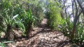
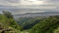
(1) Cross a bridge and take the first path on the right. Very soon, a clearing offers a view of almost the whole of Saint-Denis. The path is flat at first but starts to climb steeply. At times, you can catch a glimpse straight ahead of the hike’s destination: Cap Bernard. The path alternates between gently ascending switchbacks and flat sections, passing beneath a few flamboyant trees.

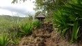
(2) When you reach the road, you can turn left towards the ‘4 Canons’ for a lovely view over Saint-Denis. Alternatively, take the path on the right, which climbs a little further under the tamarind trees, with mainly large boulders. Make the most of the few flat sections to rest. The road is never far away, and it’s very rare to find a moment without any commotion! The path climbs through chocas and a few filaos. You’ll reach the first paved section. Long since hidden beneath the vegetation, this stretch was restored a few years ago. It’s also part of the Chemin des Anglais and is every bit as good as the section between La Possession and Saint-Bernard. Soon, another clearing offers views of Saint-Denis and Cap Bernard. You’ll pass two wayside shrines. Passing the second one signals that the climb is nearly over. You’ll then soon reach a second cobbled section which climbs quite steeply!

(3) Then turn right at the first junction and wind your way down towards the Bras Gentil, which very rarely flows! Then head back up the other side and, at the wire fence, turn left.

(4) The path soon leads to the stunning viewpoint at La Vigie, which is well worth a detour and is on the left as you reach the road. Otherwise, turn right and follow the road to Chemin du Cap Bernard.

(5) At this junction, turn right into a large car park and set off along the Sentier du Cap Bernard, which starts at the far end. You’ll see casuarina trees right from the start. Then leave the path where it joins the road and head straight on to quickly reach a drainage channel.

(6) Don’t miss the inconspicuous path on the right leading to the climbing area. Reach this area via a steep but, fortunately, short section.

(7) Turn back.

(6) Turn right. The descent continues through the casuarina trees and over the rocks.

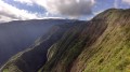
(8) It takes 20 minutes to reach Cap Bernard from the Vigie viewpoint. The view from here is spectacular! In a single glance, you can take in a vast swathe of the island’s north! Tables and kiosks are available here. Take a few minutes to enjoy the stunning view before retracing your steps back to La Redoute (S/E).

Waypoints

  1. S/E : mi 0 - alt. 157 ft - La Redoute Stadium
  2. 1 : mi 0.41 - alt. 282 ft - Bridge: turn right
  3. 2 : mi 0.6 - alt. 446 ft - Carry on to the right along the path
  4. 3 : mi 1.36 - alt. 1,063 ft - At the junction, turn right
  5. 4 : mi 1.56 - alt. 1,138 ft - La Vigie: follow the path on the right
  6. 5 : mi 1.73 - alt. 1,148 ft - Turn right
  7. 6 : mi 1.83 - alt. 1,070 ft - Turn right towards the climbing area
  8. 7 : mi 1.92 - alt. 951 ft - Climbing area
  9. 8 : mi 2.36 - alt. 830 ft - Cap Bernard
  10. S/E : mi 4.53 - alt. 157 ft - La Redoute Stadium

Notes

Take water and a cap with you.
Information boards available at (1).
A kiosk and tables are available at (2) and (8).

Worth a visit

Stade de la Redoute: whilst it is certainly the finish line for the Grand Raid – one of the toughest races in the world – it is also a historic site, as it was here that the great battle between the French and the English took place in 1810, a battle in which the French were defeated. The British subsequently took possession of Réunion Island – previously known as Bourbon Island in honour of Louis XIV – from 1810 until 1815, when it was returned to the French.

Places to visit:
The Oratory of Our Lady of La Garde: take the first path on the left off the road you follow past the Stade de la Redoute.
The ‘4 Cannons’ viewpoint (2).
The Vigie viewpoint (4).
The various cobbled sections.
The Church of the Délivrance (head back down the D41 from the starting point (S/E); the church is on the left).
The Cap Bernard viewpoint (8)

Things to do:
Visit the town of Saint-Denis.
Go rock climbing at the spot at (7).

Reviews and comments

4.2 / 5
Based on 2 reviews

Reliability of the description
4.5 / 5
Ease of following the route
4.5 / 5
Route interest
3.5 / 5
User 9441085

Overall rating : 3.7 / 5

Date of your route : Oct 26, 2026
Reliability of the description : ★★★★☆ Good
Ease of following the route : ★★★★☆ Good
Route interest : ★★★☆☆ Average
Very busy route : No

From La Redoute, the climb runs close to the road, which causes noise and odour pollution at times. The final stretch of the route on Cap Bernard is well worth the trip.

Machine-translated

Kamé84Sennin
Kamé84Sennin

Overall rating : 4.7 / 5

Date of your route : Jul 23, 2024
Reliability of the description : ★★★★★ Very good
Ease of following the route : ★★★★★ Very good
Route interest : ★★★★☆ Good
Very busy route : No

A short walk along part of the mountain. A few tourist information boards explain the history of the English conquest.

Part of the walk is along the pavement. And you can drive right up to the viewpoint at the very top – or at least get very close to it.

Machine-translated

Other walks in the area

For more walks, use our search engine .

The GPS track and description are the property of this route's author. Please do not copy them without permission.