Country:
 City:


Access: from La Possession, follow signs for Saint-Denis via the Route du Littoral, then take the second exit towards Le Barachois. Go through a tunnel, then take the first departmental road on the right towards La Montagne (D41). Stay on the same road at every junction and carry on until you see the Stade de la Redoute (signposted on the right). Park nearby.
From Sainte-Marie, head towards La Possession via Le Barachois. Stay on the same road until you have crossed the Rivière Saint-Denis. Then take the first departmental road on the left towards La Montagne. Stay on the same road at every junction and carry on until you see the Stade de la Redoute (signposted on the right). Park nearby.
(S/E) The walk starts at the Stade de la Redoute. It is a pity that there is no information board here about this very important and symbolic site in Saint-Denis (see the ‘Places to see’ section). Head up the D41 along a lovely path on the opposite bank. From here, looking to the right, you can gauge the roughly 300-metre climb to La Vigie by spotting the mast (which belongs to Piton Trésor) and the small white house to the left of it.
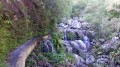
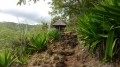
(1) Then take the first path branching off to the left towards the Rivière Saint-Denis. This path descends steeply and the steps are sometimes very high, but the path is secured by a handrail. The path then leads very quickly to the beautiful but small oratory of Notre-Dame de la Garde.
Return via the same route.
(1) Turn left. You can see the well-known Vinh-San Bridge on your left. The road gets closer and closer to it before taking two bends and crossing over the four-lane road that joins it. Crossing the road at this point can, however, be dangerous, which is why I recommend crossing it beforehand.
(2) After crossing the bridge, take the footpath that starts on the right. There is an information sign here. It is worth noting that this footpath is fairly new. It was created in 2013 to allow walkers to explore the few remaining cobbled sections. The start of the path is almost flat, and the first views of Saint-Denis and Cap Bernard appear very quickly. The gradient becomes a little steeper as you continue.
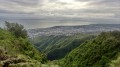
(3) Within a few minutes, you’ll reach a kiosk. At the kiosk, turn left and head towards the aptly named ‘4 Cannons’ viewpoint. This was a strategic location as it allowed ships approaching in the distance to be spotted. Today it is visited by large numbers of motorists on their way to La Montagne. It offers a beautiful view stretching from Cap Bernard to Rolland Garros Airport, as well as towards Pic Adam and the Rivière des Pluies.
Take a few minutes to admire the view, then continue the climb, which becomes more challenging once you’ve passed the kiosk. As is often the case at these altitudes, you’ll find ‘chocas’ – an invasive plant and a notorious nemesis for hikers on Réunion if allowed to take over. You’ll also notice the beautiful flamboyant trees, which are striking from a distance in summer thanks to their red flowers.
The path never strays far from the D41, which runs right alongside it! Make the most of the flat sections. After about 15 minutes’ walk from the kiosk, you’ll reach the first cobbled section. It was completely restored following the works carried out in 2013. Only two cobbled sections remain in the vicinity of the Montagne ramps. The others disappeared following the construction of the road. These cobbled sections of the Chemin des Anglais are every bit as good as the best-known stretch between La Possession and Saint-Bernard. The gradient, however, is steeper than average on these sections. Viewpoints become increasingly rare, but it is possible to see Saint-Denis through a few gaps in the trees. You’ll soon arrive near an oratory, signalling your imminent arrival at the second cobbled section, which is slightly longer than the first. It’s easy to imagine, given the era, the countless hours of gruelling labour carried out by the slaves to build between 20 and 30 km of cobbled road linking Saint-Denis to La Possession!
(4) At the next junction, turn left to stay on the paved path. It ends quickly and leads onto the D41, from where you can see the jagged ramparts of the Rivière des Pluies, Pic Adam and the Bellepierre neighbourhood.
Then return to the previous junction and turn left. This marks the start of the short descent towards Bras Gentil. The path consists entirely of hairpin bends that are easy to navigate and run alongside a fence. You’ll then reach Bras Gentil before climbing back up the other side, again via hairpin bends, to reach another fence, which you’ll go round to the left.
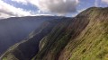
(5) After about 1 hour, reach the road and turn left. Here you’ll find the stunning viewpoint at La Vigie. From here, you can see, in a single glance, from Saint-Denis all the way to Pointe Sainte-Marie, taking in the airport, Mongaillard, Rivière des Pluies, La Bretagne and many other places in the north. You can easily make out the straight, horizontal streets of Saint-Denis. Take in the view and continue up the road.
(6) Take the path on the right which starts just behind postbox number 1, then follow the track that leads straight ahead at the next bend. Next, take the first path on the left which runs alongside a few filaos. This pleasant path is, however, short-lived. At the end of it, turn left onto a road that goes round a stadium.
(7) Then take the first paved path on the right, marked by an ONF sign. The walk along this path is pleasant and takes you through lovely woodland. After a little over an hour’s walk, you’ll arrive at La Montagne, near Piton Trésor.
Follow the same route, continuing straight on.
(1) Return to the starting point (S/E).

 Visorando Member
 Easy

 Difficult