The Pic Adam culvert

Pic Adam is named after one of the island’s botanists. Its western flank is criss-crossed by numerous small streams that often carry water. Several catchments were subsequently created and are linked by a pipeline designed to supply water to the homes downstream. It is possible to follow this pipeline on a walk that presents no major difficulties, but which does include some tricky sections for children, particularly on the way to the beautiful waterfall on the Ravine Blanche.

Details

812700
Creation:
Last update:
Last review:
  • Walking
    Activity: Walking
  • ↔
    Distance: 2.13 mi
  • ◔
    Average duration: 1h 25 
  • ▲
    Difficulty: Moderate

  • ⚐
    Back to start: Yes
  • ↗
    Ascent: + 518 ft
  • ↘
    Descent: - 512 ft

  • ▲
    Highest point: 2,776 ft
  • ▼
    Lowest point: 2,326 ft

Photos

Description of the walk

Access: head to Saint-Denis and take the Boulevard Sud. Then follow signs for the Clinique de Sainte-Clotilde, then Bois de Nèfles, then Pic Adam, and park at the end of the road in the car park. (S/E)

(S/E) From the car park, take the concrete path that goes straight ahead.

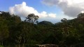
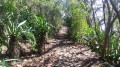
(1) At the next bend, take the first path on the right towards La Roche Écrite (signposted). The path is flat, wide and pleasant. Then cross the first stream and continue on level ground through a forest of colourful trees. The first steps come quickly but are taken with little or no effort. At this point, enjoy the occasional clearings offering views over the Bois de Nèfles.

The path then quickly levels out as it passes close to a few chocas and filaos before plunging back into a forest of colourful trees and then guava trees. A pipe occasionally emerges from the ground: follow this pipe as far as the water catchment, which carries water from the ravine to Bois de Nèfles. You will then enter a forest of cryptomerias and longoses. A few water collection points have been installed here and there, one of which is situated near a marker bearing the letters AF (impossible to miss as it’s right in the middle of the path).

(2) Follow the path to the ONF sign for “Ravine du Paradis”. Then turn right onto a less well-known but clearly visible path. Tackle one last short, steep slope with the treacherous roots of the cryptomeria trees. The path is flat afterwards and passes beneath a canopy of trees bent by the force of the wind. This section, which is rarely used, is very pleasant. You will then pass close to a water intake before going through a passage carved into the rock and past a second water intake. It is worth noting that there are a few small waterfalls at almost all of these intakes, providing a pleasant sound.

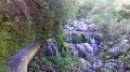
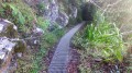
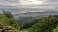
After about 5 to 10 minutes’ walk from the previous junction, you’ll reach a canal which you’ll need to follow to the ravine. The first few metres are protected by a barrier and offer a lovely view over the Ravine Blanche valley. Make the most of it, as this will be the most beautiful and one of the few panoramic views of the walk. The canal has recently been fenced off and also features a handrail. Before reaching the ravine, you can see the dizzying 50-metre waterfall downstream of the canal’s water intake! Towards the end of the canal, there are several paths leading down to the ravine where you can go and see this high waterfall by walking alongside it downstream (not tested). Take care at the end of the canal as the water flows over the mesh fencing!

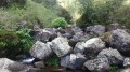
(3) Once you reach the ravine, head up it. Be careful, however, as the rocks are very slippery! The rocks are sometimes very high and require caution both when climbing up and down. After about 5 to 10 minutes of climbing, you’ll arrive near a lovely little pool fed by a beautiful waterfall a few metres high.

(4) Return via the same route to the starting point (S/E).

Waypoints

  1. S/E : mi 0 - alt. 2,326 ft - Car park
  2. 1 : mi 0.12 - alt. 2,411 ft - Turn right towards the Roche Écrite
  3. 2 : mi 0.57 - alt. 2,648 ft - Ravine du Paradis, on the right
  4. 3 : mi 1.02 - alt. 2,700 ft - Climb up the Ravine Blanche
  5. 4 : mi 1.07 - alt. 2,776 ft - Waterfall
  6. S/E : mi 2.13 - alt. 2,326 ft - Car park

Notes

__A route with no major difficulties but featuring tricky sections, which may even be impossible to manage with children!
The climb up the Ravine Blanche is over very slippery rocks: do not walk through the ravine if the water is too strong!
The water flows over the wire mesh fence along the canal at the end of the walk.__

Worth a visit

Places to see:
- The canal before the (3)
- The waterfall at (4)
- The large waterfall of around 50 metres (at (3), find a way back down into the ravine and follow it down to the break. This route hasn’t been tested yet but seems feasible to me).

Things to do:
- Option to extend the walk by doing the Pic Adam circular route (on the way back, turn right at (2)).

Reviews and comments

4.7 / 5
Based on 2 reviews

Reliability of the description
4.5 / 5
Ease of following the route
4.5 / 5
Route interest
5 / 5
Eaubell974
Eaubell974

Overall rating : 5 / 5

Date of your route : Dec 28, 2024
Reliability of the description : ★★★★★ Very good
Ease of following the route : ★★★★★ Very good
Route interest : ★★★★★ Very good
Very busy route : No

An easily accessible, quick walk; along the path you’ll find old canal structures and a magnificent landscape, just 20 minutes from the town

Machine-translated

Beatrice B
Beatrice B

Overall rating : 4.3 / 5

Date of your route : Jan 19, 2025
Reliability of the description : ★★★★☆ Good
Ease of following the route : ★★★★☆ Good
Route interest : ★★★★★ Very good
Very busy route : No

A very pleasant, shaded and relatively easy walk. The final stretch along the riverbed to reach the pool and waterfall is a bit tricky. But even if you stop before you get there, the path through the colourful woodland and the view over Saint-Denis are well worth the effort. Do pop along to the picnic area afterwards to round off your walk with a picnic on the grass.

Machine-translated

Other walks in the area

For more walks, use our search engine .

The GPS track and description are the property of this route's author. Please do not copy them without permission.