The Clarence, starting from Sachin

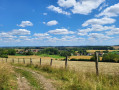
Starting from the small village of Sachin, follow the River Clarence, which rises at Le Buich and flows for nearly 32.8 km before joining the River Lys. You’ll pass through the village of Pernes and finally Aumerval before heading back down towards Sachin.

Details

4239867
Creation:
Last update:
Last review:
  • Walking
    Activity: Walking
  • ↔
    Distance: 7.45 mi
  • ◔
    Average duration: 3h 45 
  • ▲
    Difficulty: Moderate

  • ⚐
    Back to start: Yes
  • ↗
    Ascent: + 390 ft
  • ↘
    Descent: - 361 ft

  • ▲
    Highest point: 597 ft
  • ▼
    Lowest point: 272 ft
  • ⚐ Country: France
  • ⚐ City: Sachin (62550)
  • ⚑
    Start/End: N 50.48651° / E 2.37536°
  • ❏
    IGN map(s): Ref. 2305E
  • Hour-by-hour weather

Description of the walk

Park in the car park at Sachin Town Hall.

(S/E) Leave the car park and follow the road eastwards. At the first junction with a wayside cross, continue along the road opposite, still heading east. Follow theGR®127(marked in red and white).

(1) At the T-junction near the last houses in Sachin, take the path opposite and continue to follow theGR®127.

(2) At the fork in the path, keep right heading south-south-east until you reach the first Y-junction. Follow Rue du Huit Mai to the left for a few dozen metres, then, at the start of Rue des Carimarants, take the path on the left and follow theGR®127until it joins Rue de l’Église.

(3) Turn right towards the church, walk past it and, at the next junction, turn left into Rue d’Aumerval. Join the D90.

(4) Cross the road carefully and take the road opposite. Follow thePR® trail marked in yellow. Leave the road on your right and, at the next junction, turn left onto Chemin de la Justice, continuing to follow the PR®. You’ll reach the T-junction at the 125 metre mark.

(5) Take the path on the right heading north. Leave the path on your right and continue along thePR® to the Y-junction near a detached house.

(6) Follow the Aumerval road to the left, heading north. At the junction by the chapel, carry straight on until you reach the D91.

(7) Turn left, heading south-west. After about 400 metres, leave the path on your right and take the path opposite about 50 metres further on. Follow the PR®. Leave the path and the track on your right, and enter Aumerval.

(8) At the tarmac road, turn left towards the church and the town hall. Then turn left onto the D91 and walk for about 400 m.

(9) Take the path on the right after house No. 60. After the bend to the right, leave the path on your left and continue to the cemetery, where the path joins the D90.

(10) Cross the road carefully and take the path opposite. Walk through the Bois de la Ville following theGR®127until you reach the five-way junction.

(11) Continue along the road to the right, following theGR®127. At the next junction, by the isolated house, turn left, still following theGR®127, and you’ll reach the pumping station.

(12) Carry on straight ahead towards the church and Sachin town hall, your starting point (S/E).

Waypoints

  1. S/E : mi 0 - alt. 341 ft - Car park at the town hall near the - Clarence (rivière)
  2. 1 : mi 0.34 - alt. 348 ft - T-junction
  3. 2 : mi 1.11 - alt. 322 ft - Crossroads
  4. 3 : mi 1.55 - alt. 302 ft - Rue de l’Église - Église saint-Pierre (Pernes)
  5. 4 : mi 1.79 - alt. 328 ft - Junction with the D90
  6. 5 : mi 2.51 - alt. 407 ft - Contour 125 – T-junction
  7. 6 : mi 3.13 - alt. 413 ft - Isolated house, on the left
  8. 7 : mi 4.02 - alt. 374 ft - Junction with the D91
  9. 8 : mi 4.88 - alt. 433 ft - Église Saint-Maur (Aumerval)
  10. 9 : mi 5.16 - alt. 394 ft - Path on the right
  11. 10 : mi 5.68 - alt. 456 ft - Junction of the D90 and the cemetery
  12. 11 : mi 6.67 - alt. 531 ft - Crossroads of the Five Paths
  13. 12 : mi 7.3 - alt. 371 ft - Pumping station
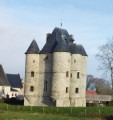
  14. S/E : mi 7.45 - alt. 341 ft - Town hall car park - Église Saint-Jean-Baptiste (Sachin)

Notes

I recommend doing this walk during the drier months as the paths get quite muddy in wet weather.

(10) Water point at the cemetery.

Make sure you wear a good pair of shoes. Don’t forget to bring something to eat and drink.

Worth a visit

Always be cautious and plan ahead when you're outdoors. Visorando and the author of this route cannot be held responsible for any accidents occurring on this route.

The GR® and PR® markings are the intellectual property of the Fédération Française de Randonnée Pédestre.

Reviews and comments

4.3 / 5
Based on 2 reviews

Reliability of the description
4.5 / 5
Ease of following the route
4.5 / 5
Route interest
4 / 5
Franlain2
Franlain2

Overall rating : 4.3 / 5

Date of your route : Aug 06, 2022
Reliability of the description : ★★★★★ Very good
Ease of following the route : ★★★★☆ Good
Route interest : ★★★★☆ Good
Very busy route : No

A pleasant walk.

Machine-translated

Jean-Mi 62550
Jean-Mi 62550

Overall rating : 4.3 / 5

Date of your route : Apr 29, 2021
Reliability of the description : ★★★★☆ Good
Ease of following the route : ★★★★★ Very good
Route interest : ★★★★☆ Good
Very busy route : No

Distance covered whilst running … perfect!

Machine-translated

Other walks in the area

For more walks, use our search engine .

The GPS track and description are the property of this route's author. Please do not copy them without permission.