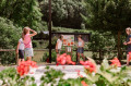
Le Salas to Brassac-sur-Agout

Hiking trail in the commune of Brassac-sur-Agout in Sidobre & Vallées in the Tarn – Occitanie. Passing through Brassac, a medieval town, and its old quarters, this relatively easy route follows the banks of the Agout, quickly taking you into the heart of the countryside.

Details

73025513
Creation:
Last update:
Last review:
  • Walking
    Activity: Walking
  • ↔
    Distance: 3.41 mi
  • ◔
    Average duration: 2h 20 
  • ▲
    Difficulty: Easy

  • ⚐
    Back to start: Yes
  • ↗
    Ascent: + 860 ft
  • ↘
    Descent: - 860 ft

  • ▲
    Highest point: 2,457 ft
  • ▼
    Lowest point: 1,585 ft

Photos

Description of the walk

Car park at Place de la Marquise. See ‘Practical Information’ for access details.

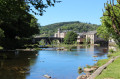
(S/E) Cross the old bridge (12th century) over the Agout. Turn right onto Rue du Moulin (half-timbered house), then immediately left onto Rue de l’Escriboto until you reach the church square, then turn right.

(1) Turn left onto Chemin de la Carrièrasse. Cross the Route de la Raviège and continue along Rue de Lafusarié (this neighbourhood was home to the ‘fusaîres’, or wool spinners). On the right, near a fountain, you can see a wayside cross depicting the various instruments used in the crucifixion of Christ.

(2) At the top of the street, turn right over the small bridge and head uphill through the woods. At the cross, turn right, then go straight on at the next two junctions until you reach the plateau.  

(3) On reaching the plateau, turn left straight away onto the track, then turn right onto a small sunken path (view of the village of Castelnau de Brassac). At the wide track, turn right, then follow the path on the right through the undergrowth to a ruin.

(4) At the ruin, follow the track to the four-way junction. Take the stony track on the right.

(5) At the crossroads, go straight on to reach the road.

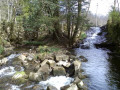
(6) Follow it to the right. At the second path on the left, head down towards the village, walk past the lodges at the Village Vacances du Camboussel, then arrive at the banks of the Agout. 

(7) Continue to the right, then take the first right until you reach the church square and the Chemin de la Carrièrasse.

(1) Turn left to return to the car park via the reverse route of the outward journey (S/E).

Waypoints

  1. S/E : mi 0 - alt. 1,598 ft - Car park - Agout (rivière)
  2. 1 : mi 0.12 - alt. 1,608 ft - Carrefour de la circular
  3. 2 : mi 0.48 - alt. 1,726 ft - Petit Pont, La Fusarié
  4. 3 : mi 1.03 - alt. 2,277 ft - Plateau
  5. 4 : mi 1.73 - alt. 2,372 ft - Ruins
  6. 5 : mi 1.98 - alt. 2,192 ft - Four paths
  7. 6 : mi 2.37 - alt. 1,959 ft - Bus
  8. 7 : mi 3.08 - alt. 1,608 ft - Banks of the - Agout (rivière)
  9. S/E : mi 3.41 - alt. 1,598 ft - Car park

Notes

Departure: Place de la Marquise car park

Arrival: same location as departure

Towns: Brassac

Road access and car park: via the D622, D53 or D62

Parking: Parc de la Marquise car park – GPS: 43.62882, 2.49675

Transport

Bus route 763

Worth a visit

The River Agoût, emerging from a steep gorge, winds its way through a vast basin.
In the Middle Ages, it separated the castles of the two seigneuries of Castelnau (right bank) and Belfortès (left bank). It carried away the bodies of the combatants during the16th-century battles, against a backdrop of fratricidal strife between Protestants and Catholics. It powered the fulling mills (paradors) which pressed the woollen cloth to give it its firm texture.
By the17th century, Brassac was already producing the finest quality cloth, known as ‘cordelats’, and flourished thanks to the energy of its waters and its people.

Restaurants (in Brassac)

Cafés (in Brassac)

Supermarket (in Brassac)

Reviews and comments

4.4 / 5
Based on 3 reviews

Reliability of the description
4.7 / 5
Ease of following the route
4.7 / 5
Route interest
4 / 5
User 22961729

Overall rating : 5 / 5

Date of your route : Oct 21, 2025
Reliability of the description : ★★★★★ Very good
Ease of following the route : ★★★★★ Very good
Route interest : ★★★★★ Very good
Very busy route : No

A beautiful hike that is a bit challenging at the start but well worth it for what follows
Perfectly marked. It's impossible to get lost

Machine-translated

jp11
jp11

Overall rating : 4.3 / 5

Date of your route : Jun 09, 2025
Reliability of the description : ★★★★★ Very good
Ease of following the route : ★★★★★ Very good
Route interest : ★★★☆☆ Average
Very busy route : Yes

No need to track your route on your mobile phone. The walk is very well signposted. Easy even in hot weather, as it takes place in the forest.
The main attractions are at the start and finish, for those who are unfamiliar with Brassac.

Machine-translated

avrilmai
avrilmai

Overall rating : 4 / 5

Date of your route : Jun 08, 2025
Reliability of the description : ★★★★☆ Good
Ease of following the route : ★★★★☆ Good
Route interest : ★★★★☆ Good
Very busy route : No

We had a lovely afternoon, hiking in the shade the whole time.
Not recommended in very hot weather
Few views - beautiful forest - easy walking

Machine-translated

Other walks in the area

For more walks, use our search engine .

The GPS track and description are the property of this route's author. Please do not copy them without permission.