The Durencuse Springs Trail

A walk between the edge of the Sidobre massif and the start of the Anglès plateau. This walk takes you through the more agricultural and wooded parts of the Sidobre, with the advantage of paths and tracks that are accessible to everyone.
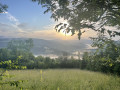
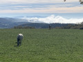
Beautiful views over the Montagne Noire and the Castres plain.

Details

73099259
Creation:
Last update:
Last review:
  • Walking
    Activity: Walking
  • ↔
    Distance: 6.63 mi
  • ◔
    Average duration: 3h 50 
  • ▲
    Difficulty: Easy

  • ⚐
    Back to start: Yes
  • ↗
    Ascent: + 899 ft
  • ↘
    Descent: - 886 ft

  • ▲
    Highest point: 2,684 ft
  • ▼
    Lowest point: 2,113 ft

Photos

Description of the walk

School car park.

(S/E) Take the small path that climbs up opposite the school (next to the car park) until you reach a track. 

(1) Pass the first track on the right and take the second one. The path climbs through woodland and joins a track; follow this to the right. At the crossroads, carry straight on. You’ll arrive at the Prunelière farm. Walk down the stony path.

(2) After a few metres, follow the path to the left of the cross and you’ll come to some meadows on your right. You’ll then reach a track.

(3) Follow it to the right. As you emerge from the woods, continue to the left. Along the path, you can see some magnificent beech trees. You’ll arriveat Chazottes.

(4) Walk behind the houses in Chazottes and follow the stony track to the Route du Viala. Continue to the right until you reach the embankment.

(5) Climb up the embankment to the right, cross the D53 with care and climb up opposite, back onto the embankment. Follow the sunken path lined with beech trees to the track and continue to the right. Beautiful views over the Montagne Noire and the Pic de Nore. Take the road to the right, then left, until you reach the crossroads.

(6) Follow the D53 – take care – towards Bouisset. Then take the track that climbs opposite the Chemin de la Pastrié. It then leads into the woods. Pass two tracks on the left and one on the right, then head up the left-hand track. Viewpoint over the Durencuse valley and Plaisance. Atthe road, turn right then follow the edge of the plantation.

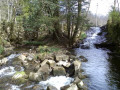
(7) Continue along the road on the left. Before the bridge, you can see the Moulin de la Resse, which is still in working order. Crossthe bridge and head up the track opposite, which runs above the houses in Plaisance, until you reach the edge of the hamlet. 

(8) On leaving the hamlet, continue left along the road, then left again onto the first track. Ignore a track on the right. Viewpoint over St-Salvy-de-la-Balme and Castres. Join the track from the start and head down to the left to return to the village (S/E).

Waypoints

  1. S/E : mi 0 - alt. 2,113 ft - School
  2. 1 : mi 0.14 - alt. 2,208 ft - Track on the right
  3. 2 : mi 0.83 - alt. 2,356 ft - La Prunelière
  4. 3 : mi 1.38 - alt. 2,398 ft - Trail
  5. 4 : mi 1.95 - alt. 2,497 ft - Behind the houses in Chazottes
  6. 5 : mi 2.56 - alt. 2,562 ft - Slope
  7. 6 : mi 3.1 - alt. 2,585 ft - Crossroads
  8. 7 : mi 5.27 - alt. 2,300 ft - Edge of the plantation
  9. 8 : mi 5.88 - alt. 2,208 ft - Leaving the hamlet of Plaisance
  10. S/E : mi 6.63 - alt. 2,113 ft - School

Notes

Start: Car park opposite the school

Finish: Same place as the start

Towns: Brassac, Le Bez, Lasfaillades

Road access and car park: Via the D30

Parking: Car park opposite the school – GPS: 43.60720, 2.47642

Transport: Bus route 763, Bel Air stop (2.4 km)

Worth a visit

Accommodation

Reviews and comments

3.8 / 5
Based on 4 reviews

Reliability of the description
3.3 / 5
Ease of following the route
4.3 / 5
Route interest
3.8 / 5
2455783
2455783

Overall rating : 3.7 / 5

Date of your route : May 11, 2026
Reliability of the description : ★★★★☆ Good
Ease of following the route : ★★★★☆ Good
Route interest : ★★★☆☆ Average
Very busy route : No

A distance of just over 10 km, with a bit of tarmac but not much else. Lots of woodland and a few scenic spots

Machine-translated

User 314220

Overall rating : 2.7 / 5

Date of your route : May 04, 2026
Reliability of the description : ★☆☆☆☆ Very disappointing
Ease of following the route : ★★★★☆ Good
Route interest : ★★★☆☆ Average
Very busy route : No

This route has been very poorly estimated in terms of distance. Although listed as 10.68 km, it turns out that we actually covered just over 14 km, as verified by three different pedometers, a GPS, and an IGN map the following day.
It would appear that the Sidobre du Bez Tourist Office in the Tarn, which created this route, was significantly mistaken regarding its length and, consequently, its duration, which is estimated at 4 hours 30 minutes at a pace of 3.2 km/h.
As for the signposting, it is relatively acceptable throughout the route.
An easy route, yes, but NOT a walk, as it is too long for people with limited distance and elevation capabilities, as in our case!

Machine-translated

gerardt
gerardt

Overall rating : 4 / 5

Date of your route : Oct 13, 2025
Reliability of the description : ★★★☆☆ Average
Ease of following the route : ★★★★☆ Good
Route interest : ★★★★★ Very good
Very busy route : No

beautiful hike, no particular difficulty. Beautiful views of the Black Mountain

Machine-translated

aline.viguier@hotmail.fr

Overall rating : 4.7 / 5

Date of your route : Sep 15, 2025
Reliability of the description : ★★★★★ Very good
Ease of following the route : ★★★★★ Very good
Route interest : ★★★★☆ Good
Very busy route : Yes

Easy hike Well marked (beautiful scenery!!) To be enjoyed without restraint...

Machine-translated

Other walks in the area

For more walks, use our search engine .

The GPS track and description are the property of this route's author. Please do not copy them without permission.