Country:

 City:
City:


Park in the car park on Place du Temple, near Saint-Sébastien Church.
(S/E) With your back to the church, turn right onto the D227 road, leaving the Impasse du Furou on your right. Immediately afterwards, look for the first yellow signpost and follow the signs for “Les Frênes” to the right.
(1) At the “Les Frênes” signpost, turn left towards “Les Caravelles”.
(2) Cross the D66 with care, continue straight ahead, then turn left at the first junction towards Les Caravelles. Walk through the hamlet.
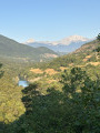
(3) Continue to the right, following the sign for “Sur les Caravelles”, up a path through the woodland which leads to a beautiful viewpoint over the Trièves: the “Sur les Caravelles” signpost.
(4) Follow the signs for “Col de Saint-Sébastien”, taking the track that descends south-west to La Peyre.
(5) Turn right onto the tarmac road leading to the Col de Saint-Sébastien via the D66.
(6) Cross it carefully and take the tarmacd uphill track opposite, towards “Château Vieux”. A little further up, you’ll come across some beautiful buildings which you should go round on the right.
(7) After the “Château Vieux” signpost, continue to the left along a pleasant path that descends gradually until you reach a junction on the edge of the Bois de Laye.
(8) Turn right and head up to the Col de Laye, a few dozen metres further up.
(9) To return to “Saint-Sébastien”, follow the tarmac road to the right for 100 m, then take the path leading down to the left: there is a signpost with a yellow arrow indicating “Saint-Sébastien 0.6 km”. You’ll emerge onto the D228 at the entrance to Saint-Sébastien.
(10) Turn right to cross the village and reach the car park (S/E).
 Visorando Member
 Moderate
  Difficult