The Saint-Sébastien (Châtel-en-Trièves) Wetland Circular Route

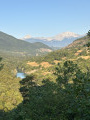
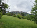
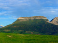
A lovely, easy walk starting from the centre of Saint-Sébastien (Châtel-en-Trièves). The route heads towards the lagoon, then on to the hamlet of Les Goirands, which offers a beautiful view of the Écrins. The return journey to the village centre takes you across the plains with a view of Le Châtel. On arrival, you can enjoy a meal or a coffee at the village restaurant, near the town hall.

Details

75804275
Creation:
Last update:
Last review:
  • Walking
    Activity: Walking
  • ↔
    Distance: 2.83 mi
  • ◔
    Average duration: 1h 30 
  • ▲
    Difficulty: Easy

  • ⚐
    Back to start: Yes
  • ↗
    Ascent: + 223 ft
  • ↘
    Descent: - 213 ft

  • ▲
    Highest point: 2,871 ft
  • ▼
    Lowest point: 2,726 ft

Description of the walk

Park in the car parks (near the temple): free parking.

(S/E) Cross the D227 at the pedestrian crossing, then cross the football pitch.

(1) Take the grassy path running alongside a hedge and a stream, and you’ll reach the wetland.

(2) Turn right and cross a lovely equestrian training area (with obstacles, etc.) to reach the woodland and the path at the far end. Follow this path through the woodland, alongside a pretty stream.

(3) Cross the wooden footbridge, continue to the concrete track, then turn right. At the end of the track, carry on down the grassy path (you may need to go under a fence) to reach a small stream (ford).

(4) Turn right to walk along the edge of the field, following the boundary, and head back up towards the country lane at the edge of the woods. Then turn right until you reach the tarmac-surfaced local road. Turn left towards the hamlet of Les Goirands, and continue on to the hamlet of Les Mottes: a lovely view of the Écrins mountain range.

(5) Head up the path on the right, pass under a power line, then cross a stream to return to the plain: lovely views of Mont Châtel.

(6) Carry on straight ahead and head back towards the village (S/E).

Waypoints

  1. S/E : mi 0 - alt. 2,831 ft - Free car park at Le Vallon opposite the temple
  2. 1 : mi 0.06 - alt. 2,828 ft - Path behind the football pitch
  3. 2 : mi 0.34 - alt. 2,818 ft - Lagunage
  4. 3 : mi 0.55 - alt. 2,782 ft - Wooden footbridge
  5. 4 : mi 0.76 - alt. 2,726 ft - Cultivated field
  6. 5 : mi 1.76 - alt. 2,743 ft - Ascent back to the plain
  7. 6 : mi 2.37 - alt. 2,871 ft - Return to the village
  8. S/E : mi 2.83 - alt. 2,831 ft - Free car park at Le Vallon opposite the temple

Notes

A walk suitable for all ages. For walkers, mountain bikers and horse riders.

Worth a visit

View of the Écrins

View of Le Châtel.

Other walks in the area

For more walks, use our search engine .

The GPS track and description are the property of this route's author. Please do not copy them without permission.