


Refine your search for walks in Chalanne (ruisseau) - Affluent du Drac
Chalanne (ruisseau) - Affluent du Drac walks


 The Ruisseau des Pavés
 Visorando Member
 2.21 mi
 +1,056 ft
 -1,079 ft
 1h 55
 Moderate
 Departure from Cordéac (Isère)
Come and discover this little stream hidden away in a large forest above Cordéac. A short trail with several information points will help you understand the history of this little stream. Mountain torrents have always been difficult to control during snowmelt or heavy rainfall. They can be destructive. This engaging trail invites you to discover how people have managed to control these watercourses. You’ll also learn how the unusual Ruisseau des Pavés was formed.
Walks near Chalanne (ruisseau) - Affluent du Drac
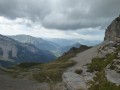
Lachaup – Les Amayères
 12.04 mi
+4,262 ft
-5,033 ft
9h 15
 Difficult
Departure from Agnières-en-Dévoluy (Hautes-Alpes)
Through the Charnier valley at the foot of the Grand Ferrand, then via Pointe Feuillette, the final stage of this route.
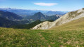
Lachaup – La Jarjatte
 8.45 mi
+2,657 ft
-3,386 ft
6h 10
Difficult
Departure from Agnières-en-Dévoluy (Hautes-Alpes)
To travel from the Hautes-Alpes to the Drôme, from the Dévoluy to the Vercors via the mountains. A lovely walk through wild and varied countryside. Apart from at the start, the route follows theGR® 93, which presents no problems in terms of signposting or navigation.
Col des Aiguilles - Return circular via Le Chauvet
 7.94 mi
+2,743 ft
-2,723 ft
6h 00
Difficult
Departure from Agnières-en-Dévoluy (Hautes-Alpes)
Most of the route follows theGRP® Tour du Dévoluy trail markedGR®94.
For the return journey, rather than going back the same way, you can vary the route by returning via Small Pass and Le Charvet. This is an off-trail route.
This alternative route must be taken in good visibility and requires the ability to use a map and compass, which is essential for off-trail hiking.
The view from Le Chauvet over Le Dévoluy is magnificent.
La Jarjatte - Lachaup
 8.40 mi
+3,140 ft
-2,434 ft
6h 35
Difficult
Departure from Lus-la-Croix-Haute (Drôme)
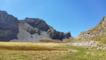
This link via the Col des Aiguilles involves an ascent facing the Aiguilles de Lus. The descent into the wild Aiguilles valley offers a glimpse of the slopes of the Joue du Loup resort.
Les Amayères - La Jarjatte
8.55 mi
+2,805 ft
-2,762 ft
6h 20
Moderate
Departure from Lus-la-Croix-Haute (Drôme)
Discover a beautiful peak on the border between Trièves and Le Dévoluy, Pointe Feuillette.
Clelles - Ferme du Désert
 13.59 mi
+4,829 ft
-3,383 ft
8 hrs
 Very difficult
Departure from Clelles (Isère)
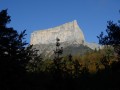
The first day is a long one, starting at the foot of Mont-Aiguille with alternating steep climbs and gentler passages through mountain pastures and forests.
Plateau and Pic de Bure via the Joue du Loup chairlift
 8.05 mi
+2,037 ft
-2,867 ft
5h 30
Moderate
Departure from Agnières-en-Dévoluy (Hautes-Alpes)
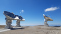
The easiest route to explore the Bure massif in summer, ascending via the ski resort’s chairlifts (open one day a week in July and August only). The plateau offers a lunar landscape with the observatory’s satellite dishes, and in clear weather, the view from the Pic de Bure is extraordinary.
The route is described here starting from La Joue du Loup, but there is a similar route starting from SuperDévoluy. Please note: this route is only accessible during the summer opening period of the ski lifts!
Le Lauvet - Lac Labarre
 11.84 mi
+4,869 ft
-3,711 ft
9h 40
Difficult
Departure from Valjouffrey (Isère)
From Le Lauvet, descend to La Chapelle-en-Valjouffrey. Then take the Sentier du Facteur trail, cross the Haute Vallée du Béranger nature reserve in Valsenestre, and finish on the GR®54B trail to Lac Labarre.
Ferme du Désert – Glandage
 13.96 mi
+5,377 ft
-5,377 ft
8 hrs
Very difficult
Departure from Treschenu-Creyers (Drôme)
Another very difficult and long stage, starting in a landscape of mountain pastures and ending in a vast, dark forest. The view of the Dévoluy peaks (Obiou, Grand Ferrand) from the Jocou (2,051 m, the highest point of these five days) makes up for the gruelling climb leading up to it.
From Chichilianne to Clelles-Mens station
 3.14 mi
+161 ft
-646 ft
1h 35
 Easy
Departure from Chichilianne (Isère)
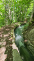
Chichilianne is a treasure trove of hikes towards the Vercors plateau. Once finished, some people take the train which stops at Clelles. But few hikers know that you can set off from Chichilianne or La Richardière and reach Clelles station in under two hours, walking alongside an irrigation canal for nearly three kilometres. This return walk to Clelles can also be taken in the opposite direction when you start your journey.