


Refine your search for walks in Lac de Tracens
Lac de Tracens walks


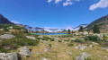
 Lac dets Coubous, Lac de la Jonquère and Lac de Tracens
 Visorando Member
 7.08 mi
 +2,398 ft
 -2,398 ft
 5h 20
 Moderate
 Departure from Barèges (Hautes-Pyrénées)
This is a very accessible walk. After following a valley where irises bloom in late July, it climbs up to the Lac de Barrage dets Coubous. It then winds its way from lake to lake, across the meadows of a high-altitude cirque.
Above Barèges, the Col de Tracens
 9.82 mi
+3,297 ft
-3,301 ft
7h 25
Moderate
Departure from Barèges (Hautes-Pyrénées)
This relatively easy hike offers many attractions: scenery, several lakes along the route for fishing enthusiasts, and the option of completing a circular hike via the Col de Tracens, returning to the starting point.
 Pic de Madaméte and the lakes: a winter circular route
 9.99 mi
+3,940 ft
-3,940 ft
8 hrs
 Difficult
Departure from Barèges (Hautes-Pyrénées)
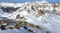
Above Barèges, winter shrouds the Aygues Cluses valley in silence. Beneath the snow-laden mountain pines, we tread softly; only the torrent accompanies the ascent, with the occasional track of a ptarmigan or a chamois in the powder snow. The Madamète lakes, so popular in summer, now lie dormant beneath their layer of ice, and the path is nothing more than a series of tracks to follow in the fresh snow.Higher up, the valley opens out and reveals the horizon: at 2,657 metres, the Pic de Madamète offers a 360° panoramic view of the entire Néouvielle massif, with its jagged ridges and string of frozen lakes. The descent via the Coubous Lakes completes the circular route in the low afternoon light.A wonderful winter’s day on snowshoes – challenging and spectacular – on the edge of a nature reserve which, for a few months each year, reveals itself only to those willing to explore it on foot.
I hope I’ve made you want to join me!
The Pic de Gourguet and the Col de Tracens in winter
 12.18 mi
+4,800 ft
-4,777 ft
10 hrs
 Very difficult
Departure from Barèges (Hautes-Pyrénées)
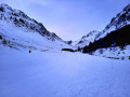
Above Barèges, the mountain landscape changes completely as soon as the snow settles. From Tournaboup, the snowshoe route first ascends the Vallon d’Aygues-Cluses, a gentle track that winds its way between the ridges, to the recently built refuge and the old shepherd’s hut. The route then climbs up slopes of varying difficulty towards the Pic de Gourguet, at nearly 2,600 metres: in winter, the summit is reached in a silence disturbed only by the occasional tracks of chamois. From there, the view stretches far into the distance — the Néouvielle, the Pic du Midi, and the slope down into the Coubous valley. The return route via the Col de Tracens takes you past a succession of lakes lying dormant beneath the snow: Tracens, La Jonquère and Les Coubous. A simple, challenging and rocky circular route, where the winter season sweeps away the crowds and strips the massif back to its essence.
Walks near Lac de Tracens
Aygues-Cluses Refuge - Campana de Cloutou Refuge
 4.62 mi
+2,146 ft
-1,867 ft
4h 00
Difficult
Departure from Barèges (Hautes-Pyrénées)
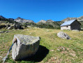
Day three of the four-day Tour du Massif de Néouvielle, the shortest route of the four days, but no less magnificent.This hike is classified as difficult due to the ascent of Pic d'Aygues-Cluses (T5 ridge). See the variants if you wish to avoid the peak or climb it in the other direction (less complicated).
From Tournaboup to Lac de l’Oule
11.29 mi
+3,957 ft
-2,785 ft
8h 40
Difficult
Departure from Barèges (Hautes-Pyrénées)
First day of a three-day circular route, from the Tournaboup car park to Lac de l’Oule. The first section up to the Col de Madamète is quite stony and requires good footwear, but after that it’s a real pleasure to walk past the magnificent Néouvielle lakes, including, amongst others, Lac d’Aumar, Lac d’Aubert and Lac de l’Oule.
Tournaboup - Bastan Refuge
 8.80 mi
+4,337 ft
-1,742 ft
7h 50
Difficult
Departure from Barèges (Hautes-Pyrénées)
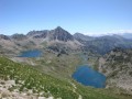
First stage of the Three Days in the Néouvielle Nature Reserve and its lakes.From the Tournaboup car park to the Bastan refuge.A fairly challenging hike due to its elevation gain and short distance.At point (6), it is possible to shorten the route and reduce the elevation gain. See Practical Information.At (7), it is possible to shorten the route and reduce the elevation gain slightly by taking a south-facing, balcony-style path.
Please note: the refuge has been closed by the authorities since May 2025
Orédon Mountain Hut – La Glère Mountain Hut
6.59 mi
+2,966 ft
-2,044 ft
5h 35
Moderate
Departure from Aragnouet (Hautes-Pyrénées)
The first part of the 4-day Tour du Massif de Néouvielle, taking in the massif’s largest lakes.
Chalet Hôtel d'Orédon - Tournaboup
 9.05 mi
+2,096 ft
-3,494 ft
6h 00
Moderate
Departure from Aragnouet (Hautes-Pyrénées)
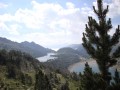
Third stage of the Three Days in the Néouvielle Reserve and its lakesFrom the Chalet-Hôtel d'Orédon to the Tournaboup car park.The multi-day hike is coming to an end, but the beauty of the 20 lakes remains.You are entering the Néouvielle National Nature Reserve, which is protected by regulations. Please respect these regulations (see practical information).
Du Refuge du Campana de Cloutou à Artigues par le Lac de Montarrouye
 7.58 mi
+974 ft
-4,275 ft
4h 20
Difficult
Departure from Bagnères-de-Bigorre (Hautes-Pyrénées)
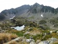
This second stage, after spending the night at the Refuge de Campana de Cloutou, returns to Artigues, off the beaten track, with the discovery of the little-known Montarrouye valley.This day is classified as difficult because you need to know how to find your way.
Campana de Cloutou Mountain Hut – Orédon Mountain Hut
9.03 mi
+3,681 ft
-4,869 ft
7h 20
Difficult
Departure from Bagnères-de-Bigorre (Hautes-Pyrénées)
The final day of the 4-day Tour of the Néouvielle Massif. The longest and most challenging of the four stages, passing by the viewpoint of this multi-day hike: the Pic de Bastan. This peak offers a magnificent view over the entire massif and the surrounding lakes.
Bastan refuge - Chalet Hôtel d'Orédon
 5.60 mi
+2,126 ft
-3,330 ft
4h 25
Moderate
Departure from Vielle-Aure (Hautes-Pyrénées)
Second stage of the Three Days in the Néouvielle Reserve and its lakes.
From the Bastan refuge to the Chalet-Hôtel d'Orédon.
The tour and contemplation of the 20 lakes continues.
You are entering the Néouvielle National Nature Reserve, which is protected by regulations. Please respect these regulations (see practical information).
From the Refuge de l’Oule to the village of Artigues
10.75 mi
+2,365 ft
-4,377 ft
7h 00
Moderate
Departure from Saint-Lary-Soulan (Hautes-Pyrénées)
Second day of a three-day circular route. You can book a packed lunch if you’re staying overnight at the Refuge de l’Oule, as well as top up your water flasks. Afterwards, the trail is lovely as it runs alongside the lake. It passes through the Col de Bastanet and takes in magnificent lakes all along the route. At the Campana de Cloutou mountain refuge, you can sit at a table to eat your packed lunch and refill your water flask. The trail then descends, passing by pretty lakes, to the village of Artigues.
From Artigues to the Campana de Cloutou refuge
 7.46 mi
+4,469 ft
-1,148 ft
7h 20
Difficult
Departure from Campan (Hautes-Pyrénées)
Ascent to the Hourquette de Caderolles, the Col de Bastanet and overnight stay at the Campana de Cloutou refuge.
This first stage is classified as difficult because there is a lot of elevation gain.