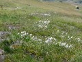
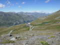
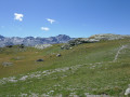
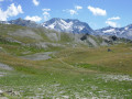
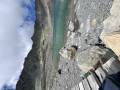
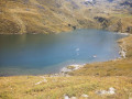
The little Lac du Montaulever seen from Val Thorens

Here’s a short walk above Val-Thorens, with just the right amount of paths through the rocks and across wide open spaces to really enjoy the mountain atmosphere. As well as admiring the pretty little Lake Montaulever, you might also be lucky enough to spot some Alpine newts there.

Details

9399873
Creation:
Last update:
Last review:
  • Walking
    Activity: Walking
  • ↔
    Distance: 4.09 mi
  • ◔
    Average duration: 2h 50 
  • ▲
    Difficulty: Moderate

  • ⚐
    Back to start: Yes
  • ↗
    Ascent: + 1,073 ft
  • ↘
    Descent: - 1,093 ft

  • ▲
    Highest point: 8,442 ft
  • ▼
    Lowest point: 7,516 ft

Photos

Description of the walk

Once you reach the village of Val Thorens, take the Grande Rue (which continues from the approach road) and follow it as it turns left, passing under the archway between the Skiset Goitschel shop and the Carrefour Montagne mini-market.
Park in the open-air car park between the Grande Rue and the Rue de la Boucle, opposite the P1 car park (covered car park).

(S/E) Cross Rue de la Boucle and turn left onto the footpath, which soon runs alongside the Club Méditerranée via a covered walkway. Walk past the blocks of flats.

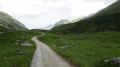
(1) Once past the blocks of flats, head straight on along the track, which climbs gently westwards to a Fork in the road.

(2) Stay on this track (the track branching off to the left below will be the one you take on the way back). After crossing two streams that run under the track through culverts, you’ll soon reach a junction.

(3) The track continues straight on towards Lac des Échauds and then Les Ménuires. On the left is a path to take on the return journey. Follow the track that climbs to the right, towards Lac du Montaulever.

(4) At a left-hand bend, leave the track which continues towards a ski lift and take the path climbing to the right. This path soon crosses rocky areas, even scree in places, and climbs – sometimes winding its way – towards a small pass, beyond which Lac du Montaulever comes into view on the right, set against a moraine backdrop.

(5) Ignore the path climbing straight ahead towards the Col de la Chambre, and take the path on the right which descends towards the lake. Walk round the lake on the right-hand side and, on your return, cut across the Col de la Chambre path to take a path descending from the right which joins a track further down.

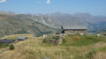
(6) Take this track on the left. It winds its way round in hairpin bends and passes in front of the restaurant ‘L’Alpage’ and its large terrace, which is clearly closed in summer. Continue along the track, which soon crosses the Montaulever ski lift.

(7) Turn left onto the path that follows the route of the ski lift and continue along it until you rejoin the track you took on the way up.

(4) Join the track on the right until you reach the main track suitable for vehicles.

(3) Cross the main track and take the path opposite, which winds down to the track below, running parallel to the main track.

(2) Join the track and follow it back in the opposite direction

(1). Follow the original route back in the opposite direction, passing near Club Méditerranée.
Cross Rue de la Boucle and return to the car park (S/E).


Waypoints

  1. S/E : mi 0 - alt. 7,562 ft - Grande Rue car park
  2. 1 : mi 0.15 - alt. 7,520 ft - Montaulever Track
  3. 2 : mi 0.29 - alt. 7,579 ft - Lower track
  4. 3 : mi 0.64 - alt. 7,730 ft - Track leading up to the lake
  5. 4 : mi 0.87 - alt. 7,904 ft - Lake Trail
  6. 5 : mi 1.36 - alt. 8,419 ft - Col de Chambre Trail
  7. 6 : mi 1.93 - alt. 8,307 ft - Junction with the track
  8. 7 : mi 2.8 - alt. 7,815 ft - Below the ski lift
  9. S/E : mi 4.09 - alt. 7,556 ft - Grande Rue car park

Notes

This walk is short and easy. The sections amongst the moraine boulders during the ascent do, however, mean you should wear suitable footwear and perhaps even take your walking poles. The return journey, mainly along tracks, is a breeze.

Worth a visit

This somewhat short walk is well worth it for a visit to the little Lac du Montaulever, with its moraine setting, aquatic vegetation and, above all, the population of Alpine newts it is home to. An information board by the lake is dedicated to them. Despite our best efforts, we weren’t lucky enough to spot any: perhaps the tourist office hadn’t warned them of our visit.

The more adventurous may press on to Lac de la Chambre, which is very different as it lies in an entirely rocky landscape, at the modest cost of an extra 3 km each way and an additional 300 m in elevation gain.

Instead of heading back down via the ski runs, you can take the Combe du Pluviomètre, which you reach by continuing eastwards along the path skirting the lake.

Reviews and comments

4.7 / 5
Based on 3 reviews

Reliability of the description
5 / 5
Ease of following the route
4.5 / 5
Route interest
4.7 / 5
lechabin
lechabin

Overall rating : 4.7 / 5

Date of your route : Sep 02, 2024
Reliability of the description : ★★★★★ Very good
Ease of following the route : ★★★★☆ Good
Route interest : ★★★★★ Very good
Very busy route : No

A really lovely walk starting from the resort
Plenty of marmots on the way back down
It’s worth noting that I couldn’t find the path that went round the lake, so I ended up off-trail, but it wasn’t difficult
Also worth noting: on the way back, the route takes you along the cycle path, which is theoretically off-limits to pedestrians (although it’s possible to stay off the tarmac if necessary)

Machine-translated

stjo
stjo

@Kire71, that’s a brilliant idea – heading back via the Combe du Pluviomètre. That’s exactly what I’d planned to do on my next visit to this walk. But, unfortunately, circumstances have meant I haven’t been able to go back there yet.

Machine-translated

Kire71
Kire71

Overall rating : 4 / 5

Date of your route : Jul 26, 2023
Reliability of the description : Not used / Not applicable
Ease of following the route : Not used / Not applicable
Route interest : ★★★★☆ Good
Very busy route : No

Hello, the climb is very steep! But if you take your time, it’s easily manageable. I chose to walk along the lake and follow this path eastwards to take the Combe du Pluviomètre on the way down. As far as I know, it’s a blue run. It’s more physically demanding than the return route described. A lovely little walk to warm up.

Machine-translated

mica15
mica15

Overall rating : 5 / 5

Date of your route : Jul 18, 2022
Reliability of the description : ★★★★★ Very good
Ease of following the route : ★★★★★ Very good
Route interest : ★★★★★ Very good
Very busy route : No

A brilliant walk in a stunning setting; we didn’t come across many people, and we arrived at the lake on our own, greeted by a group of marmots. Absolutely lovely.

Machine-translated

Other walks in the area

For more walks, use our search engine .

The GPS track and description are the property of this route's author. Please do not copy them without permission.