Country:

 City:
City:


Please note regarding signposting: the route is not always clearly marked. At the start in particular, there are no route markings. Make sure you follow the GPS route carefully.
Towards the end of the route (after Lac de la Portette), you’ll find clear yellow markings to follow, as well as signs indicating Lac Blanc and the remaining distance and time.
Park at Place Caron.
(S/E) Head down alongside the Castor and Pollux magic carpets. You’ll arrive at the Cosmojet.
(1) Cross the stream behind the building. Start the climb opposite to reach the Thorens Lakes.
(2) Walk along the large lake, then take the path on the right, passing under the cable car, to reach the artificial Lac de la Moutière.
(3) Turn left and you’ll soon reach the Deux Lacs station.
(4) Head down to the right to reach the Plateau ski lift.
(5) Here you have two options:
- follow the ski lift route, but do be careful of the steep gradient,
- go round to the left and take a long detour beneath Grand Fond, following the route shown on the map,
in both cases, you’ll reach the top station of the Plateau ski lifts.
(6) Turn left onto the ascending track, which starts with hairpin bends before levelling out, and head towards the Portette chairlift and then the lake of the same name.
(7) Turn left and stay at the same level to reach the Moraine chairlift.
(8) Pass underneath it to reach a viewpoint overlooking Tête Ronde.
(9) Continue uphill to reach the Cascades chairlift.
(10) Continue straight ahead up this slope to finish at Lac Blanc.
(11) Take a track to the left and, after a long descent, reach the car park at Place Caron (S/E).
 Visorando Member
 Moderate

 Tourism professional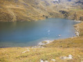
 Very difficult
 Easy
Easy