Mont Bréquin

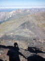
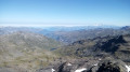
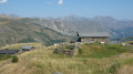
From the summit of this “3000”, you’re treated to a 360° view stretching from Mont Blanc to the Barre des Écrins.

Details

1427436
Creation:
Last update:
Last review:
  • Walking
    Activity: Walking
  • ↔
    Distance: 10.62 mi
  • ◔
    Duration according to the author: 7 hrs 
  • ▲
    Difficulty: Very difficult

  • ⚐
    Back to start: Yes
  • ↗
    Ascent: + 4,183 ft
  • ↘
    Descent: - 4,160 ft

  • ▲
    Highest point: 10,164 ft
  • ▼
    Lowest point: 6,132 ft

Photos

Description of the walk

Park at the Chasse car park, at a hairpin bend on the D117.

(S/E) At the far end of the car park, take the south-south-easterly path which climbs gently. Cross the La Cachote farm and descend to the Torrent de Péclet.

(1) Cross the stream and take the track leading to the Refuge du Lac du Lou (second on the right). Pass under a chairlift line and climb steadily in a west-south-westerly direction.

(2) At a Fork in the road, take the left-hand path, continuing to climb. Further on, cross the Torrent du Lou via a footbridge. On the other side, turn left and follow the stream. This will take you to the refuge.

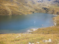
(3) Then take the path that climbs halfway up the slope (do not stay by the lake). Walk above the lake situated below on the left. Cross the Torrent du Lou again, upstream of the lake.

(4) Pass close to a shepherd’s hut and continue climbing. Cross a stream and reach the first of the Pierre Blanche lakes.

(5) Go round the lake to the left and continue south. After a steep climb, you’ll reach a junction.

(6) Turn left at the signpost, towards the Col de la Vallée Étroite. Pass close to some small lakes. Climb gently but steadily up to the pass.

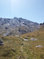
(7) Turn left to ascend the north-west ridge of Mont Bréquin. The track is barely visible, but numerous cairns help to guide the way. The vegetation disappears.

(8) Once you reach the base of the summit, the ridge is blocked by two rock pinnacles which you must bypass on the left (see the recommendation in the ‘Practical Information’ section). The first pinnacle can be bypassed without difficulty. For the second gendarme, stay close to the rock until you are blocked by a perilous traverse. Then take a few steps back and pass 5m lower down. Climb up a little, then continue along the descending traverse.

Then continue along the ridge, which is clearly marked, to the summit.

(9) The return is via the same route as the ascent, in the opposite direction, back to the car park (S/E).

Waypoints

  1. S/E : mi 0 - alt. 6,184 ft - La Chasse car park
  2. 1 : mi 0.3 - alt. 6,135 ft - Péclet torrent - Doron de Belleville (rivière)
  3. 2 : mi 1.03 - alt. 6,421 ft - Fork in the road
  4. 3 : mi 1.54 - alt. 6,739 ft - Lac du Lou mountain hut
  5. 4 : mi 2.18 - alt. 6,906 ft - Shepherd’s hut.
  6. 5 : mi 2.7 - alt. 7,559 ft - Pierre Blanche
  7. 6 : mi 3.07 - alt. 7,802 ft - Crossroads
  8. 7 : mi 4.61 - alt. 8,960 ft - Col de la Vallée Etroite (2730m - Maurienne)
  9. 8 : mi 5.09 - alt. 9,941 ft - Bypassing the two rock spires
  10. 9 : mi 5.3 - alt. 10,164 ft - Mont Brequin
  11. S/E : mi 10.62 - alt. 6,184 ft - La Chasse car park

Notes

Essential mountain hiking kit. Make sure you take enough water with you.

Recommendation for bypassing the two rock pinnacles (8):
In an old guidebook, I read that the first gendarme could be bypassed on the right. That’s what I did at first, and I found myself on steep, slippery slopes. The route on the left, described here, is much easier.

Reviews and comments

5 / 5
Based on 2 reviews

Reliability of the description
5 / 5
Ease of following the route
5 / 5
Route interest
5 / 5
Hayate73
Hayate73

Overall rating : 5 / 5

Date of your route : Jul 20, 2021
Reliability of the description : ★★★★★ Very good
Ease of following the route : ★★★★★ Very good
Route interest : ★★★★★ Very good
Very busy route : No

Hello,
I’ve done this route half a dozen times over the last 18 years.
Nothing to report until the Col de la Vallée Etroite; after that, it’s literally off the beaten track.
A 400-metre climb over 1 km, 80 per cent of which is scree – good to know.
The main route follows the north-eastern slope, except for a short section around the first gendarme.
There are plenty of cairns and they’re clearly visible – roughly every 20 metres on average – right up to the face of the second gendarme.
Personally, I’ve always climbed these 3 metres, which offer a few handholds.
I’ve never been keen on going round it, even though I’ve seen others do so.
The area isn’t very safe, and it’s best to be in a party of two or more.
Otherwise, a sensible U-turn is always preferable to a one-way trip.
Once past the obstacle, the triangulation point at the summit is finally visible, and there are no further difficulties.
On the way back, make sure you take the same route as on the way up.
Not because of the risk of getting lost – which is non-existent here – but because it’s best to avoid making a trail across a scree slope of slate.
The cairns are much less visible than on the way up; you’ll have to look for them.
All in all, allow at least 1h30 for the outward journey and 1h00 for the return.
That’s around ten hours in total from the Plan de l’Eau car park in Les Menuires.
In conclusion, it’s important to realise that this is effectively two hikes in one:
- from the start to the Col de la Vallée Etroite and back, a 14-km signposted route presenting no difficulty or danger,
- from the pass to Mont Brequin and back, a completely different kind of hike with 2 km of more challenging and difficult terrain.
Finally, without wishing to promote it, this excursion is included in the programme organised by the Les Menuires Guides’ Office.
Happy hiking to you all.

Machine-translated

jlf13
jlf13
• Edited:

Overall rating : 5 / 5

Date of your route : Jul 29, 2020
Reliability of the description : ★★★★★ Very good
Ease of following the route : ★★★★★ Very good
Route interest : ★★★★★ Very good
Very busy route : No

A hike that ended at 3,060 metres, at the famous rock formations that were too difficult for me to get round.
So I turned back to the Col de La Vallée Etroite and headed off across towards the Col de Pierre Blanche via the Mont du Chat.
There’s no marked path, and hardly any cairns. Not recommended for those who, like me, don’t have a very good sense of direction.

Machine-translated

Other walks in the area

For more walks, use our search engine .

The GPS track and description are the property of this route's author. Please do not copy them without permission.