From the Refuge du Saut to the Chalet du Clou

Third day of a 4-day route in the Vanoise Massif.
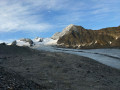
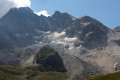
A beautiful ascent along the Gébroulaz Glacier and a lunar landscape via the Col du Soufre

This walk is part of a multi-day hike: Four days in the Vanoise

Details

1461290
Creation:
Last update:
Last review:
  • Walking
    Activity: Walking
  • ↔
    Distance: 10.51 mi
  • ◔
    Average duration: 7h 55 
  • ▲
    Difficulty: Difficult

  • ⚐
    Back to start: No
  • ↗
    Ascent: + 3,517 ft
  • ↘
    Descent: - 3,458 ft

  • ▲
    Highest point: 9,285 ft
  • ▼
    Lowest point: 6,132 ft
  • ⚐ Country: France
  • ⚐
    Areas: Alps, Vanoise
  • ⚐ City: Les Allues (73550)
  • ⚑
    Start: N 45.337074° / E 6.632203°
  • ⚑
    End: N 45.33904° / E 6.70664°
  • ❏
    IGN map(s): Ref. 3534OT, 3534OTR
  • Hour-by-hour weather

Photos

Description of the walk

(S) From the Refuge du Saut, head back up the descent you took the previous day to reach the footbridges.

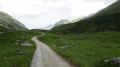
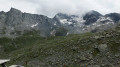
(1) Cross the torrent and turn right immediately to follow the cairn-marked path uphill to the Col du Soufre, skirting the Gébroulaz Glacier.

(2) Keep an eye out for chamois. In bad weather, many chamois take refuge in natural caves and on the eastern slope from this point.

(3) At the Col du Soufre, head down towards the Refuge de Péclet-Polset.

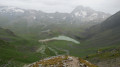
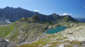
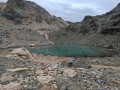
(4) Quite early on during the descent, you may (or may not) see a track branching off to the right towards two lakes behind a scree hill. Ignore this track and continue your descent slightly further to the left. The path descends gradually along a ledge overlooking Lac Blanc.

(5) As you approach Lac Blanc, do not take the track that runs horizontally through the grass (unless you want to take a shortcut without going via the refuge), but continue the descent to the lake. Walk along the lake, then make a short climb at its far end before heading down towards the refuge.

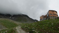
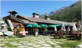
(6) Pass the Péclet-Polset refuge and preferably continue down theGR®55towards the Roc de la Pêche refuge.

(7) Keep following the track, unless you wish to take the alternative route, which runs more like a balcony overlooking the valley.

(8) A track leading off the shortcut path should be visible on the hillside to your left. Continue along the track.

(9) You’ll pass the start of the path to the Col Rouge. Carry on along the track to the Roc de la Pêche mountain hut.

(10) Just before you reach the refuge, take the path branching off to the right towards the hamlet of Montaimont; turn left at the next junction to head downhill.

(11) Cross the bridge over the Doron de Chavière.

(12) Walk through the hamlet of Montaimont and head up to Plan des Bôs.

(13) Without reaching the building at Plan des Bôs, head to the right and then take a wide bend to the left. The path will lead you slightly uphill to Chalet Clou.

(14) When the path levels out again, take care not to miss a fork to the left.
If you miss the fork to the left leading to Chalet du Clou, you’ll realise you’ve gone wrong when you see the lake below on your left (at 8 o’clock).

(15) You should see the ruins of Chalet Clou after crossing the Ruisseau des Ferrandes. Continue along the lake (pond) and look out for the markings delineating the Vanoise National Park so that you can set up camp outside the park (E).

Waypoints

  1. S : mi 0 - alt. 7,005 ft - Refuge du Saut
  2. 1 : mi 1.53 - alt. 8,002 ft - Footbridges over the - Doron des Allues (rivière)
  3. 2 : mi 2.28 - alt. 8,652 ft - Viewpoint at a chamois lookout point
  4. 3 : mi 3.19 - alt. 9,262 ft - Col du Souffre
  5. 4 : mi 3.33 - alt. 9,081 ft - Junction towards the glacial lakes
  6. 5 : mi 4.19 - alt. 8,104 ft - Junction for a shortcut
  7. 6 : mi 5.06 - alt. 8,100 ft - Refuge de Peclet-Polset
  8. 7 : mi 5.22 - alt. 7,963 ft - Junction for the alternative route along the ridge
  9. 8 : mi 6.02 - alt. 7,369 ft - Junction with the shortcut path
  10. 9 : mi 7.23 - alt. 6,699 ft - Junction for the Col Rouge trail
  11. 10 : mi 8.73 - alt. 6,299 ft - Refuge du Roc de la Pêche
  12. 11 : mi 8.93 - alt. 6,142 ft - Doron de Bozel (rivère)
  13. 12 : mi 9.06 - alt. 6,237 ft - Montaimont
  14. 13 : mi 9.52 - alt. 6,650 ft - Map of Les Bôs
  15. 14 : mi 10.28 - alt. 7,211 ft - Junction for the Clou chalet
  16. 15 : mi 10.36 - alt. 7,162 ft - Chalet du Clou
  17. E : mi 10.51 - alt. 7,064 ft - Campsite – Night 3

Worth a visit

Alternative route, recommended in good weather, starting from the Péclet-Polset refuge (6).
Continue south-east from the refuge to cross the Doron de Chavière and walk along a more or less level path via Les Planettes, the Rosoire chalet, at the foot of Pointe Ariande and Le Vallonnet to reach the Chalet du Clou.

Always be cautious and plan ahead when you're outdoors. Visorando and the author of this route cannot be held responsible for any accidents occurring on this route.

The GR® and PR® markings are the intellectual property of the Fédération Française de Randonnée Pédestre.

Other walks in the area

For more walks, use our search engine .

The GPS track and description are the property of this route's author. Please do not copy them without permission.