Country:
 City:
City:



Park in the car park at Montreuil-l’Argillé town hall.
Route marked in yellow.
(S/E) With your back to the town hall, turn left onto Rue Grande (D819); ignore Rue du Pont on the left (which you’ll take on the way back) and continue straight ahead on the D819.
(1) At the Fork in the road, turn right onto Rue du Moulin (D35) (take care when crossing), pass the fish farm and, on the left, weave your way between two brick houses into a small alleyway, follow the Guiel stream and climb the path through the woods, continuing until you reach a road.
(2) Follow it to the left for about 50 metres and, at the junction, turn left again until you reach the start of a path on the right.
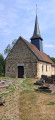
(3) Take this path and, when you reach the road, head down to the left towards the church of Saint-Aquilin d’Augerons.
(4) Turn right just before the church and continue towards the wash house, where you can take a break. Head up into the woods and continue along the road to the left until you reachthe first path on the right (Impasse de la Vallée).
(5) Take this, join a road and follow it to the left (Impasse du Bois Thibout), then take the path on the left and follow the most clearly marked track. Continue across the fields to the village of Verneusses. In the village, walk past the sawmill until you reach a crossroads.
(6) Carefully cross the Route du Dolmen and head down opposite towards the river. Cross it via a small stone bridge and, after passing a Norman-style house, turn left to join a road.
(7) Take the road on the left towards the Long Pré farm, carry on straight ahead past the farm (cattle grids), ignore the path on the right and continue to the D611 (Route de Montreuil).
(8) Follow it to the left, passing the Saint-Denis d’Augerons town hall and then the war memorial, and carry on along the D611. Pass the dead-end road on the right (Les Prés Glos) and continue along the D611 for about a hundred metres.
(9) Leave the D611 and take the path on the left down to the village of Montreuil-l’Argillé.
(10) At the Stop sign, turn left onto the D819 (Rue des Canadiens), cross it carefully and take Rue de la Libération opposite.
(11) Turn left onto Rue du Pont (D35) and continue onto Rue Grande (D819), where you’ll find the car park for Montreuil-l’Argillé Town Hall on your right (S/E).
 Visorando Member

 Easy
Easy