Mont Rose, starting from Bernay

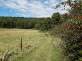
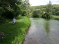
An easy walk characterised by the pastures and wooded hillsides. Equestrian activities are a prominent feature, with the Bouffey stud farm and the Victor Lebrun racecourse, as well as the beautiful view of the town of Bernay at the end of the route.

Details

41644323
Creation:
Last update:
Last review:
  • Walking
    Activity: Walking
  • ↔
    Distance: 5.75 mi
  • ◔
    Average duration: 2h 55 
  • ▲
    Difficulty: Easy

  • ⚐
    Back to start: Yes
  • ↗
    Ascent: + 312 ft
  • ↘
    Descent: - 312 ft

  • ▲
    Highest point: 518 ft
  • ▼
    Lowest point: 315 ft
  • ⚐ Country: France
  • ⚐ City: Bernay (27300)
  • ⚑
    Start/End: N 49.086218° / E 0.599229°
  • ❏
    IGN map(s): Ref. 1813SB
  • Hour-by-hour weather

Description of the walk

Park in the cinema car park opposite the Intermarché on Avenue du 8 mai 1945 in Bernay.

(S/E) Turn left onto Avenue du 8 mai 1945 and, 100 metres further on, turn left onto Rue Jacques Daviel. Continue to the junction of Chemin de Saint-Clair and Place Dupont de l’Eure.

(1) Turn right onto this road, which climbs steeply. Continue along Chemin de Saint-Clair and then Chemin de la Galopinière. You will reach the junction with Rue du Champ de Courses.

(2) Cross the road and continue straight ahead along the small road (Chemin de la Briquetterie) until you reach the care home (EHPAD de Saint-Aubin le Vertueux).

(3) Follow the dirt track straight ahead to La Touranguerie.

(4) Head down the tarmac road to the right for about 500 metres, then take the path on the left, descending into the valley until you come out onto a tarmac road. Turn left and join the D24 at Carentonne.

(5) Turn left; several hundred metres further on, you’ll reach a crossroads on the edge of the woodland.

(6) Turn left at a sharp angle onto Rue de la Forêt, then immediately turn right onto the path through the woods. After a virtually straight stretch, you’ll reach the Conardière crossroads.

(7) Carry on straight ahead, leave the woods and continue straight on to reach the Bouffey stud farm.

(8) Carry on past the statue of Notre-Dame du Vœu, which overlooks the town; continue along Rue du Champ de Courses and head down to Place Dupont de l’Eure to reach the junction you passed on the way out.

(1) Follow the outbound route in the opposite direction to return to the cinema car park (S/E).

Waypoints

  1. S/E : mi 0 - alt. 348 ft - Cinema car park - Gare de Bernay
  2. 1 : mi 0.29 - alt. 354 ft - Chemin de Saint-Clair
  3. 2 : mi 0.8 - alt. 495 ft - Junction with Rue du Champ de Courses
  4. 3 : mi 1.39 - alt. 518 ft - Ehpad crossroads
  5. 4 : mi 1.98 - alt. 482 ft - La Touranguerie
  6. 5 : mi 3.29 - alt. 315 ft - D24
  7. 6 : mi 3.76 - alt. 377 ft - Rue de la Forêt
  8. 7 : mi 4.29 - alt. 509 ft - La Conardière
  9. 8 : mi 4.92 - alt. 502 ft - Stud Farm
  10. S/E : mi 5.75 - alt. 344 ft - Cinema car park

Notes

Route marked in yellow.

Worth a visit

Reviews and comments

5 / 5
Based on 1 review

Reliability of the description
5 / 5
Ease of following the route
5 / 5
Route interest
5 / 5
IMASSON
IMASSON

Overall rating : 5 / 5

Date of your route : Aug 29, 2025
Reliability of the description : ★★★★★ Very good
Ease of following the route : ★★★★★ Very good
Route interest : ★★★★★ Very good
Very busy route : No

A beautiful route covered in 2 hours and 15 minutes.

Machine-translated

Other walks in the area

For more walks, use our search engine .

The GPS track and description are the property of this route's author. Please do not copy them without permission.