A stroll through Parissot Park

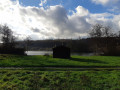
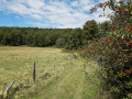
This route will delight you with its variety, from the ruins of the former Beaumont-le-Roger Abbey to the botanical trail in Parc Parissot – named after its benefactor – and the superb views over the Risle Valley; a truly rejuvenating walk.

Details

48728647
Creation:
Last update:
Last review:
  • Walking
    Activity: Walking
  • ↔
    Distance: 5.61 mi
  • ◔
    Average duration: 2h 50 
  • ▲
    Difficulty: Easy

  • ⚐
    Back to start: Yes
  • ↗
    Ascent: + 292 ft
  • ↘
    Descent: - 282 ft

  • ▲
    Highest point: 489 ft
  • ▼
    Lowest point: 272 ft
  • ⚐ Country: France
  • ⚐ City: Beaumontel (27170)
  • ⚑
    Start/End: N 49.088676° / E 0.765592°
  • ❏
    IGN map(s): Ref. 1913SB
  • Hour-by-hour weather

Photos

Description of the walk

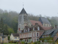
Starts from the car park by the primary school and church in Beaumontel, on the D23.

Blue-marked route.

(S/E) Opposite the school, turn left and cross the bridge over the Risle. Walk past the town hall.

(1) Take the first left onto Chemin de Saint-Laurent. At the next junction, continue along the street of the same name until you reach a roundabout.

(2) Go round the roundabout on the left and follow the D133, passing a petrol station on your left. Cross two streams. Further on, let Rue de Bernay branch off to the left and continue along the D133. You’ll cross Rue Heurteboust on your right and cross another branch of the Risle.

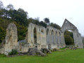
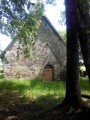
(3) Turn left immediately to cross Parc Chantereine. You’ll come out onto Rue de l’Abbaye; follow it to the left. After about a hundred metres, level with the former abbey (a historic site), turn right, passing under a portico.

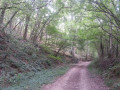
(4) Carry on straight ahead, heading uphill through the forest. At a Fork in the road, keep to the right and continue uphill. Cross a small road and carry on straight ahead.

(5) Turn left at the hamlet of Les Bruyères.

(6) Cross the D25 with care and head diagonally uphill to the left. Enter Parc Parissot (information board) and continue straight on.

(7) At the T-junction, turn right then immediately left. Follow a wide path (botanical trail) past a pavilion. At the monument in memory of Albert Parissot, veer right and follow the path to a crossroads.

(8) Carry on straight ahead (north-east). At the next junction, turn left.

(9) Turn slightly left (towards the houses) then continue straight on, skirting a meadow on your right.

(10) At the junction near the hamlet of Fréville, turn left.

(11) At the next junction, turn left again. Carry straight on through the woodland (south-east) until you reach a crossroads.

(12) Then veer slightly to the right (south-south-east). At the T-junction, turn left. This will take you back to a junction you passed earlier.

(8) Turn right and, at the first Fork in the road, take the path on the right. After about 200 m, at another Fork in the road, head down the path on the left. Continue along a path running parallel to the one you took on the way there and descend following the valley.

(13) At the junction, take a footpath on the right and head downhill. Pass the school on your right and come out onto a small road. First turn right then left (take care when crossing the road) to return to the car park where you started (S/E).


Waypoints

  1. S/E : mi 0 - alt. 295 ft - School car park - Eglise de Beaumontel
  2. 1 : mi 0.17 - alt. 276 ft - Rue de la Mairie x Chemin de Saint-Laurent
  3. 2 : mi 0.74 - alt. 292 ft - Roundabout
  4. 3 : mi 1.15 - alt. 292 ft - Chantereine Park
  5. 4 : mi 1.45 - alt. 354 ft - Forest path
  6. 5 : mi 2.08 - alt. 479 ft - The heather
  7. 6 : mi 2.23 - alt. 449 ft - Crossing the D25
  8. 7 : mi 2.52 - alt. 446 ft - T-junction
  9. 8 : mi 2.96 - alt. 469 ft - Junction of the two circular loops
  10. 9 : mi 3.2 - alt. 489 ft - Junction
  11. 10 : mi 3.9 - alt. 476 ft - Junction near Fréville
  12. 11 : mi 4.07 - alt. 476 ft - Junction
  13. 12 : mi 4.52 - alt. 463 ft - Crossroads
  14. 13 : mi 5.46 - alt. 410 ft - Crossroads
  15. S/E : mi 5.61 - alt. 295 ft - School car park - Eglise de Beaumontel

Notes

Blue-marked route
Watch out for traffic in Beaumont-le-Roger
Picnic facilities available
Restaurants in Beaumontel and Beaumont-le-Roger

Worth a visit

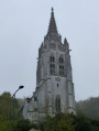
Saint-Pierre Church in Beaumontel
Parissot Park
The Risle Valley
Sainte-Marie Mill

Reviews and comments

4.7 / 5
Based on 2 reviews

Reliability of the description
4.5 / 5
Ease of following the route
4.5 / 5
Route interest
5 / 5
benoitrando
benoitrando

Overall rating : 5 / 5

Date of your route : Nov 04, 2024
Reliability of the description : ★★★★★ Very good
Ease of following the route : ★★★★★ Very good
Route interest : ★★★★★ Very good
Very busy route : Yes

A rather pleasant walk with no particular difficulties.
Thanks to Brave for this route

Machine-translated

ludovic Oden
ludovic Oden

Overall rating : 4.3 / 5

Date of your route : May 19, 2024
Reliability of the description : ★★★★☆ Good
Ease of following the route : ★★★★☆ Good
Route interest : ★★★★★ Very good
Very busy route : No

An interesting walk steeped in history.
Information board near the car park at the entrance to Parissot Park.

Machine-translated

Other walks in the area

For more walks, use our search engine .

The GPS track and description are the property of this route's author. Please do not copy them without permission.