Country:

 City:




Drive past Saint-Martin-Vésubie then head towards Le Boréon. Just after the lake, turn left towards Mollières and park at the Vacherie de Salèse car park.
(S/E) The start is in front of the large Mercantour sign at the far end of the car park, marked with signpost 434. Head up the entire Salèse valley to the pass, towards Lac Nègre.
(1) When you reach the track at marker 435, continue towards the pass and pass marker 436 until you reach the next one a little further down.
(2) At marker 268, leave the track and take the path straight ahead towards Lac Nègre.
(3) Once you have crossed the bridge, keep heading towards the lake at marker 269, climbing to your right.
(4) You’ll reach Camp Soubran at marker 270; turn left towards Lac Nègre and the Pas du Préfouns.
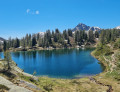
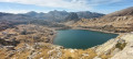
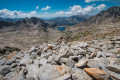
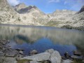
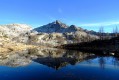
(5) You’ve finally reached Lac Nègre, the first stage of the ascent. Follow the path that runs along the eastern shore of the lake, climbing gently towards the Pas du Préfouns.
(6) Here is the Pas du Préfouns and the Italian border. Now the real challenge begins! Look out for the path on your right heading north-east between the rocks and take it. Be careful, as the junction leading up to the Tête is a little tricky to spot.
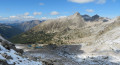
(7) This is where you need to turn off due north. The path isn’t particularly visible, despite three cairns clustered together at the junction. Have a look at the photos to see what the area looks like. Within the first few metres, you’ll come across some blue markings on the rocks. If you do, you’re on the right track. The climb is now getting quite steep. So pluck up your courage.
(8) This is where the trickiest part of the climb begins. You’ll spot a few cairns at the start, but they quickly become fewer and harder to make out. The climb is quite unstable on a very steep scree slope; climb carefully until you reach a point where the path seems to split. I went up on the left, but I think it’s also possible to take the right-hand route without any danger. Even though it’s quite a steep climb, you shouldn’t need to use your hands.
(9) A short breather just before the summit, with a few metres of almost flat ground where you’ll see your destination ahead of you. The climb over the last few metres is quite steep, but you’ll soon reach the top.
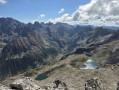
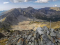
(10) You’ve made it to the summit – congratulations. On the French side, you’ll have a lovely view of Lac Nègre below, and Mont Malinvern above Isola to the north-west. On the Italian side, you’ll enjoy a magnificent view of the famous Argentera, due east. Recharge your batteries before heading back to the car park via the same route (S/E).

 Visorando Member

 Moderate
 Very difficult