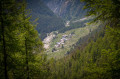
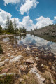
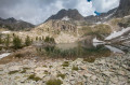
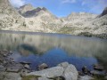
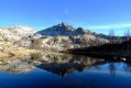
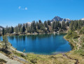
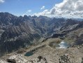
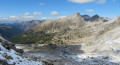
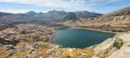
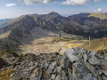
Lake Tavels as seen from the Salèse cattle pastures

A long but relatively easy walk to the very beautiful Lake Tavels. There is the option of a detour on the way back to the lovely Lake Scluos.

Details

3290580
Creation:
Last update:
Last review:
  • Walking
    Activity: Walking
  • ↔
    Distance: 13.87 mi
  • ◔
    Average duration: 9h 20 
  • ▲
    Difficulty: Difficult

  • ⚐
    Back to start: Yes
  • ↗
    Ascent: + 3,419 ft
  • ↘
    Descent: - 3,402 ft

  • ▲
    Highest point: 7,349 ft
  • ▼
    Lowest point: 5,476 ft

Photos

Description of the walk

(S/E) The walk starts at the Vacheries de Salèse car park. Pass through Saint Martin Vésubie then head towards Le Boréon. After the lake, take the track on the left to the car park a little further on. The path begins gently, heading towards the Col de Salèse.

(1) Leave the path here at marker 435 to join the Mollières track; continue towards the hamlet until you reach the next marker.

(2) Turn left here towards Mollières until you reach marker 268b.

(3) You’ll follow the track for a few metres before turning right to rejoin the path.

(4) At marker 267, head towards Isola 2000/Col Mercière; you’ll soon see the Ingolf footbridge, which you’ll need to cross a little further on. From there, you’ll follow a wide, mostly flat track that’s very easy to follow.

(5) Note the cairn here, which marks a path branching off to the right towards Lac Scluos; you’ll take this on the way back if you wish to extend the walk. For now, carry on along the track.

(6) Signpost 265 indicates the path down to Mollières, but carry on due north towards the pass.

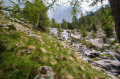
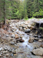
(7) You’ll come to a hairpin bend; here, you’ll need to leave the path to reach the lake. A cairn marks the path just at the bend, alongside the stream. The going is much steeper here, so pace yourself, but the path is easy to follow and very well marked with cairns.

(8) There’s a small scree slope to cross here; the lake is almost in sight.

(9) You’ve now reached Lac de Travels; enjoy the view and don’t forget the small lake to the west, which is also very pleasant. Return via the same route.

(5) You can take a short round trip to the lovely Lac Scluos from here, as shown on the map. Please note that this is off the beaten track, so you’ll need to follow the cairns. The first one marks the start of the path here, on the left.

(10) Turn back from the lake.

(5) Return to the path on the left and follow it back to the car park (S/E)..

Waypoints

  1. S/E : mi 0 - alt. 5,476 ft - Salèse car park
  2. 1 : mi 1.66 - alt. 6,591 ft - Mollières track
  3. 2 : mi 1.83 - alt. 6,647 ft - Col de Salèse
  4. 3 : mi 1.96 - alt. 6,555 ft - Mollières track
  5. 4 : mi 2.23 - alt. 6,407 ft - Passerelle d'Ingolf
  6. 5 : mi 4.43 - alt. 6,627 ft - Towards Lac Scluos
  7. 6 : mi 5.65 - alt. 6,565 ft - Path to Mollières
  8. 7 : mi 6.2 - alt. 6,785 ft - Junction towards the lake
  9. 8 : mi 6.53 - alt. 7,346 ft - Scree slope
  10. 9 : mi 6.63 - alt. 7,326 ft - Lac de Tavels (2290m)
  11. 10 : mi 9.13 - alt. 6,988 ft - Lac Scluos
  12. S/E : mi 13.87 - alt. 5,476 ft - Salèse car park

Notes

There are a few water sources along the way, but it is not known whether the water is safe to drink.

Much of the walk follows a pleasant track; the only difficulties are the final climb before the lake and the length of the walk.

The distance and elevation gain are calculated including the climb to Lac Scluos (10).

This route passes through a protected area, which may be subject to special regulations:

Reviews and comments

4.8 / 5
Based on 3 reviews

Reliability of the description
4.7 / 5
Ease of following the route
5 / 5
Route interest
4.7 / 5
Patrick V2
Patrick V2

Overall rating : 5 / 5

Date of your route : Aug 02, 2026
Reliability of the description : ★★★★★ Very good
Ease of following the route : ★★★★★ Very good
Route interest : ★★★★★ Very good
Very busy route : No

A really lovely walk that offers a change from the usual route from Isola 2000 to the lake… But much more challenging because of its length (even though there are plenty of flat sections)! I didn’t do the round trip to Lake Scluos (the walk is rewarding enough in itself, especially as I’m suffering from a recurrence of plantar fasciitis ). As for the start of the route to Scluos, there’s another option besides the one shown on the map. On the main track leading to the Col Mercière, a vertical cairn made of large boulders a short distance away marks the path to take.

Machine-translated

Sticot
Sticot
• Edited:

Overall rating : 4.7 / 5

Date of your route : Jun 21, 2020
Reliability of the description : ★★★★☆ Good
Ease of following the route : ★★★★★ Very good
Route interest : ★★★★★ Very good
Very busy route : No

A brilliant hike.
I was all on my own at the Tavels Lakes (on a Sunday when the weather was actually lovely), I hadn’t expected it to be quite so good.
As for the Scluos Lakes, I didn’t quite understand the signposts, so I just headed up as I saw fit and then followed the terrain. I didn’t stay for more than five minutes because of the swarms of mosquitoes (I arrived at the Scluos Lakes around 9 am). The same went for the descent; I headed almost straight down until I came back onto the path.
No trouble, however, getting to the Tavels Lakes; the cairns are visible, except perhaps for the last few before reaching the lakes.
Photos from the hike https://www.instagram.com/p/CBzqkeIgALt/

Machine-translated

DEVOUASSOUX
DEVOUASSOUX

Overall rating : 4.7 / 5

Date of your route : Aug 09, 2020
Reliability of the description : ★★★★★ Very good
Ease of following the route : ★★★★★ Very good
Route interest : ★★★★☆ Good
Very busy route : No

A lovely walk – challenging due to its length, but very shaded, so perfectly manageable even in hot weather.

Machine-translated

Other walks in the area

For more walks, use our search engine .

The GPS track and description are the property of this route's author. Please do not copy them without permission.