The Col de la Pierre on the Montagne de la Blanche

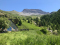
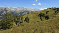
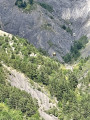
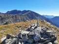
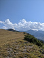
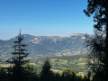
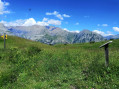
The ascent from the Cabane des Mulets follows a track through exceptional mountain scenery. The approach to the Col la Pierre is challenging. The return route takes you off the beaten track: first a descent through grassy terrain between two scree slopes, then across the wide mountain pasture back to the Cabane des Mulets.

Details

n°22980777
Creation:
Last update:
Last review:
  • Walking
    Activity: Walking
  • ↔
    Distance: 5.86 mi
  • ◔
    Average duration: 5h 30 
  • ▲
    Difficulty: Very difficult

  • ⚐
    Back to start: Yes
  • ↗
    Ascent: + 3,209 ft
  • ↘
    Descent: - 3,215 ft

  • ▲
    Highest point: 8,022 ft
  • ▼
    Lowest point: 4,810 ft

Photos

Description of the walk

From the D900, take the D657 towards the hamlet of Maure. Continue straight on along this road, which turns into a track. At the end of the track, park in the car park just past the wooden bridge.

(S/E) At this wooden bridge, you’ll find the signpost marked ‘Ravin de la Blanche 1462 m’; take the track towards Cabane des Mulets for 2 km.

(1) At this bend, leave the track and turn left towards Cabane des Mulets. The path, which is flat for a while, then climbs steeply. Walk alongside a beautiful stream. Cross the wooden bridge and continue along the path. You’ll be treated to some beautiful waterfalls. As you emerge from the woodland, continue along the path across the meadow. Ahead of you lies the rocky massif of La Roche Close.

(2) Cabane des Mulets, which is in fact a beautiful, large 18th-century stone building. On the façade, there is a ‘private property’ sign which must be respected, and a drinking water tap with a constant flow. In the middle of the building on the east side, there is a door leading to toilets and a lovely shelter in case of bad weather.

No signposting

Go round the building on the right. Take the track suitable for vehicles which starts about fifty metres to the north. Continue along the track, which climbs gradually.

(3) Cross the stream. There is a menhir at the side of the path. Continue along the track. Take care. The track sometimes disappears, giving way to grassy areas, then reappears a little further on.

(4) Turn left onto the path. At times a narrow track, at times a proper path, at times a grassy area, with a few cairns; use the app if necessary. The surroundings make it easy to find your bearings.

Yellow markings

(5) A challenging section of the path with a steep gradient.

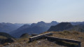
(6) Col la Pierre, elevation 2,433. Take in the extraordinary view of the Alpine massif. Continue due north along the ridge to reach the summit at elevation 2,452. From this summit, continue along the ridge for about a hundred metres. Pass the scree slope and continue to a grassy area, which will be your descent route.

(7) From this grassy area, off the trail, descend the slope in stages heading west. Follow these large, grassy terraces which allow you to descend for approximately 200 metres.

(8) As soon as you have passed the rocky outcrop coming from Col la Pierre – which you have been following from the summit – veer left towards the grassy ridge line that you can see (south-west). Cross three fairly narrow scree slopes.

(9) Once you reach the grassy ridge known as Clot du Col la Pierre – where livestock are sometimes present – continue straight west across the fields. You can see the Cabane des Mulets below.

(10) Go round the trees at this spot, known as ‘le Bosquet’, on the right to avoid the scree slope. Continue downwards due south towards the Cabane des Mulets.

(2) Refreshing water source. Cross the stream situated 50 m south-east of the hut. At the signpost marked ‘Cabane des Mulets, altitude 1710 m’, continue along the track which descends back towards your starting point. Return to the bend in the track you passed on the way up.

(1) Follow the descending track – the reverse route of the outward journey – to return to the car park (start/finish).


Waypoints

  1. S/E : mi 0 - alt. 4,816 ft - Car park - Blanche (rivière)
  2. 1 : mi 0.25 - alt. 4,951 ft - Bend in the track – start of the footpath.
  3. 2 : mi 0.78 - alt. 5,604 ft - Cabane des Mulets
  4. 3 : mi 1.44 - alt. 6,191 ft - Menhir by the stream
  5. 4 : mi 2.03 - alt. 6,575 ft - Junction of the track and the footpath
  6. 5 : mi 3.05 - alt. 7,684 ft - Trail
  7. 6 : mi 3.22 - alt. 7,963 ft - Col la Pierre (2433m)
  8. 7 : mi 3.43 - alt. 7,913 ft - Ridge line – grassy area
  9. 8 : mi 3.54 - alt. 7,526 ft - Change of direction
  10. 9 : mi 3.73 - alt. 7,359 ft - Ridge line
  11. 10 : mi 4.39 - alt. 6,142 ft - Le Bosquet
  12. S/E : mi 5.86 - alt. 4,810 ft - Car park - Blanche (rivière)

Notes

Hiking boots and walking poles essential.
A stony track suitable for vehicles.

Water points, toilets and shelter at the Cabane des Mulets.
The Visorando app is useful.

Worth a visit

Visit the village of Seyne-les-Alpes.
Notre-Dame de Nazareth Church (13th century).
Vauban Citadel (17th century).

A unique event in France dedicated to mules.
Mule-driving competition, held on the second Saturday in August.

Reviews and comments

3.2 / 5
Based on 3 reviews

Reliability of the description
3.7 / 5
Ease of following the route
3 / 5
Route interest
3 / 5
bernard bb
bernard bb

Totally agree with you Beautiful day to you friendship rando, b.

Machine-translated

jpderail
jpderail

Thank you for changing the difficulty level. On the "interest" criterion, I would change it to 4 stars and "route", in reality we did follow it, but I wanted to point out that there is no path on the way back.

Machine-translated

bernard bb
bernard bb

Hello jperail Thank you for your opinion. At your request, this hike is classed as "very difficult". It's not all bad news, as you write "the scenery is exceptional and the presence of the Bouquetins makes the finish sublime". The point (7) states "grassy area, off path"" Amitié rando, b.

Machine-translated

jpderail
jpderail

Overall rating : 2.5 / 5

Date of your route : May 29, 2025
Reliability of the description : ★★★☆☆ Average
Ease of following the route : Not used / Not applicable
Route interest : ★★☆☆☆ Disappointing
Very busy route : No

The weather was fine. We were a group of 6 hikers in very good physical condition. I do not recommend this route, as it is not one. On the outward journey, the route can be completed without difficulty by following the yellow track of the hiking circuit to the top of the Col la Pierre. The scenery is exceptional and the presence of the ibex makes the finish sublime. The total absence of a path to the return to the Mulet hut makes the experience both dangerous and unpleasant. This route can only be done as an out-and-back as far as the col. From my point of view, there's no point in going back down through the scree slopes, which also included areas of impassable snow that had to be avoided. Any fall could be very dangerous. Once you reach the meadow area, there is no more path, and the descent has to be made again through grassy areas. The loop is therefore of no interest other than not wanting to come back down on the path marked out on the outward journey. To be classed as very difficult.

Machine-translated

bernard bb
bernard bb

Thank you, Millim, for your constructive feedback
I wish you all the best for your future hikes
b.

Machine-translated

millim
millim

Overall rating : 4.3 / 5

Date of your route : Jul 14, 2023
Reliability of the description : ★★★★★ Very good
Ease of following the route : ★★★★☆ Good
Route interest : ★★★★☆ Good
Very busy route : No

A lovely walk in fine weather.
The descent from the pass is indeed tricky, but if you take your time, it’s manageable.
I realised afterwards that there was a path following the course of the Blanche between the Cabane des Mulets and the car park.
If I were to do it again, I’d take that route.

Machine-translated

bernard bb
bernard bb

Thank you, Mapa, for sharing your thoughts

Machine-translated

mapa
mapa

Overall rating : 2.7 / 5

Date of your route : Jun 15, 2023
Reliability of the description : ★★★☆☆ Average
Ease of following the route : ★★☆☆☆ Disappointing
Route interest : ★★★☆☆ Average
Very busy route : Yes

At the pass, there is a beautiful viewpoint reached after a relatively steady climb along a track that is generally easy to follow. This gave us the chance to see some not-so-wild ibex grazing at the pass, just 15 metres away from us.
As for the return journey, we’d chosen to follow the suggested route and came to regret it. The grassy area (location confirmed by GPS track) is particularly unpleasant to cross and even dangerous. Combined with the scree slopes, this section of the descent spoils the enjoyment we’d previously experienced on the ascent; subsequently, the suggested route back to the Cabane des Mulets struck us as rather uninteresting, even tedious. The return journey along the track, like all such tracks, adds nothing to the experience.
If we were to tackle this pass again, we would do a simple round trip (i.e. using the same route as on the way up).

Machine-translated

bernard bb
bernard bb

Hello balbobebop

This walk you’re familiar with is a real delight
a haven for chamois and marmots
Best wishes, B.

Machine-translated

balbobebop
balbobebop

I haven’t done this walk yet this year.
I did it two or three years ago, but not quite the same route,

Machine-translated

Other walks in the area

For more walks, use our search engine .

The GPS track and description are the property of this route's author. Please do not copy them without permission.