La Forestière in La Seyne

The walk is mainly on tracks, except for the first kilometre which is on a footpath. Explore the La Blanche State Forest. Round trip to Clos des Ayres (possible picnic spot). Return via the Bellevue Forest House. This route initially follows the GR®69 – La Routo.

Details

102298016
Creation:
Last update:
Last review:
  • Walking
    Activity: Walking
  • ↔
    Distance: 4.62 mi
  • ◔
    Average duration: 2h 40 
  • ▲
    Difficulty: Easy

  • ⚐
    Back to start: Yes
  • ↗
    Ascent: + 636 ft
  • ↘
    Descent: - 614 ft

  • ▲
    Highest point: 5,640 ft
  • ▼
    Lowest point: 5,187 ft

Photos

Description of the walk

Bellevue car park (44.358447, 6.391194) near the Bellevue Forest House.

(S/E) Take the Route du Col Bas and leave it shortly afterwards, at the GR®69 signpost, turning right onto a red and white marked path: this is the GR®69, the Routo. Follow the marked path for 1 km and you’ll come out onto a track after a steady climb.

(1) Turn left onto the track, which is almost level .

(2) Cross the Route du Col Bas, continue straight ahead along the Piste Forestière de la Centrale and emerge at a crossroads of tracks.

(3) Take the hairpin bend to the left, which descends gently and leads to another track, the Chemin de la Forestière.

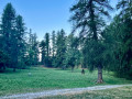
(4) Take the hairpin bend to the right to reach the Clos des Ayres: a lovely spot for a picnic, with tables and a fountain.

(5) Retrace your steps.

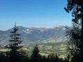
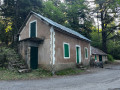
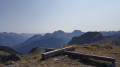
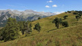
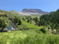
(4) Continue to the right along the track that leads back to the starting point. Enjoy the views over the surrounding peaks (Chabanon, Clôt de Bouc). Cross two streams. Pass in front of the Bellevue Forest House and arrive at the car park (S/E).

Waypoints

  1. S/E : mi 0 - alt. 5,210 ft -  Bellevue car park near the forest ranger’s house
  2. 1 : mi 0.58 - alt. 5,617 ft - Forest track
  3. 2 : mi 1.11 - alt. 5,581 ft - Route du Col Bas
  4. 3 : mi 2.05 - alt. 5,607 ft - Crossroads of trails
  5. 4 : mi 2.42 - alt. 5,433 ft - Junction with the Forestière track
  6. 5 : mi 2.87 - alt. 5,443 ft - Clos des Ayres
  7. S/E : mi 4.62 - alt. 5,207 ft -  Bellevue car park near the forest ranger’s house

Notes

Water points at Clos des Ayres and the forest ranger’s house; water not tested. Shelter at the forest ranger’s house.

Worth a visit

La Blanche State Forest. Clos des Ayres. Bellevue Forest House.

Always be cautious and plan ahead when you're outdoors. Visorando and the author of this route cannot be held responsible for any accidents occurring on this route.

The GR® and PR® markings are the intellectual property of the Fédération Française de Randonnée Pédestre.

Other walks in the area

For more walks, use our search engine .

The GPS track and description are the property of this route's author. Please do not copy them without permission.