Country:

 City:
City:


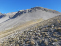
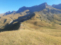
From Digne, head towards Barcelonnette, cross the Col du Labouret, continue towards Seyne-les-Alpes, turn right at Le Vernet, cross the bridge, enter the village and turn left towards the Col de Mariaud. Further on, turn right towards the Col de Mariaud. Stop at the car park (traffic is prohibited beyond this point).
(S/E) Set off south-east and follow the wide track which climbs with several hairpin bends up to the Col de Mariaud.
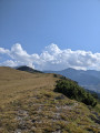
(1) Turn left and follow a signposted path. Head northwards uphill and, after several hairpin bends, reach Tête de la Bau.
(2) Turn right (east) onto the path towards Val Pousane.
(3) At the gate, turn left and head north-east along a ridge. This will take you to the Tête du Travers.
(4) Continue north-east and climb to the summit of Le Pinet.
(5) Descend the northern slope and join a track (by following this northwards, you can reach the Vieille Cabane directly).
(6) Carry on straight ahead, keeping to the left of the ridge.
(7) Go round the Tête de Belau on the left. Climb up the scree. Traverse left (following the tracks) then take the edge of the couloir to reach the ridge and, finally, the Tête de Beloupet.
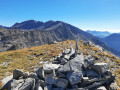
(8) Continue easily north-east towards the final outcrop. Climb the cone towards a square piton. Take a couloir on its right-hand side (cairn). Via steps on the left, reach the summit slopes which lead easily to the summit.
(9) Descend the north ridge, following yellow markings to a marker post. Continue along the left-hand edge of the ridge until you find a good path (cairns) which descends to the left (west-north-west), first in switchbacks and then traversing. The path disappears above Pié Gros: descend as best you can, either over fine scree or down the slope that is half grass, half rock. Descend below Pié Gros over grassy slopes, heading south-west. This will take you to the Cabane des Têtes.
(10) Follow a track south-west and continue down. Climb slightly to reach the Vieille Cabane.
(11) Continue westwards then south-west. Climb up to reach the Tête de la Bau.
(2) Follow the outward route in reverse: head south back to the Col de Mariaud, then descend the track to the right to the car park (S/E).
 Visorando Member
 Moderate
 Easy
Easy