Circular route via the Col de Mariaud and Col de Grisonniere

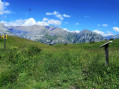
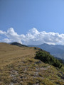
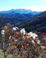
A lovely walk through woodland and meadows with magnificent views and, in early July, a carpet of flowers.

Details

36139503
Creation:
Last update:
Last review:
  • Walking
    Activity: Walking
  • ↔
    Distance: 5.92 mi
  • ◔
    Average duration: 4h 30 
  • ▲
    Difficulty: Moderate

  • ⚐
    Back to start: Yes
  • ↗
    Ascent: + 2,018 ft
  • ↘
    Descent: - 2,018 ft

  • ▲
    Highest point: 5,965 ft
  • ▼
    Lowest point: 3,947 ft

Photos

Description of the walk

Park in the centre of the village of Le Vernet.

This walk is signposted in the village. It’s best to follow it in the direction indicated, as the descent to Le Vernet is quite steep; going uphill would be difficult.

(S/E) Follow the tarmac road towards Col Mariaud, marked with yellow signposts. You’ll come to a junction.

(1) Ignore a path on the right – this will be the return route. Continue straight ahead until you reach a Y-junction.

(2) Turn right onto a dirt track which leads to Col Mariaud.
Along the way, you’ll find a few information boards about the area.

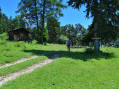
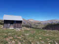
(3) A small hut and picnic tables.
From the hut, take the path that starts at the far end and climbs towards the ridge. Follow it along a narrow track that runs along the southern side of the Barre des Béliers, where you’ll find Mediterranean plants (including lavender).
In early July, the track becomes a little overgrown in the meadow leading down to the Col de Grisonnière.

(4) Option: you can climb up to the summit of Prisonnière opposite.
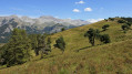
Alternatively, continue due west along the path that descends diagonally across the meadow; this is also poorly marked at the start of the season and passes through a carpet of very varied flowers. There are two tracks. Take the lower one and look out for the yellow markings on the trees.

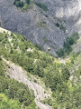
(5) Pass a plaque (fixed to a tree) in memory of Marc Baratelli. Continue diagonally to a small rocky outcrop, then descend straight down (bend your knees well, as the slope is steep) to the Cabane du Berger.
The track is almost lost, as the heavy spring rains have washed away most of the path, but you can easily spot the yellow markings on the trees or rocks, or by following the track on the Visorando app.

(6) Cross it, keeping an eye out for any livestock, and join a wide dirt track which you follow until you reach the small tarmac road taken at the start of the walk.

(1) Return to the village (S/E) by turning left onto it.

Waypoints

  1. S/E : mi 0 - alt. 3,947 ft - Parking in the village. Near the - Bès (rivière) - Affluent de la Bléone
  2. 1 : mi 0.31 - alt. 4,009 ft - Junction shared by the outward and return routes
  3. 2 : mi 0.89 - alt. 4,183 ft - Junction
  4. 3 : mi 2.6 - alt. 5,098 ft - Col de Mariaud (1561m)
  5. 4 : mi 4 - alt. 5,925 ft - Col de Grisonnière (1810m)
  6. 5 : mi 4.11 - alt. 5,804 ft - Marc Baratelli plaque
  7. 6 : mi 4.74 - alt. 4,711 ft - Cabane du Berger
  8. S/E : mi 5.92 - alt. 3,947 ft - Parking in the village

Notes

On the climb up to the Col de Mariaud, you’ll find a water source (unmonitored, of course).
You’ll need good, securely laced shoes for the descent.
Whilst the start is in the forest, the rest of the route is very sunny, so take the usual precautions.

Worth a visit

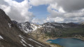
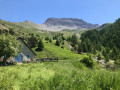
There are plenty of views to the south and north as you walk along the Barre des Béliers.

Reviews and comments

4.2 / 5
Based on 3 reviews

Reliability of the description
4.3 / 5
Ease of following the route
3.3 / 5
Route interest
5 / 5
User 25893080

Overall rating : 4.7 / 5

Date of your route : Jun 23, 2025
Reliability of the description : ★★★★★ Very good
Ease of following the route : ★★★★☆ Good
Route interest : ★★★★★ Very good
Very busy route : No

no change

Machine-translated

Duprez Michel
Duprez Michel

Overall rating : 4 / 5

Date of your route : Sep 20, 2024
Reliability of the description : ★★★★☆ Good
Ease of following the route : ★★★☆☆ Average
Route interest : ★★★★★ Very good
Very busy route : No

A lovely route with a magnificent view from the summit of La Grisonnière. The path from the summit of La Grisonnière to the Cabane du Berger is uneven; walking sticks are recommended.

Machine-translated

Louvier38
Louvier38
• Edited:

Overall rating : 4 / 5

Date of your route : Nov 26, 2023
Reliability of the description : ★★★★☆ Good
Ease of following the route : ★★★☆☆ Average
Route interest : ★★★★★ Very good
Very busy route : No

A magnificent hike. No problems up to the Col de Grisonnière – the track is well signposted and very pleasant.
However, from the pass onwards, make sure you follow the directions on the map carefully, as the signposting and the trail itself can be difficult to spot at times. Just so you know: the Baratelli sign is attached to a tree, so if you can’t find it, don’t panic!
In any case, a superb hike – not too difficult and with stunning views! We didn’t come across a single soul, and the pleasant silence was broken only by the songs and calls of the many birds!

Machine-translated

AUDO13
AUDO13

Thanks for the quick reply.👍

Machine-translated

pbizet
pbizet

Access to the hamlet of Haut Vernet is regularly restricted, but this isn’t a problem for this walk, as you can even reach the starting point without going through the village of Vernet.

Machine-translated

AUDO13
AUDO13

Hello, is the walk currently possible following the disappearance of little Émile? Thank you.

Machine-translated

Other walks in the area

For more walks, use our search engine .

The GPS track and description are the property of this route's author. Please do not copy them without permission.