Tête de la Bau circular walk starting from Le Vernet

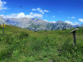
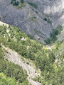
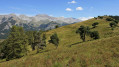
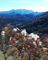
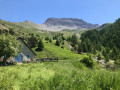
A short excursion into the mountain pastures above Le Vernet. This walk is best done early in the morning or in the late afternoon during the summer. The scenery is magnificent, featuring forests, rivers and mountain pastures. No particular difficulties. Please note: there is a section off the marked path; a GPS device is useful.

Details

102876173
Creation:
Last update:
Last review:
  • Walking
    Activity: Walking
  • ↔
    Distance: 7.14 mi
  • ◔
    Average duration: 5h 00 
  • ▲
    Difficulty: Moderate

  • ⚐
    Back to start: Yes
  • ↗
    Ascent: + 1,982 ft
  • ↘
    Descent: - 1,962 ft

  • ▲
    Highest point: 5,955 ft
  • ▼
    Lowest point: 4,006 ft

Photos

Description of the walk

You can easily park on the right-hand side of the road in front of the restaurant and lodge L’Inattendu.

(S/E) Walk up the road. It’s not very busy, but do take care. You’ll arrive at the Roussimal farm.

(1) Take the dirt track on the right, cross the footbridge over the Riou de la Montagne and follow the signs for Col de Mariaud.

(2) Turn left onto the dirt track signposted ‘Col de Mariaud’. Go through the gate and follow the road uphill to the Col de Mariaud (altitude 1,561).

(3) You’ll find a fountain and some picnic tables. Take the path leading uphill to the left, heading north (yellow markings).

(4) Go through the mountain pasture gate and you’ll reach the Tête de la Bau.

(5) Turn right and follow the yellow markings for about 200 m.

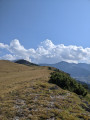
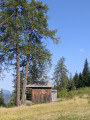
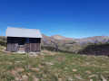
(6) At an altitude of 1,758 m (use the GPX track on the app to help you), leave the path and head up to the left, north-north-east, across the mountain pasture towards the mountain ridge. There may be cows (no Patou dogs); please avoid disturbing them. As soon as you reach the ridge, you’ll see the track leading to the Vieille Cabane below. Head towards this track (no signposting).

(7) Once on the track, enjoy the view of the Massif des Trois Évêchés, then turn left to head back down into the valley.

(8) Pass through the gate at the exit from the mountain pastures. There are then several fords which are easy to cross. This will take you back to the initial fork in the trail.

(1) Carry on straight ahead to reach the tarmac road and follow it down to the car park (S/E).

Waypoints

  1. S/E : mi 0 - alt. 4,006 ft - Car park located opposite L’Inattendu
  2. 1 : mi 0.9 - alt. 4,229 ft - Junction of the circular loop
  3. 2 : mi 1.15 - alt. 4,203 ft - End of tarmac
  4. 3 : mi 2.87 - alt. 5,108 ft - Col de Mariaud (1561m)
  5. 4 : mi 3.25 - alt. 5,620 ft - Barrier
  6. 5 : mi 3.3 - alt. 5,640 ft - Tête de la Bau (1705 m)
  7. 6 : mi 3.42 - alt. 5,768 ft - Trail
  8. 7 : mi 4.05 - alt. 5,643 ft - Access track to the Vieille Cabane
  9. 8 : mi 4.76 - alt. 5,115 ft - Barrier – Exit from the mountain pastures
  10. S/E : mi 7.14 - alt. 4,012 ft - Car park located opposite L’Inattendu

Notes

  1. You can avoid the tarmac section by parking at the car park (3) at the foot of the Col de Mariaud. In this case, at the end of the route at (1), cross the footbridge and head for (2) then (3).
  2. The climb up to the pass (3) and the descent from the Vieille Cabane (7) follow stony paths with little shade. The mountain pasture is also exposed. A hat and plenty of water are recommended.

Other walks in the area

For more walks, use our search engine .

The GPS track and description are the property of this route's author. Please do not copy them without permission.