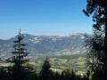
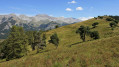
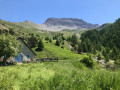
Pic de Bernardez as seen from the Bellevue forest lodge

A challenging hike near Seyne-les-Alpes, which takes you to a magnificent viewpoint over the Blanche Valley and the surrounding Alps: the Pic de Bernardez.

Details

3718310
Creation:
Last update:
Last review:
  • Walking
    Activity: Walking
  • ↔
    Distance: 7.67 mi
  • ◔
    Average duration: 6h 20 
  • ▲
    Difficulty: Difficult

  • ⚐
    Back to start: Yes
  • ↗
    Ascent: + 3,219 ft
  • ↘
    Descent: - 3,219 ft

  • ▲
    Highest point: 7,956 ft
  • ▼
    Lowest point: 5,217 ft

Photos

Description of the walk

To reach the starting point: from Seyne, head towards Saint-Pons then follow the signs for ‘maison forestière de Bellevue’. There, at the junction, you can park easily.

(S/E) Walk back up the Route Forestière du Col Bas for a few dozen metres, then turn right onto a well-signposted path marked ‘Col de Bernardez’.
Follow the path uphill for about 1 km until you reach the Route Forestière de la Chaumasse, which you follow to the right.

(1) After a hairpin bend to the left, continue up the track, ignoring a signposted turn-off to the right marked “Col de Bernardez”. It’s a steep climb.

(2) 200 metres further up, take the track starting on the right, then immediately turn left – unfortunately, this is the steepest section.
The other, more direct path on the right is becoming overgrown, so ignore it.

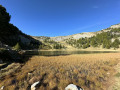
(3) After 700 m, carry on left along theGR® 6, which takes you through a magnificent larch forest, and it climbs, and climbs. At the source of the Chandelette, you begin the ‘arid’ section of the climb, where you may occasionally spot an ibex or a marmot.

(4) At the Chandelette hairpin bend, turn right and head straight on to the pass, 1,600 metres further on.

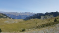
(5) At the pass, you can admire the views on either side over the high-altitude valleys, the Grosse Motte de Neillière to the south-east and, above all, to the north-west, very close by, your next destination: the Pic de Bernardez.
The path is narrow, steep and challenging but fairly well signposted, so it’s nothing a moderate hiker can’t manage.

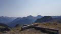
(6) You reach the peak, which has a brand-new cross; the old one lies on the ground. The 360° panorama is magnificent. To the west, you can clearly make out the mountains of the La Blanche ski resorts: Le Grand Puy, Chabanon, etc.; then to the south, the three ‘évêchés’ of grim memory, the Tête de l’Estrop and, closer by, the Aiguillette and the Tête de Chabrière. To the east lies the Ubaye valley, which rises towards Barcelonnette and its resorts.

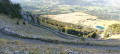
(7) We begin the descent from the peak, which is very steep, towards another vantage point that offers nothing new in terms of the panorama but allows you to gaze upon the impressive Pic de Bernardez, from which we have just come. The path is sometimes very poorly signposted, but you simply need to follow the ridge. We cross another hilltop before heading back down towards the start of the descent.

(8) Here, the path leads down towards the mountain pastures. A little further down, take care not to miss the path; after about 1 km, you’ll reach the Col Bas.

(9) Head down the path which immediately turns right off the Col Bas track to join the forest road of the same name after a fairly rugged and heavily used descent.

(10) Follow the road southwards for 700 m until you reach a hairpin bend to the right, which you leave behind, taking a long track that continues in the same southerly direction – a bit of a nuisance as it is sometimes narrow and on a slope. There’s no risk of going astray until you reach the junction from the outward journey, which you’ll find after one final leg-breaking climb.

(2) We retrace our steps along the same route as on the way out until we reach the car park (S/E).

Waypoints

  1. S/E : mi 0 - alt. 5,217 ft - Bellevue crossroads car park
  2. 1 : mi 0.56 - alt. 5,600 ft - La Chaumasse forest track
  3. 2 : mi 1.06 - alt. 5,971 ft - Crossroads of the circular loop
  4. 3 : mi 1.51 - alt. 6,319 ft - Turn left at the junction
  5. 4 : mi 1.96 - alt. 6,736 ft - Chandelette hairpin bend
  6. 5 : mi 2.9 - alt. 7,533 ft - Col de Bernardez (2304m)
  7. 6 : mi 3.3 - alt. 7,956 ft - Pic de Bernardez (2430m)
  8. 7 : mi 3.86 - alt. 7,375 ft - Panorama
  9. 8 : mi 4.29 - alt. 7,503 ft - Junction for the descent
  10. 9 : mi 4.78 - alt. 6,926 ft - Col Bas (2112m)
  11. 10 : mi 5.2 - alt. 6,480 ft - Col Bas Forest Road
  12. S/E : mi 7.67 - alt. 5,217 ft - Bellevue crossroads car park

Always be cautious and plan ahead when you're outdoors. Visorando and the author of this route cannot be held responsible for any accidents occurring on this route.

The GR® and PR® markings are the intellectual property of the Fédération Française de Randonnée Pédestre.

Reviews and comments

4.4 / 5
Based on 3 reviews

Reliability of the description
4 / 5
Ease of following the route
4.7 / 5
Route interest
4.7 / 5
Klodeko
Klodeko

Overall rating : 4.5 / 5

Date of your route : Aug 31, 2024
Reliability of the description : Not used / Not applicable
Ease of following the route : ★★★★★ Very good
Route interest : ★★★★☆ Good
Very busy route : No

We did this walk with two dogs, starting from the forest lodge where there’s a fountain. Alternative route: Once we reached the foot of the Col Bas, we took the path along the hillside leading to Dormillouse, which offers a lovely view of Lake Serre-Ponçon. From Dormillouse, we descended to Lac Noir before continuing on and climbing back up to the Col Bas. From there, we rejoined the track, following the clearly visible cairns along the ridge to the Pic de Bernardez. Splendid panoramic views. We descended the Col de Bernardez at a brisk pace (5 km).
A total of 22 km, 1,450 m of elevation gain including the detour via Dormillouse. It took 5 hours to complete the circular route.

Machine-translated

claire.beunier@gmail.com

Overall rating : 4.3 / 5

Date of your route : May 29, 2022
Reliability of the description : ★★★★☆ Good
Ease of following the route : ★★★★☆ Good
Route interest : ★★★★★ Very good
Very busy route : No

A lovely walk, though the signposting was a bit confusing when you have to ignore the ‘Col de Bernardez’ sign on the right and carry on for 200 metres, according to the guidebook, to reach the larch forest; because after those 200 metres, there were no further signs, and I almost turned back to head for the ‘Col de Bernardez’ again.

Machine-translated

Mountolive
Mountolive

Overall rating : 4.7 / 5

Date of your route : Aug 23, 2021
Reliability of the description : ★★★★☆ Good
Ease of following the route : ★★★★★ Very good
Route interest : ★★★★★ Very good
Very busy route : No

A lovely walk with superb views from the Pic de Bernardez and from the pass of the same name just before it. A few tricky sections, but accessible to most walkers.
I only heard marmots, but I was lucky enough to have a brief chat with a shepherd amongst his sheep.
A pleasant walk, though some walkers might be disappointed by the ascent: just under an hour and a half of climbing for keen walkers. I’d recommend starting the GR6 from Seyne.

Thank you for this walk.

Machine-translated

Pit
Pit

Hello
I did this walk several years ago: I highly recommend it!
Stunning views.

Machine-translated

Other walks in the area

For more walks, use our search engine .

The GPS track and description are the property of this route's author. Please do not copy them without permission.