The Hay Trail to La Rosière

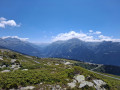
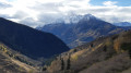
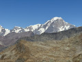
Let yourself be enchanted by the vast flower-filled meadows overlooking Le Châtelard.

Details

n°3544060
Creation:
Last update:
Last review:
  • Walking
    Activity: Walking
  • ↔
    Distance: 3.36 mi
  • ◔
    Average duration: 2h 20 
  • ▲
    Difficulty: Moderate

  • ⚐
    Back to start: Yes
  • ↗
    Ascent: + 932 ft
  • ↘
    Descent: - 925 ft

  • ▲
    Highest point: 6,063 ft
  • ▼
    Lowest point: 5,138 ft

Description of the walk

Park near the Tourist Office in the centre of La Rosière.

(S/E) Walk up the street for about a hundred metres. At the first junction, take the Route de l’École, which heads down to the left. At the second junction, turn left again, heading towards the Old Village.
After passing the Horizon 1850 residence, head downhill to your right. Walk past the tennis courts and you’ll come back onto the road.

(1) Turn left, go under the school and head down a narrow, sloping lane towards the chapel.

(2) At the chapel, take the path that leads down through the mountain pasture to the hairpin bend on the Route de la Station (D 1090).

(3) Follow the road downhill for 100 m and take the path leading into the woods on your right. Cross the D 1090 then head towards Le Châtelard and its famous Saint-Michel Chapel perched on its rock.

(4) Before reaching Le Châtelard, take the path on the left to head back towards La Rosière via La Devanchaz. Pass under the chairlift and continue due north at the next junction.

(5) In the hamlet of La Devanchaz, follow the path, pass under the chairlift once more and reach La Rosière via Rue des Eucherts.

(6) Turn right onto Rue de l’Avenue, cross Place des Eucherts, then follow the road along the forest footpath to reach the Tourist Office (S/E).

Waypoints

  1. S/E : mi 0 - alt. 6,037 ft - Office de Tourisme La Rosière
  2. 1 : mi 0.24 - alt. 5,928 ft - Tennis
  3. 2 : mi 0.35 - alt. 5,886 ft - Chapel
  4. 3 : mi 0.63 - alt. 5,669 ft - D 1090
  5. 4 : mi 1.41 - alt. 5,138 ft - Junction before Châtelard
  6. 5 : mi 2.3 - alt. 5,866 ft - Devanchaz
  7. 6 : mi 2.69 - alt. 5,997 ft - Place des Eucherts
  8. S/E : mi 3.36 - alt. 6,037 ft - Office de Tourisme La Rosière

Notes

Water point and public toilets at Le Châtelard.

Worth a visit

Saint-Michel Chapel at Le Châtelard.

Reviews and comments

5 / 5
Based on 1 review

Reliability of the description
5 / 5
Ease of following the route
5 / 5
Route interest
5 / 5
User 26511122

Overall rating : 5 / 5

Date of your route : Jul 10, 2025
Reliability of the description : ★★★★★ Very good
Ease of following the route : ★★★★★ Very good
Route interest : ★★★★★ Very good
Very busy route : No

Perfect!

Machine-translated

Other walks in the area

For more walks, use our search engine .

The GPS track and description are the property of this route's author. Please do not copy them without permission.