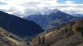
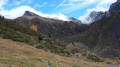
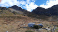
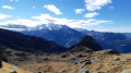
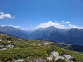
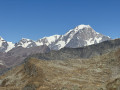
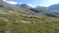
Lac du Retour as seen from La Rosière

A challenging hike to discover a stunning high-altitude lake, nestled at 2,400 metres above sea level opposite the Mont Pourri glacier.

Details

12265702
Creation:
Last update:
Last review:
  • Walking
    Activity: Walking
  • ↔
    Distance: 5.41 mi
  • ◔
    Average duration: 4h 45 
  • ▲
    Difficulty: Difficult

  • ⚐
    Back to start: Yes
  • ↗
    Ascent: + 2,549 ft
  • ↘
    Descent: - 2,556 ft

  • ▲
    Highest point: 7,940 ft
  • ▼
    Lowest point: 5,823 ft

Photos

Description of the walk

The walk starts from the Plan de l’Arc car park, at the end of the Route des Euchets.

(S/E) Cross the Plan de l’Arc play area and head to the lower station of the Plan du Repos chairlift.

(1) Leave the chairlift on your left, ignore a path coming from the left and continue north-east along the main path.

(2) At the Putétruit sheepfolds, take a path on the left and head to a footbridge over the Torrent des Moulins.

(3) Cross the Torrent des Moulins and head south-east towards the Plan Pigeux sheepfolds. On this section, the gradient becomes steeper.

(4) At Plan Pigeux, follow the path ahead of you heading south-east.

(5) At a junction of paths, turn left and begin a steep climb with numerous hairpin bends. This will take you to the Passage du Retour.

(6) Continue eastwards towards Lac de Retour. Descend slightly and head off to the left to reach the lake, overlooked by the Mont Pourri glacier.

(7) The return journey follows the same route in the opposite direction to the Plan d’Arc car park (S/E).


Waypoints

  1. S/E : mi 0 - alt. 6,056 ft - Plan de l’Arc car park
  2. 1 : mi 0.29 - alt. 6,093 ft - Lower station of the Plan du Repos chairlift
  3. 2 : mi 0.98 - alt. 5,948 ft - Putétruit sheepfolds
  4. 3 : mi 1.22 - alt. 5,823 ft - Footbridge
  5. 4 : mi 1.65 - alt. 6,414 ft - Plan Pigeux
  6. 5 : mi 1.82 - alt. 6,575 ft - Trail junction
  7. 6 : mi 2.43 - alt. 7,927 ft - Passage du Retour
  8. 7 : mi 2.71 - alt. 7,831 ft - Lac du Retour
  9. S/E : mi 5.41 - alt. 6,056 ft - Plan de l’Arc car park

Notes

Car park at the start of the walk at Plan d’Arc
Walking poles recommended
Water point at Plan Pigeux

Reviews and comments

4.8 / 5
Based on 2 reviews

Reliability of the description
5 / 5
Ease of following the route
5 / 5
Route interest
4.5 / 5
Orélie
Orélie

Overall rating : 5 / 5

Date of your route : Oct 24, 2024
Reliability of the description : ★★★★★ Very good
Ease of following the route : ★★★★★ Very good
Route interest : ★★★★★ Very good
Very busy route : No

A wonderful hike – I loved it, especially the colours in autumn.

And whilst you’re here, do consider coming along to the Xplore Alpes outdoor festival – in the evenings, there are some brilliant films about the great outdoors. It’s a great way to spend the day hiking and the evening at the festival.

Machine-translated

obus74
obus74

Overall rating : 4.7 / 5

Date of your route : Jul 25, 2022
Reliability of the description : ★★★★★ Very good
Ease of following the route : ★★★★★ Very good
Route interest : ★★★★☆ Good
Very busy route : Yes

This is a fairly challenging hike as the slopes are steep and there aren’t many opportunities to take a breather. But the effort of the climb is rewarded by the route’s destination. Lac du Retour is magnificent, nestled amongst the mountains.
Afterwards, the descent is quite tough as it’s very steep and the stones roll under your feet.
One last push: the climb back up to the car park, where you just need to switch off and let your mind wander.

Machine-translated

Other walks in the area

For more walks, use our search engine .

The GPS track and description are the property of this route's author. Please do not copy them without permission.