The Chemin des Alpages from La Rosière

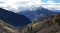
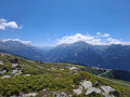
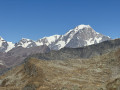
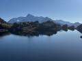
A lovely, accessible walk that will take you through high-altitude meadows, alpine chalets and picturesque hamlets.

Details

3688306
Creation:
Last update:
Last review:
  • Walking
    Activity: Walking
  • ↔
    Distance: 4.81 mi
  • ◔
    Average duration: 3h 15 
  • ▲
    Difficulty: Moderate

  • ⚐
    Back to start: Yes
  • ↗
    Ascent: + 1,145 ft
  • ↘
    Descent: - 1,155 ft

  • ▲
    Highest point: 6,138 ft
  • ▼
    Lowest point: 4,970 ft

Description of the walk

Start from the Plan de l’Arc car park.

(S/E) Head north and cross the leisure area towards the start of the Plan du Repos chairlift.

(1) Pass the lower chairlift station on your left and follow a wide, downhill track suitable for vehicles.

(2) Pass the Putéruit chalets on your left and take a sharp right-hand bend. Then take a sharp left-hand bend and you’ll reach the Torrent des Moulins.

(3) Cross the bridge over the torrent and follow a balcony path heading south-south-west. Pass in front of an EDF building.

(4) At the junction, turn right (due south) onto a path leading downhill.

(5) Cross a stream via a footbridge and walk past the Petit Bois chalets.

(6) At the junction, turn right and walk through the hamlet of Le Vaz. Pass a chairlift line. Shortly afterwards, cross the Torrent des Moulins, follow the switchbacks uphill and pass under the chairlift line.

(7) At the junction, follow a path running along the hillside to the right. Pass under the chairlift line again. Take a hairpin bend to the left, then another to the right. Do not pass under the chairlift line again; follow the signs for La Rosière – La Devanchaz.

(8) At La Devanchaz, follow a track suitable for vehicles to the left. At the next junction, under the chairlift, turn right and you’ll return to the Plan de l’Arc car park (S/E).

Waypoints

  1. S/E : mi 0 - alt. 6,056 ft - Plan de l’Arc car park
  2. 1 : mi 0.32 - alt. 6,096 ft - Lower station of the - Télésiège du Plan du Repos
  3. 2 : mi 0.95 - alt. 5,948 ft - Putétruit
  4. 3 : mi 1.41 - alt. 5,673 ft - Bridge
  5. 4 : mi 2.05 - alt. 5,620 ft - Junction
  6. 5 : mi 2.63 - alt. 5,223 ft - Footbridge
  7. 6 : mi 2.97 - alt. 4,970 ft - Le Vaz
  8. 7 : mi 3.5 - alt. 5,282 ft - Crossroads
  9. 8 : mi 4.39 - alt. 5,879 ft - La Devanchaz
  10. S/E : mi 4.81 - alt. 6,056 ft - Plan de l’Arc car park

Notes

Picnic tables, dry toilets and a water point at Le Vaz.
Water point at Plan de l’Arc.

Worth a visit

Make the most of the various facilities (children’s play area, picnic tables with barbecue, climbing wall, pétanque and football pitches).

Reviews and comments

4.7 / 5
Based on 2 reviews

Reliability of the description
5 / 5
Ease of following the route
5 / 5
Route interest
4 / 5
Philippe M
Philippe M

Overall rating : 5 / 5

Date of your route : Aug 18, 2025
Reliability of the description : ★★★★★ Very good
Ease of following the route : ★★★★★ Very good
Route interest : ★★★★★ Very good
Very busy route : No

Beautiful route, well-marked trail with a steady slope

Machine-translated

jrbuecher
jrbuecher

Overall rating : 4.3 / 5

Date of your route : Aug 19, 2024
Reliability of the description : ★★★★★ Very good
Ease of following the route : ★★★★★ Very good
Route interest : ★★★☆☆ Average
Very busy route : No

It’s an easy route, suitable for everyone, despite a few climbs towards the end.
The start along the gravel road isn’t particularly scenic, but as soon as you leave that road (after 30 minutes), you’ll find yourself on a very pleasant path.

Machine-translated

Other walks in the area

For more walks, use our search engine .

The GPS track and description are the property of this route's author. Please do not copy them without permission.