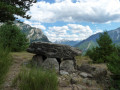
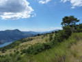
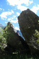
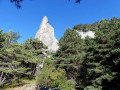
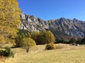
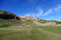
The rocky scree on the southern slope of the Morgonnet and the Villard Dolmen

A lovely circular walk through the woodland to explore the rocky outcrops and, at the same time, a brief visit to the Villard Dolmen, with access to the outcrops via an ancient path long since forgotten.

Details

3878685
Creation:
Last update:
Last review:
  • Walking
    Activity: Walking
  • ↔
    Distance: 4.92 mi
  • ◔
    Average duration: 3h 20 
  • ▲
    Difficulty: Moderate

  • ⚐
    Back to start: Yes
  • ↗
    Ascent: + 1,230 ft
  • ↘
    Descent: - 1,207 ft

  • ▲
    Highest point: 5,135 ft
  • ▼
    Lowest point: 4,049 ft

Photos

Description of the walk

From the D954 running along the northern shore of Lake Serre-Ponçon, turn right, heading due north onto the D7 and then towards Les Hugues. At the fork in the tracks, turn left until you reach the car park.

(S/E) From the car park, continue along the track towards the Col du Morgonnet.

(1) Ignore the first junction on the right, which leads down to “Champ Contier”, and also the second, less visible junction at the 1515 mark.

(2) Leave the main track at the next junction and turn right at the cairn onto a secondary track. Follow it to its end at the small clearing. Ignore the three junctions on the right as well as the start of a path on the left. Cross the clearing straight ahead to find a cairn at its far end.

(3) The path runs more or less along the contour line to reach the bank of the Torrent de Paréou.

(4) The route continues in a zigzag pattern (marked by cairns), staying on the right bank of the torrent; you will soon cross the bed of the torrent flowing down from Les Gougeasses. At the point where the torrent ends, the path runs straight along the hillside, then zigzags steeply up the slope until it crosses a flatter, better-marked path (a dead tree forms an arch at this point and you pass underneath it).

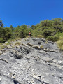
(5) Turn right and follow this path, which leads to the rocky outcrops.
After crossing the Ravin des Gourgeasses, continue straight on for 100 m to rejoin the path and follow it to the rocks.

(6) From the end of the path in the centre of the boulders, head straight up the slope to reach the horizontal path about 30 to 50 metres lower down and follow it to the right, south-west, to the Villard mountain pasture. Join the GRP®.
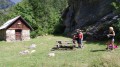
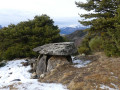
Once you reach the 1270-metre mark, head left along the flat to reach the clearly visible old building, cross the meadow still heading west and descend slightly south-west to find the Villard Dolmen on the edge of the forest.

(8) Turn back to the previous junction at the 1,270-metre mark.

(7) Follow the GPR Tour du Lac de Serre-Ponçon signposting to the left.

(1) Head left along the same path you took on the way there until you reach the car (S/E).

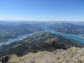
(S/E) From the car park, you can see Lac de Serre-Ponçon by walking uphill for 10 minutes along the marl strata path opposite the car park (signposted).

Waypoints

  1. S/E : mi 0 - alt. 4,790 ft - Car park at the end of the track, which is open to traffic
  2. 1 : mi 0.29 - alt. 4,875 ft - Common junction S/E
  3. 2 : mi 0.8 - alt. 5,092 ft - Leave the main track to the right
  4. 3 : mi 1.44 - alt. 5,105 ft - Path at the end of the clearing
  5. 4 : mi 1.69 - alt. 5,039 ft - The route continues to the right up the slope
  6. 5 : mi 2.18 - alt. 4,419 ft - Turn right after the arched tree
  7. 6 : mi 2.66 - alt. 4,206 ft - End of the path: head down to the left
  8. 7 : mi 3.26 - alt. 4,170 ft - Round trip to the Villard Dolmen
  9. 8 : mi 3.49 - alt. 4,049 ft - Villard Dolmen
  10. S/E : mi 4.92 - alt. 4,787 ft - Return to the car park

Notes

There are no painted markings except once you reach the mountain pasture for the return climb (red and yellow markings).
Only cairns are in place to help guide the route and progress as clearly as possible.
The cairns vary in size depending on the stones found on site, and there are a few short sections without cairns as there were no stones to hand!
For the section from (3) to (4), the route follows an old path which isn’t yet very well marked, but progress is easy thanks to the cairns and branches that help guide the bends and routes to follow, in addition to the cairns.
The spring at the Villard mountain pasture is clearly marked on the map; the water flows from a pipe 10 metres from the wellhead, which is well constructed.
The GPS track was plotted by hand on a map, so between (3) and (4), don’t expect precision in this section!

Worth a visit

The beech wood below the village of Pontis (the road runs through it) is magnificent and stays cool.
The ‘Demoiselles Coiffées’ on the road between Savines-le-Lac and the village of Sauze-du-Lac.

Reviews and comments

4.1 / 5
Based on 4 reviews

Reliability of the description
4.3 / 5
Ease of following the route
3.5 / 5
Route interest
4.5 / 5
chris05
chris05

Hello Emmanuel G2, thank you for your feedback
Some sections aren’t easy to mark out ‘with cairns’ as there aren’t any stones nearby, such as on part of the descent!

Have a great hiking season

Christian

Machine-translated

Emmanuel G2.
Emmanuel G2.

Overall rating : 4 / 5

Date of your route : May 31, 2022
Reliability of the description : ★★★★☆ Good
Ease of following the route : ★★★☆☆ Average
Route interest : ★★★★★ Very good
Very busy route : No

A lovely walk,
Much like the other comments, the signposting is poor and it’s tricky to find your way.
Cairns have been put in place, which makes the walk easier, but be careful at point 4 – the cairns lead off in two directions; don’t take the path going uphill, but the one going downhill to the right.
Apart from that, a very pleasant walk.
Thank you

Machine-translated

chris05
chris05

Good evening, lios13
Thank you for your positive feedback!
Yes, I drew the route by hand on the map!

Enjoy the rest of your hike

Christian

Machine-translated

lios13
lios13

Overall rating : 4 / 5

Date of your route : Apr 20, 2022
Reliability of the description : ★★★★★ Very good
Ease of following the route : ★★★☆☆ Average
Route interest : ★★★★☆ Good
Very busy route : No

Hello,
A lovely walk we went on right at the start of spring. Under the trees.
We had a picnic at the top of the famous rocks with a magnificent view over the valley.
As for the route on the map, which is a bit inaccurate, you simply need to follow the path marked on the map background.
It added a bit of excitement !
We were a bit disappointed, though, by the dolmen (which is basically just a huge pile of stones with a grave underneath?)
But a lovely walk that I’d definitely recommend!
Thank you

Machine-translated

jfmc
jfmc

A very pretty spot at the foot of the Morgon. The walk got off to a great start in the sunshine, with a little snow still on the ground. At first the path was clear, then we entered the forest – snow and plenty of dry leaves – the first cairns were clearly visible; it was a pleasure to spot them, followed by a long path following the contour lines, and at the end, nothing. We checked our altimeter – should we go up or down? We needed to go down, but we couldn’t find the continuation of that old path. We scrambled through the undergrowth, came across some lovely rocks which we thought might be the ‘chaos’ formation but weren’t, and eventually rejoined the path leading to the lane after a long, haphazard trek

our tracks in the snow! We didn’t reach our destination, but never mind – it was a lovely walk. We’ll be back.

Machine-translated

chris05
chris05

Hello jfmc
What a shame! What can I say? We might have to add some cairns!
Next time I’m in the area, I’ll try to do that, provided I can find any stones nearby – “even in the mountains, sometimes there aren’t any close by”. Keep up the good work with your hiking!
Christian

Machine-translated

jfmc
jfmc

Overall rating : 3.3 / 5

Date of your route : Mar 17, 2021
Reliability of the description : ★★★☆☆ Average
Ease of following the route : ★★★☆☆ Average
Route interest : ★★★★☆ Good
Very busy route : No

A very pretty spot at the foot of the Morgon. The walk got off to a great start in the sunshine, with a little snow still on the ground. At first the path was clear, then we entered the forest – snow and plenty of dry leaves – the first cairns were clearly visible; it was a pleasure to spot them, followed by a long path following the contour lines, and at the end, nothing. We checked our altimeter – should we go up or down? We needed to go down, but we couldn’t find the continuation of that old path. We scrambled through the undergrowth, came across some lovely rocks which we thought might be part of the rock field but weren’t, and eventually rejoined the path leading to the lane after a long, haphazard trek

our tracks in the snow! We didn’t reach our destination, but never mind – it was a lovely walk. We’ll be back.

Machine-translated

chris05
chris05

Good evening, mesange44
Thank you for your positive feedback – enjoy the rest of your hike!
Christian

Machine-translated

mesange44
mesange44

Overall rating : 5 / 5

Date of your route : Oct 19, 2020
Reliability of the description : ★★★★★ Very good
Ease of following the route : ★★★★★ Very good
Route interest : ★★★★★ Very good
Very busy route : No

A lovely, varied walk; stunning scenery; historical interest and a glimpse into traditional mountain life.

Machine-translated

Other walks in the area

For more walks, use our search engine .

The GPS track and description are the property of this route's author. Please do not copy them without permission.