Les Vallettes and the Villard dolmen

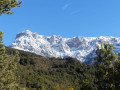
A very pleasant circular route along paths and trails with magnificent views of Lake Serre-Ponçon, the summit of the Pic de Morgon overlooking the walk, and the entire ridge line as far as the Tête de la Vieille.

Details

4682972
Creation:
Last update:
Last review:
  • Walking
    Activity: Walking
  • ↔
    Distance: 4.47 mi
  • ◔
    Average duration: 3h 25 
  • ▲
    Difficulty: Moderate

  • ⚐
    Back to start: Yes
  • ↗
    Ascent: + 1,549 ft
  • ↘
    Descent: - 1,545 ft

  • ▲
    Highest point: 4,137 ft
  • ▼
    Lowest point: 2,589 ft

Photos

Description of the walk

Park in the car park at the cemetery of the old village of Ubaye.

(S/E) Take the path (east) which winds its way up above the D954 road and runs alongside the field. Follow it to the hairpin bend at an elevation of 1003.

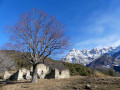
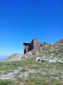
(1) Take the path straight ahead, marked by a cairn, and follow it to the ruins of Les Vallettes. Head up to the upper ruin and cross the small embankment that follows.

(2) Head left along the flat for 100 m and descend a few steps, following a well-marked track to rejoin the clearly visible path. Continue to the right. The path soon levels out again until you reach the junction withthe GR® de Pays (yellow and red markings).

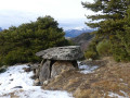
(3) Turn left and follow the yellow and red markings to the Villard mountain pasture. Cross the pasture to the left (west) towards the ruins. Continue across the pasture until you can see the dolmen, which lies slightly below the contour line at the edge of the meadow.

(4) Head left (east) for 200 m to reach the path leading down. Follow a series of hairpin bends to reach the junction at the 1003-metre mark.

(1) Continue down the path to the car park (S/E).

Waypoints

  1. S/E : mi 0 - alt. 2,589 ft - Car park - Lac de Serre-Ponçon
  2. 1 : mi 0.97 - alt. 3,287 ft - Junction of the circular loop
  3. 2 : mi 1.54 - alt. 3,455 ft - Ruins of Les Valettes
  4. 3 : mi 1.83 - alt. 3,698 ft - Turn left onto the GR de Pays
  5. 4 : mi 2.43 - alt. 4,052 ft - Villard Dolmen
  6. S/E : mi 4.47 - alt. 2,592 ft - Car park - Ubaye (rivière)

Notes

A spring flows all year round 100 m above the Villard house.
There is no shelter on the circular loop.

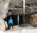
Two kilometres towards the village of Lauzet-Ubaye, visit the tunnels originally planned for the Barcelonnette railway line: the starting point is at an altitude of 801 m at the exit of the road tunnel. Bring a head torch.

Worth a visit

From the Villard mountain pasture, visit the rocky outcrops to the east of the Champ du Parc: these can be reached via the well-marked path that starts at the top of the meadow.

(S/E) When the lake isn’t at its highest level, a stroll along the shore is a real pleasure! Take the time to enjoy the lake! Visit the fountain and the route of the railway line that was intended to reach Barcelonnette.

Always be cautious and plan ahead when you're outdoors. Visorando and the author of this route cannot be held responsible for any accidents occurring on this route.

The GR® and PR® markings are the intellectual property of the Fédération Française de Randonnée Pédestre.

Reviews and comments

4.2 / 5
Based on 4 reviews

Reliability of the description
4.3 / 5
Ease of following the route
3.8 / 5
Route interest
4.5 / 5
marrirando
marrirando

Overall rating : 4.3 / 5

Date of your route : Aug 16, 2023
Reliability of the description : ★★★★★ Very good
Ease of following the route : ★★★☆☆ Average
Route interest : ★★★★★ Very good
Very busy route : No

A walk to avoid in very hot weather as the climb is continuous right up to the highest point (no respite).
After that, you’ll have to search a bit for the dolmen as this little rascal is playing hide-and-seek, but the directions from a fellow hiker proved invaluable. Just look out for a large pile of stones and there it is.

Machine-translated

chris05
chris05

Hello vinss
Thanks for your feedback and for pointing out a few things to change in your comment!
I’ll sort it out straight away!
Enjoy your future hikes
Christian

Machine-translated

vinss789
vinss789

Overall rating : 4 / 5

Date of your route : Jul 31, 2023
Reliability of the description : ★★★★☆ Good
Ease of following the route : ★★★★☆ Good
Route interest : ★★★★☆ Good
Very busy route : No

Done today with the family. An 8-year-old child and a 75-year-old grandfather. As described. It climbs steadily right from the start, but there are no difficult sections.
We hesitated a little at the start as there are several paths: you need to take the one just to the left of the sign saying ‘Anne Sainte /1983–2000’.
And at the end, we had trouble finding the dolmen. In fact, it’s near point 4 on the route description, just below a large pile of stones visible from a distance. We thought we had to continue along the path that runs past the abandoned building, but no: you have to leave the path before reaching it and head into the meadows on the left. We reoriented ourselves using the GPS against the Visorando data, as the path had worn away in this area: thank you – the track was very precise! As we were in the blazing sun, we didn’t eat at the dolmen, which is too exposed. There’s a large tree, perfect for a break, on the path 300 metres before reaching the abandoned building.

Machine-translated

dezei
dezei

Overall rating : 4.3 / 5

Date of your route : Sep 12, 2022
Reliability of the description : ★★★★☆ Good
Ease of following the route : ★★★★☆ Good
Route interest : ★★★★★ Very good
Very busy route : No

A superb, varied walk. We had a picnic near the dolmen, which offered a superb view.Back at the cemetery, we had a look around the lake’s shores. This year (September 2022), the lake is severely low on water (3 to 5 metres below normal); the wash house and gravestones were clearly visible. It’s strange to see this black earth completely parched, cracked and hard as stone.

Machine-translated

chris05
chris05

Hello martinelejeune
Thanks for the feedback! The main thing is that you found it – it always brings back more memories
Have a lovely day
Christian

Machine-translated

martinelejeune
martinelejeune

Overall rating : 4 / 5

Date of your route : Mar 01, 2021
Reliability of the description : ★★★★☆ Good
Ease of following the route : ★★★★☆ Good
Route interest : ★★★★☆ Good
Very busy route : No

We had to search around a bit near the ruins of Les Vallettes before we found the path.

Machine-translated

Other walks in the area

For more walks, use our search engine .

The GPS track and description are the property of this route's author. Please do not copy them without permission.