Country:

 City:
City:


Park at the side of the road in the Saint-Antoine neighbourhood, or down below at the old campsite.
(S/E) Cross the Torrent d’Ailefroide via the footbridge and head to a crossroads with several routes. Cross the Ravin de Sapenier.
(1) At the next fork, turn left and follow the Sapenier Ravine, then begin a winding ascent through the forest. You’ll reach a Y-shaped fork.
(2) Take the red-marked path on the left and follow it round the next few bends. Be careful: you may sometimes need to find your way through the undergrowth, as the forest and the path are rarely, if ever, maintained. You’ll reach a tricky section.
(3) Carefully navigate this tricky section situated above a slab of schist. The slope is steep but not dangerous. You will then reach the end of the red markings.
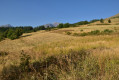
(4) Now walk along grassy slopes. The GPS track is only a guide here, but take care not to veer too far to the left, or you’ll end up in the torrent’s ravine, which won’t be very pleasant. Continue on and turn right again via a series of hairpin bends to reach the junction at the Ravin de la Tambourinière.
(5) Carry on to the right, heading north through the mountain pasture, cross the Ravin des Jaratéoux, then reach the boundary of the Écrins National Park.
(6) Continue up an easy climb to reach the junction with the path leading to the summit of La Blanche.
(7) Turn right to reach the Belvédère des Trois Refuges.
(8) Then, carefully, begin the descent via the reverse route of the outward journey to return to the Saint-Antoine car park (S/E).
 Visorando Member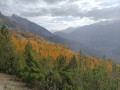

 Very difficult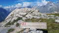
 Moderate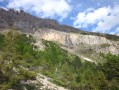

 Easy
Easy