Cime de la Condamine from Pelvoux

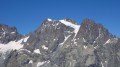
A walk that winds its way through thorny scrub and scree to end with a breathtaking view!

Details

3948581
Creation:
Last update:
Last review:
  • Walking
    Activity: Walking
  • ↔
    Distance: 11.51 mi
  • ◔
    Duration according to the author: 8 hrs 
  • ▲
    Difficulty: Very difficult

  • ⚐
    Back to start: Yes
  • ↗
    Ascent: + 5,036 ft
  • ↘
    Descent: - 5,036 ft

  • ▲
    Highest point: 9,633 ft
  • ▼
    Lowest point: 4,596 ft

Description of the walk

To reach the start point, coming from Vallouise via Le Sarret, turn right onto the D421T towards Lac de l’Eychauda. Pass four hairpin bends and you’ll soon come to the start of a tarmac track on the left and an entrance to a house on the right. Park at the side of the road on the left just after this junction (only a few spaces available).

(S/E) Continue along the road for 300 m until you reach a turn-off on the right.

(1) Take the forest track on the right, heading towards La Condamine. The track climbs gently until you reach the first junction.

(2) Keep heading towards La Condamine by taking the track that branches off to the left. After a few bends, you’ll reach a car park.

(3) Continue the climb along the path that starts as an extension of the track.

(4) Just before a ravine, turn right. The path climbs through the forest. Continue towards Chouvet/Condamine.

(5) After several hairpin bends, leave the signposted route for “Condamine via the forest” and turn right towards Cabane Chouvet.
(The two paths rejoin further up, but it’s best to take this one as it’s better maintained).

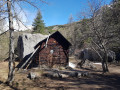
(6) At the fork, continue towards Condamine by taking the path that branches off to the left. Pass close to Cabane Chouvet, where there is a source of drinking water. Continue along the path through the forest.

(7) Join the “Condamine via the forest” path, turn off at the previous fork and continue to the right.
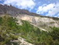
The trees gradually give way to rocky terrain.

(8) Keep to the left and follow the shortest path to the summit.

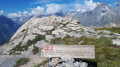
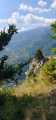
(9) Keep left as the path climbs through a cirque of rock and grass. The path begins to become spectacular, with impressive cliffs visible all around.

(10) Once you reach the pass, take the path furthest to the left to reach the summit. Pass through a short section along a track that becomes less visible, with a few steps that can be quite daunting amidst large boulders and small cliffs. Then continue over a large hump leading to the Cime de la Condamine.

(11) After taking in the panoramic views, return to the car park via the same route (S/E).

Waypoints

  1. S/E : mi 0 - alt. 4,596 ft - Car park
  2. 1 : mi 0.12 - alt. 4,626 ft - Path on the right
  3. 2 : mi 0.52 - alt. 4,813 ft - Junction, turn right
  4. 3 : mi 0.81 - alt. 4,984 ft - Car park
  5. 4 : mi 0.97 - alt. 5,079 ft - Junction, turn right
  6. 5 : mi 1.43 - alt. 5,561 ft - Junction: turn right towards the Chouvet Hut
  7. 6 : mi 1.64 - alt. 5,745 ft - Junction, turn left
  8. 7 : mi 2.17 - alt. 6,234 ft - “Condamine via the forest” path, on the right
  9. 8 : mi 3.31 - alt. 7,123 ft - Junction, turn left
  10. 9 : mi 4.11 - alt. 7,703 ft - Junction, turn left
  11. 10 : mi 4.78 - alt. 8,488 ft - Col de Vallouise (2621m)
  12. 11 : mi 5.74 - alt. 9,633 ft - Cime de la Condamné (2940m)
  13. S/E : mi 11.51 - alt. 4,596 ft - Car park

Notes

(3) A car park accessible by car to slightly shorten the climb.

If needed, the Cabane Chouvet offers shelter and/or a place to refill your water bottle.

Snow can be found right up until late in the season in the immediate vicinity of the summit. Make sure you wear good walking boots.
A windbreaker may also be a useful item to have.

Reviews and comments

4.8 / 5
Based on 2 reviews

Reliability of the description
5 / 5
Ease of following the route
4.5 / 5
Route interest
5 / 5
RAMAT Jean-Marie
RAMAT Jean-Marie

Overall rating : 5 / 5

Date of your route : Aug 27, 2024
Reliability of the description : ★★★★★ Very good
Ease of following the route : ★★★★★ Very good
Route interest : ★★★★★ Very good
Very busy route : No

I must have done this walk about ten times over the last 30 years; the description on Visorando is very well done.
Bear in mind that I’ve done it in foggy conditions, with clouds behind me, in front of me, and in glorious sunshine, and when I reached the summit, the clouds had rolled up from Pelvoux. I’d therefore advise having a GPS that’s accurate to the nearest metre in case of fog, as there are two sections of rock climbing and numerous cairns, and – as I always do – make sure you’ve got enough to survive on the spot for 24 hours!

Machine-translated

6784B8062127046
6784B8062127046

Overall rating : 4.7 / 5

Date of your route : Aug 11, 2023
Reliability of the description : ★★★★★ Very good
Ease of following the route : ★★★★☆ Good
Route interest : ★★★★★ Very good
Very busy route : No

A magnificent walk through varied landscapes, along a well-marked path that makes you forget the climb…
We really enjoyed stopping at the spring on the way back.

Machine-translated

Other walks in the area

For more walks, use our search engine .

The GPS track and description are the property of this route's author. Please do not copy them without permission.